Historic Center (Salvador)
| Historic Center of Salvador de Bahia Historic Centre of Salvador de Bahia | |
|---|---|
| Name as inscribed on the World Heritage List | |
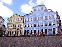 Old houses in Pelourinho | |
| Type | Cultural |
| Criteria | iv, vi |
| Reference | 309 |
| UNESCO region | Latin America and the Caribbean |
| Inscription history | |
| Inscription | 1985 (9th Session) |
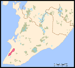
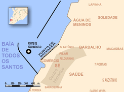
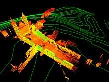
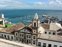
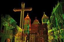
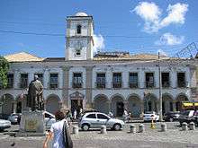
The Historic Center (US) or Centre (UK; Portuguese: Centro Histórico) of Salvador de Bahia in Brazil,[1] also known as the Pelourinho (Portuguese for "Pillory") or Pelo, is a historic neighborhood in western Salvador, Bahia. It was the city's center during the Portuguese colonial period and was named for the whipping post in its central plaza where African slaves received punishment for various infractions, as well as for disciplinary purposes. The Historic Center is extremely rich in historical monuments dating from the 17th through the 19th centuries. Salvador was the first colonial capital of Brazil and the city is one of the oldest in the New World (founded in 1549 by Portuguese settlers). It was also the first slave market on the continent, with slaves arriving to work on the sugar plantations.[2] This area is in the older part of the upper city (Cidade Alta) of Salvador. It ecompasses several blocks around the triangular Largo, and it is the location for music, dining and nightlife. In the 1990s, a major restoration effort resulted in making the area a highly desirable tourist attraction. It has a place on the national historic register and was named a world cultural center by UNESCO in 1985.[1] Easily walkable, Pelo has something to see along every street, including churches, cafes, restaurants, shops and the pastel-hued buildings. Police patrol the area to ensure safety.[3]
History
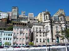
Salvador's Historic Center comprises the colonial city's primitive nucleus and its geographical expansion until the end of the 18th century. From Praça Municipal, open within the dense tropical forest by the first general-governor, Tomé de Sousa, in 1549, to largo de Santo Antônio Além do Carmo, battle field where Portuguese and Dutch soldiers from Companhia das Índias Ocidentais fought in 1638, monuments of civil, religious and military architecture make up a scenery that reveals Salvador's inhabitants art and way of living through the centuries. From Portas de Santa Luzia, which kept the southern boundary of the old city safe, with mud walls, to the thick walls of Fort Santo Antônio Além do Carmo, which guarded the north entrance, Salvador's Historic Center is divided in three areas that can be visited all at once: from Praça Municipal to largo de São Francisco, Pelourinho, and from largo do Carmo to largo de Santo Antônio Além do Carmo.
Many ruined buildings from the Historic Center started to be recuperated in the last thirty years; however, from 1991 on, this work had great impulse with the revitalization of whole blocks of old houses, convents, and churches. That is why nowadays there are more than 800 buildings with restored facades and interiors, among which are the ones adapted to new functions due to the aim of revitalizing the area for cultural purposes.
The area between Praça Municipal and largo de São Francisco chronologically starts from the place chosen by general-governor Tomé de Souza for the construction of the Colonial Government buildings, and in the places occupied by religious brotherhoods that came from Europe in 1549. Praça Municipal was opened because it offered better protection against attacks by natives and corsairs. The Governor's House, the City Hall, and other constructions were initially made of mud wall and covered with straw, but later re-built with stone, bricks, and lime. Nowadays, the visitors' preferred historic buildings are the Paço Municipal (completed in the end of the 17th century), the Palácio Rio Branco (built on the site of the former Governor's House in 1919), and the Lacerda Elevator (Elevador Lacerda), amplified in the thirties. Towards the north are Santa Casa and Our Lady of Mercy Church (Igreja de Nossa Senhora da Misericórdia). The Customs Building at Cayrú Square was constructed in 1861. The Model Market (Mercado Modelo) near the foot of the elevator claims to be the largest handicraft market in Latin America.[4]
Igreja da Sé's old foundations, put down in 1933, and Palácio Arquiepiscopal, Brazil's Prime Archbishop's old house and place of work. It is important to point out that the old Sé, and other lour blocks from the colonial and imperial periods were put down in the beginning of the century for the construction of the city's cable car stations. A little bit forward, in Terreiro de Jesus, one will find 17th to 19th century constructions. Catedral Basilica, former Igreja dos Jesuítas (Jesuits Church), and churches Ordem Terceira de São Domingos and São Pedro dos Clérigos stand out in Terreiro de Jesus, with its beautiful water fountain in the center.
In the old Medical School Building, originally occupied by the Jesuit School, are museums Memorial da Medicina (Medicine Memorial), Arqueologia e Etnologia (Archeology and Ethnology), and Afro-Brasileiro (Afro-Brazilian). Largo do Cruzeiro de São Francisco (Cruzeiro de São Francisco Largo), practically an extension of Terreiro de Jesus, has an old cross in the center, and, on the back, the monumental religious set made up of São Franscisco Church and Convent, and Ordem Terceira de São Franscisco Church.
Pelourinho today
Today Pelourinho, located at the heart of the city's historical center, is a big open-air shopping mall that offers numerous artistic and musical attractions. There is a concentration of bars, restaurants, boutiques, museums, theaters, churches and other monuments of great historical value all located in the Pelourinho area. Now is a revived and colorful Pelourinho, thriving with cultural activities and events, especially the Pelourinho Night & Day project that is performed in the many squares and streets of the neighborhood.
The program, which is free of charge, brings to the public daily events such as musical performances, dances, and short plays. Practice sessions of the band Olodum are also open to the public. The Filhos de Gandhy also have practices there in the months that precede Carnival.
References
- 1 2 "Historic Centre of Salvador de Bahia", World Heritage List, Paris: UNESCO.
- ↑ "Historic Centre - Facts", World Heritage Site.
- ↑ Pelourinho, Salvador - Today
- ↑ "Model Market of Salvador". Portalmercadomodelo.com.br. Retrieved 2010-04-17.
External links
- Pelourinho digital media archive (creative commons-licensed photos, laser scans, panoramas) from a CyArk/UNESCO research partnership.
- (English) (French) (Dutch) discovering Salvador and Bahia in your language.
Coordinates: 12°58′19″S 38°30′29″W / 12.97194°S 38.50806°W
