Hoàng Su Phì District
| Hoang Su Phi District Huyện Hoàng Su Phì | |
|---|---|
| Rural district | |
| Country |
|
| Region | Northeast |
| Province | Ha Giang |
| Capital | Vinh Quang |
| Area | |
| • Total | 243 sq mi (629 km2) |
| Population (2003) | |
| • Total | 53,937 |
| Time zone | UTC + 7 (UTC+7) |
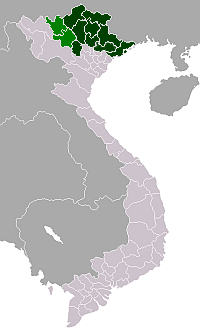
Hoàng Su Phì is a rural district of Ha Giang province in the northeastern region of Vietnam. As of 2003 the district had a population of 53,937.[1] The district covers an area of 629 km². The district capital lies at Vinh Quang.[1] Hoang Su Phi is famous for its rice fields terraces, especially on the road between Hoang Su Phi and Xin Man, where those terraces are classified as a National Heritage by the Vietnamese Government.
Administrative divisions
Vinh Quang, Bản Luốc, Bản Máy, Bản Nhùng, Bản Péo,Bản Phùng, Chiến Phố, Đản Ván, Hồ Thầu, Nam Sơn, Nàng Đôn, Nậm Dịch, Nậm Khòa, Nậm Ty, Ngàm Đăng Vài, Pố Lồ, Pờ Ly Ngài, Sán Xả Hồ, Tả Sử Choóng, Tân Tiến, Thàng Tín, Thèn Chu Phìn, Thông Nguyên, Tụ Nhân, Túng Sán
References
- 1 2 "Districts of Vietnam". Statoids. Retrieved March 13, 2009.
Coordinates: 23°40′01″N 104°40′01″E / 23.667°N 104.667°E