Holland Patent, New York
| Holland Patent, New York | |
|---|---|
| Village | |
 Location in Oneida County and the state of New York. | |
| Coordinates: 43°14′31″N 75°15′25″W / 43.24194°N 75.25694°WCoordinates: 43°14′31″N 75°15′25″W / 43.24194°N 75.25694°W | |
| Country | United States |
| State | New York |
| County | Oneida |
| Government | |
| • Mayor | Michael Bennison |
| • Deputy Mayor | Thomas "Bulldog" Furlong |
| Area | |
| • Total | 0.5 sq mi (1.3 km2) |
| • Land | 0.5 sq mi (1.2 km2) |
| • Water | 0.0 sq mi (0.0 km2) |
| Elevation | 640 ft (195 m) |
| Population (2010) | |
| • Total | 458 |
| Time zone | Eastern (EST) (UTC-5) |
| • Summer (DST) | EDT (UTC-4) |
| ZIP code | 13354 |
| Area code(s) | 315 |
| FIPS code | 36-35144 |
| GNIS feature ID | 0952992 |
Holland Patent is a village in Oneida County, New York, United States. The population was 458 at the 2010 census. The village is named after a land grant.
The Village of Holland Patent is in the western part of the Town of Trenton at the junction of Routes 274, 291, and 365.
History
The village was founded in 1797. The village is named after the original land grant, the Holland Patent, which formed part of the area of the Town of Trenton.
The Holland Patent Stone Churches Historic District was listed on the National Register of Historic Places in 1991.[1] The Holland Patent Railroad Station was listed in 2000.[1]
Geography
Holland Patent is located at 43°14′31″N 75°15′25″W / 43.24194°N 75.25694°W (43.241819, -75.257057).[2]
According to the United States Census Bureau, the village has a total area of 0.5 square miles (1.3 km2), of which, 0.5 square miles (1.3 km2) of it is land and 2.04% is water.
Demographics
| Historical population | |||
|---|---|---|---|
| Census | Pop. | %± | |
| 1870 | 320 | — | |
| 1880 | 401 | 25.3% | |
| 1890 | 406 | 1.2% | |
| 1900 | 352 | −13.3% | |
| 1910 | 337 | −4.3% | |
| 1920 | 328 | −2.7% | |
| 1930 | 337 | 2.7% | |
| 1940 | 388 | 15.1% | |
| 1950 | 400 | 3.1% | |
| 1960 | 538 | 34.5% | |
| 1970 | 556 | 3.3% | |
| 1980 | 534 | −4.0% | |
| 1990 | 411 | −23.0% | |
| 2000 | 461 | 12.2% | |
| 2010 | 458 | −0.7% | |
| Est. 2015 | 455 | [3] | −0.7% |
As of the census[5] of 2000, there were 461 people, 201 households, and 129 families residing in the village. The population density was 958.8 people per square mile (370.8/km²). There were 227 housing units at an average density of 472.1 per square mile (182.6/km²). The racial makeup of the village was 98.48% White, 0.22% Asian, 0.22% from other races, and 1.08% from two or more races. Hispanic or Latino of any race were 0.65% of the population.
There were 201 households out of which 31.8% had children under the age of 18 living with them, 49.8% were married couples living together, 10.9% had a female householder with no male present, and 35.8% were non-families. 31.3% of all households were made up of individuals and 9.5% had someone living alone who was 65 years of age or older. The average household size was 2.29 and the average family size was 2.91.
In the village the population was spread out with 23.6% under the age of 18, 9.3% from 18 to 24, 27.5% from 25 to 44, 24.3% from 45 to 64, and 15.2% who were 65 years of age or older. The median age was 39 years. For every 100 females there were 104.9 males. For every 100 females age 18 and over, there were 93.4 males.
The median income for a household in the village was $42,167, and the median income for a family was $51,667. Males had a median income of $30,000 versus $27,917 for females. The per capita income for the village was $21,864. About 3.2% of families and 4.1% of the population were below the poverty line, including 2.6% of those under age 18 and 3.8% of those age 65 or over.
Notable residents
- First Lady Rose Cleveland grew up in Holland Patent.
See also
References
- 1 2 National Park Service (2009-03-13). "National Register Information System". National Register of Historic Places. National Park Service.
- ↑ "US Gazetteer files: 2010, 2000, and 1990". United States Census Bureau. 2011-02-12. Retrieved 2011-04-23.
- ↑ "Annual Estimates of the Resident Population for Incorporated Places: April 1, 2010 to July 1, 2015". Retrieved July 2, 2016.
- ↑ "Census of Population and Housing". Census.gov. Retrieved June 4, 2015.
- ↑ "American FactFinder". United States Census Bureau. Retrieved 2008-01-31.
External links
- Village of Holland Patent, NY
- RW&O Railroad, Holland Patent, NY
- Holland Patent Free Library and Historic Preservation Center on New York Heritage Digital Collections
Municipalities and communities of Oneida County, New York, United States | ||
|---|---|---|
| Cities | 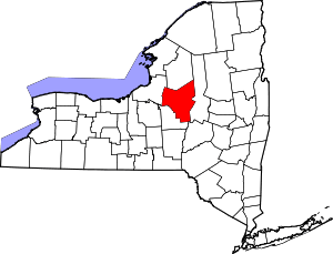 | |
| Towns | ||
| Villages | ||
| CDPs | ||
| Hamlets | ||