Hollins, Alabama
| Hollins, Alabama | |
|---|---|
| Census-designated place | |
 Hollins | |
| Coordinates: 33°07′03″N 86°08′40″W / 33.11750°N 86.14444°WCoordinates: 33°07′03″N 86°08′40″W / 33.11750°N 86.14444°W | |
| Country | United States |
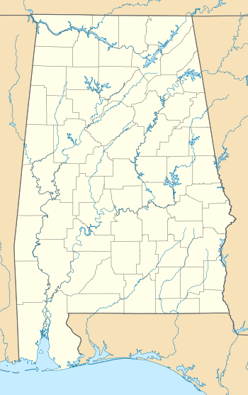
| State | Alabama |
| County | Clay |
| Area[1] | |
| • Total | 11.873 sq mi (30.75 km2) |
| • Land | 11.842 sq mi (30.67 km2) |
| • Water | 0.031 sq mi (0.08 km2) |
| Elevation | 827 ft (252 m) |
| Population (2010)[2] | |
| • Total | 545 |
| • Density | 46/sq mi (18/km2) |
| Time zone | Central (CST) (UTC-6) |
| • Summer (DST) | CDT (UTC-5) |
| Area code(s) | 256 & 938 |
| GNIS feature ID | 159790[3] |
Hollins is a census-designated place and unincorporated community in Clay County, Alabama, United States. Its population was 545 as of the 2010 census.[4]
History
Hollins is named after an official who worked for the Kaul Lumber Company.[5] Hollins began when the Columbus and Western Railway reached the area in the late 1800s. In 1888, John Kaul bought out the Sample Lumber Company in Hollins and founded the Kaul Lumber Company. The large demand for lumber led to an increase in lumber jobs in Hollins. In addition to the Kaul Lumber headquarters and mill, Hollins was home to a hotel, several general stores, three churches, a school, and a cotton gin. Hollins was incorporated on February 21, 1893. In 1908, the Kaul Lumber mill burned and was rebuilt. In 1911, the mill was closed and was moved to Kaulton. The population began to decline, and Hollins' town charter was dissolved on September 25, 1919.[6] A post office began operation under the name Hollins in 1887.[7]
In 1890 and 1900, Hollins was the second largest community in Clay County after Ashland, the county seat. It reached its zenith of 688 persons in 1910 before its dissolution in 1919, but had fallen behind Lineville in importance to third place. With its recognition as a census-designated place in 2010, it has resumed its third-place position.
Demographics
| Historical population | |||
|---|---|---|---|
| Census | Pop. | %± | |
| 1890 | 422 | — | |
| 1900 | 238 | −43.6% | |
| 1910 | 688 | 189.1% | |
| 2010 | 545 | — | |
| U.S. Decennial Census[8] | |||
References
- ↑ "US Gazetteer files: 2010, 2000, and 1990". United States Census Bureau. 2011-02-12. Retrieved 2011-04-23.
- ↑ "American FactFinder". United States Census Bureau. Retrieved 2011-05-14.
- ↑ "Hollins". Geographic Names Information System. United States Geological Survey.
- ↑ "Geographic Identifiers: 2010 Demographic Profile Data (G001): Hollins CDP, Alabama". U.S. Census Bureau, American Factfinder. Retrieved June 6, 2014.
- ↑ Foscue, Virginia (1989). Place Names in Alabama. Tuscaloosa: The University of Alabama Press. p. 73. ISBN 0-8173-0410-X.
- ↑ Don C. East (1 December 2008). A Historical Analysis of the Creek Indian Hillabee Towns: And Personal Reflections on the Landscape and People of Clay County, Alabama. iUniverse. pp. 138–42. ISBN 978-1-4401-0154-0.
- ↑ "Clay County". Jim Forte Postal History. Retrieved 7 January 2015.
- ↑ "U.S. Decennial Census". Census.gov. Retrieved June 6, 2013.
External links
Municipalities and communities of Clay County, Alabama, United States | ||
|---|---|---|
| City | 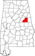 | |
| Town | ||
| CDPs | ||
| Unincorporated communities | ||