Hoonah Airport
| Hoonah Airport | |||||||||||
|---|---|---|---|---|---|---|---|---|---|---|---|
 | |||||||||||
| IATA: HNH – ICAO: PAOH – FAA LID: HNH | |||||||||||
| Summary | |||||||||||
| Airport type | Public | ||||||||||
| Owner | State of Alaska DOT&PF - Southeast Region | ||||||||||
| Serves | Hoonah, Alaska | ||||||||||
| Elevation AMSL | 19 ft / 6 m | ||||||||||
| Coordinates | 58°05′46″N 135°24′35″W / 58.09611°N 135.40972°WCoordinates: 58°05′46″N 135°24′35″W / 58.09611°N 135.40972°W | ||||||||||
| Map | |||||||||||
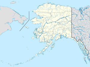
 HNH Location of airport in Alaska | |||||||||||
| Runways | |||||||||||
| |||||||||||
| Statistics (2007) | |||||||||||
| |||||||||||
Hoonah Airport (IATA: HNH, ICAO: PAOH, FAA LID: HNH) is a state-owned public-use airport located one nautical mile (2 km) southeast of the central business district of Hoonah, Alaska.[1]
This airport is included in the National Plan of Integrated Airport Systems for 2015-2019, which categorized it as a nonprimary commercial service airport based on 9,564 enplanements in 2012.[2] As per Federal Aviation Administration records, the airport had 7,680 passenger boardings (enplanements) in calendar year 2008,[3] 7,651 enplanements in 2009, and 10,759 in 2010.[4]
Facilities and aircraft
Hoonah Airport has one runway designated 6/24 with an asphalt surface measuring 2,997 by 75 feet (913 x 23 m).[1] For the 12-month period ending December 31, 2007, the airport had 3,750 aircraft operations, an average of 10 per day: 80% air taxi and 20% general aviation.[1]
Airlines and destinations
The following airline offers scheduled passenger service:
| Airlines | Destinations |
|---|---|
| Air Excursions | Juneau[5] |
| Wings of Alaska | Juneau |
| Carrier | Passengers (arriving and departing) |
|---|---|
| SeaPort | 8,850(43.4%) |
| Wings of Alaska | 8,280(40.6%) |
| Excursions | 3,250(15.9%) |
| Rank | City | Airport | Passengers |
|---|---|---|---|
| 1 | Juneau, AK | JNU | 10,000 |
See also
References
- 1 2 3 4 FAA Airport Master Record for HNH (Form 5010 PDF). Federal Aviation Administration. Effective August 25, 2011.
- ↑ "Appendix A: List of NPIAS Airports with 5-Year Forecast Activity and Development Estimate" (PDF (7.89 MB)). National Plan of Integrated Airport Systems (NPIAS) Report. Federal Aviation Administration. Retrieved May 23, 2016.
- ↑ "Enplanements for CY 2008" (PDF, 1.0 MB). CY 2008 Passenger Boarding and All-Cargo Data. Federal Aviation Administration. December 18, 2009. External link in
|work=(help) - ↑ "Enplanements for CY 2010" (PDF, 189 KB). CY 2010 Passenger Boarding and All-Cargo Data. Federal Aviation Administration. October 4, 2011. External link in
|work=(help) - ↑ "Destinations". Air Excursions. Retrieved October 27, 2011.
- 1 2 "Hoonah, AK: Hoonah Airport (HNH)". Bureau of Transportation Statistics. July 2011.
External links
- Topographic map from USGS The National Map
- Resources for this airport:
- FAA airport information for HNH
- AirNav airport information for PAOH
- ASN accident history for HNH
- FlightAware airport information and live flight tracker
- NOAA/NWS latest weather observations for PAOH
- SkyVector aeronautical chart for HNH