Horní Újezd (Třebíč District)
| Horní Újezd | |||
|---|---|---|---|
| Municipality | |||
 | |||
| |||
 Horní Újezd | |||
| Coordinates: 49°8′26″N 15°50′34″E / 49.14056°N 15.84278°ECoordinates: 49°8′26″N 15°50′34″E / 49.14056°N 15.84278°E | |||
| Country |
| ||
| Region | Vysočina | ||
| District | Třebíč | ||
| Area | |||
| • Total | 7.16 km2 (2.76 sq mi) | ||
| Elevation | 490 m (1,610 ft) | ||
| Population (2005) | |||
| • Total | 257 | ||
| • Density | 36/km2 (93/sq mi) | ||
| Postal code | 675 22 | ||
| Website | http://mesta.obce.cz/vyhledat.asp?id_org=4452 | ||


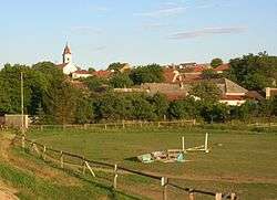
Horní Újezd is a village and municipality (obec) in Třebíč District in the Vysočina Region of the Czech Republic.
The municipality covers an area of 7.16 square kilometres (2.76 sq mi), and has a population of 257 (as at 2005).
Horní Újezd lies approximately 10 kilometres (6 mi) south of Třebíč, 34 km (21 mi) south-east of Jihlava, and 147 km (91 mi) south-east of Prague.
References
| Wikimedia Commons has media related to Horní Újezd (Třebíč District). |
This article is issued from Wikipedia - version of the 4/7/2016. The text is available under the Creative Commons Attribution/Share Alike but additional terms may apply for the media files.