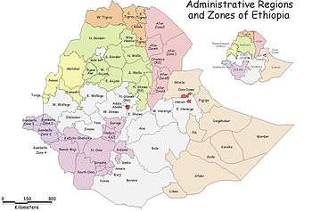
Horo Guduru Welega Zone
Horo Guduru Welega is one of the zones of the Oromia Region in Ethiopia. It is named after the former province of Welega, whose eastern part lay in the area Horo Guduru Welega now occupies. Horo Guduru Welega was formed of woredas which included to East Welega Zone.
The seat of the zonal administration cabinet is in Shambu town. Shambu is a seat for Horro Woreda and Shambu town woreda in addition to the zonal service.
Demographics
Based on the 2007 Census conducted by the Central Statistical Agency of Ethiopia (CSA), this zone has a total population of 570,040, of whom 285,515 are men and 284,525 women. 64,739 or 11.36% of the population are urban inhabitants. A total of 121,136 households were counted in this zone, which results in an average of 4.71 persons to a household and 112,403 housing units.
The two largest ethnic groups reported in Horo Gudru Welega were the Oromo (86.12%) and the Amhara (13.34%); all other ethnic groups made up 0.54% of the population. Oromiffa was spoken as a first language by 85.95% and 13.59% spoke Amharic; the remaining 0.46% spoke all other primary languages reported. The majority of the inhabitants were Protestants, with 42.99% of the population having reported they practiced that belief, while 38.47% of the population professed Ethiopian Orthodox Christianity, 8.91% observed Waaqeffataa [traditional beliefs] and 8.61% of the population were Muslim.[1]
Woredas of Horo Guduru Welega
Abay Coman
Abay Chomen is on the eastern part of the zone. Today this district is sub-divided into 31 Farmer Associations. Finca’a is the capital town of the district, about 47 km from the zonal capital Shambu and 280 km from capital town of Oromia called Finfinne. Fincha’a as an administrative center was established in 1960 E.C when the construction of hydropower dam started.
Abe Dongoro
Abe Dongoro is in the west part of zone. Tulu wayu is the capital town of this district, about 265 km from the zonal capital Shambu and 448 km from the capital town of Oromia called Finfinne.
Amuru-Jarte
Geography
Amuru Jarte district with an area of 2380.3 km2 is the 4th largest district in East Wellega zone bordering Abbay Chomen and Jimma Horro in the east, Gidda Kiremu in the west, Amhara Regional State in the north and Jimma Horro and Abe Dongoro in the south. Alibo is the center for the district’s administration. The district has rugged landforms dominated by mountain ridges of Koye (2657m), Daben (2531m) and Dima (2530m). The district mainly experiences sub-tropical (W/Dega) and temperate (Dega) types of climatic conditions. The altitude ranges from 860m to 2657m above sea level. The rivers in the district are Anger, Chogo, Supe, Ejersa, Bereda, Kono, Aseeti and Jarmet. All are tributaries of the Abay river. The dominant soil types are Rendizinas and Haplic Phaeozems. There are no parks, games reserves or sanctuaries for wildlife conservation.
Population
The projected population size for Amuru Jarte district in 1997 was 77,826. The urban population accounted for 8.4% of the total. Females accounted for 53.4% of the urban, 50.6% of the rural and 50.8% of the population. The crude density of the district was 36.7 persons per km2.
Agriculture
About 49.1% of the district’s area was cultivable land, 16% was pasture land, forests and buses covered 10.5% and others accounted for the remaining 24.4%. The farm size per household was 2.5 hectares. However, about 33.6% of the farmers had no farm oxen. The district had 13 Farmers’ Associations with 9847 member farmers. There were 10 Farmers’ Service Cooperatives with 7250 members in the district.
Teff, wheat, barley, maize, millet and sorghum from cereals, horse beans, peas and haricot beans from pulses are important crops grown in Amuru Jarte. The area under all annual crops was 15,670 hectares (13.4% of the cultivable land) and the total production was about 184,9490 quintals. About 12,687 quintals of fertilizers, 459 quintals of improved seeds and 250 kg of powder pesticides were distributed to farmers. The farmers practice traditional method of maintaining soil fertility like fallowing, crop rotation and manuring. Crop pests include shoot fly, stalk borer, army worm, grasshopper, aphids, birds, apes, monkeys and other wild animals. Regarding crop diseases, bacterial and fungal cases have been reported. The district had 61,901 heads of cattle, 10,112 sheep, 11,000 goats, 4925 equines and 30,749 poultry. Livestock diseases in the district are trypanosomiasis, anthrax blackleg, pasteurolosis, external and internal parasistes.
Mining and industry
Studies have not been made of mineral resources, but there are minerals like gold in the area. Construction materials such as sandstone and gravel are also available. The district had three grain mills (the only small-scale industries) in the mentioned year.
Trade and tourism
The local cash crops are Niger seed, rape seed and linseed. These oil seeds are supplied to the central market in large quantities. About 1,542 hides and 22,681 skins were sent to the central market from the district.
Amuru Jarte is endowed with waterfalls such as Malka Sadan, Birbe, Walage and Bajet, caves such as Sire and Weskemba and hot springs that can attract tourists to the area.
Services
There were 11 km of all weather and 16 km of dry weather roads in the district. There were no telephone and postal services in the district in the mentioned year. The district had 19 elementary, four junior, and one senior secondary schools. There were 10,240 students (37.5% were females) and 261 teachers (7.7% were females). Dropouts were 10.8% of the student population.
One health center and four clinics were the health institutions with five nurses and 17 health assistants. About 12.5% of the district’s population had access to potable water. The district had no electricity supply and fuel stations. Similarly, there were no banks and insurance organizations. Amuru Jarte had one veterinary clinic, two animal health posts with two animal health assistants and three technicians.
Problems and potential
Soil erosion, lack of health institutions and personnel, insufficient veterinary services, lack of communication services and electricity supply are some of the problems. Regarding the potentialities, Amuru Jarte has untouched farmland in the lowland which is suitable for crop production.
Jimma Horro
Geography
In the northeast central part of East Wellega zone with an area of 998.7 km2, Jimma Horro district borders Abay Chomen and Guduru in the east, Bila Sayo and Abe Dongoro in the west, Amuru Jarte in the north and West Shewa in the south. Shambu town is the administrative center. Most of the district is characterized by undulating surface dominated by mountain ridge and hilly landforms. The district experiences a temperate (Dega) type of climate. There are many mountains such as Belbela (3178m), Debisho (2980m) Jeldessa (2950m), Gudena (2740m) (2747m) and Korma (2820m). Most of these are the sources of many rivers and streams. Some of the rivers are Geber, Gembo, Deneba and Abjar. The dominant soil types are Rendzinas, Haplic and Luvic Phaeozems. There are natural and man-made forest areas. There are small patches of forests. The wild animals include leopard, fox, buffalo, lion, ape and monkey. The district had no parks, game reserves or sanctuaries for wildlife conservation.
Population
Jimma Horro district is the 2nd populous district in East Wellega zone. The total population of the district was 125,346 in 1997. The urban population was 14% of the total. Females accounted for 52.2% of the urban, 50.6% of the rural and 50.8% of the total population in the district. The crude population density of the district was about 109 persons per km2.
Agriculture
Cultivable land grazing land covered 61.6% and 8.0% of the district respectively. About 11.1% was covered by forests and shrubs, while others covered 19.3% of the district. Jimma Horro had 27 Farmers’ Associations with 21,138 member farmers (9.3% females). About 13,974 farmers (7.8% females) were also members of the 15 Service Cooperatives in the district. The important crops grown in the district are teff, wheat, barley, maize, millet, oats and sorghum from cereals, horse beans and peas from pulses, and Niger seed, falx and rape seed from oil seed from oil crops. About 437,667 quintals were harvested from 44,382 hectares under different crops. Jimma Horro district is a surplus producing district. However, 20.8% of the farmers had no farm oxen. About 6563 quintals of fertilizers, 304 quintals of improved seeds, 179 kg of powder pesticides and 300 liters of herbicides were distributed to farmers. Crop pests such as termites, weevils, rodents, apes, monkeys and birds and crop diseases such as rust, smuts, leaf blights and powdery mildew were reported. Jimma Horro had 138,871 cattle, 27,777 sheep, 13,724 goats, 16,780 equines and 26,787 poultry.
Mining and industry
Construction materials such as sand and granite are available in the district. No detailed study has been conducted regarding mineral resources of the district. The district had 40 grain mills, 3 oil mills and one bakery.
Trade and tourism
Niger seed, rape seed and linseed are produced as local cash crop and for export. Large quantities of these crops are supplied to the central market. About 4369 hides and 40,828 skins (number) were supplied to the central market. Chato natural forest and Chomen swamp are important sites for tourist attractions in the district.
Services
Jimma horro had 89 km of all weather and 15 km of dry weather roads, one manually operated telephone station and two post offices. About 11.7% of the district’s population had access to potable water supply. The district had two hanks (Commercial Bank and Development Bank) but no insurance organizations. The district gets hydro electricity supply from Fincha’a. Shambu town has a fuel station in the district. The 20 elementary, 6 junior and 2 senior secondary schools of the district had 19,003 students (37.1% females) and 537 teachers (14.2% females). It was reported that 11.9% of the students in the district were dropouts. There were one hospital and 8 clinics with 2 doctors, 14 nurses, 30 health assistants and 3 technicians. Regarding veterinary service, the district had one veterinary clinic and 3 animal health posts with one veterinary doctor, 4 animal health assistants and 3 technicians.
Problems and potentials
Shortage of farmland and grazing land, deforestation, high prices of agricultural inputs and insufficient veterinary services can be mentioned as problems in the district. Even though there is shortage of land in the district, Jimma Horro is a self-sufficient and surplus producing district with some areas suitable for irrigation in the future.
AANAA JIMMAA GANNATII Aanaan jimmaa gannatii magaala guddoo baiyya keenyaa addis ababaa irraa 287km irratti argamti.aanaan kun qilleensa mijataa fi baayyee jireenyaaf mijatu qabdi
.
Jimma Rare
Jima Rare is found in Horo Guduru Wellega Zone in the east part of the zone. Today this district is sub-divided into 18 farmer associations for administrative purpose.
Wayu is the capital town, about 96 km away from the zonal capital shambu and 245 km from the capital town of Oromia that is called Finfinnee. Wayu is reach of many natural and artificial properties and there are many sites of recreation like Tullu Mara and Qunburo.
Jardega-Jarte
Jarte Jardega is one of the districts found in Horro Guduru Wallagga Zone in the east part. Today this district is sub-divided into peasant associations for administrative purposes. Alibo is the capital town, about 54 km from the zonal capital Shambu and 367 from capital town Oromia called Finfinne.
Guduru
Geography
Guduru district (2474 km2) is the third largest district in East Wellega zone bordering West Shewa in the east, Jimma Horro and Abay Chomen in the west, Amhara Regional State in the north and West Shewa and Jimma Rare in the south. Kombolcha is the administrative center of the district. A sub-tropical (W/Dega) Climate covers most of the district. The highest peak is Habib mountain with an altitude of 2430m. Rivers of the district are Abune, Boye, Asendabo, Gebete, Korke, Kersa, Imbabo and Dede wata. Most of them flow to Guder, Abay and Fincha’a rivers. The three types of soils are Nitosols, Eutric Cambisols and Arenosols. The district has no natural and man-made forests, except the bushes and shrubs in lowland areas of Abay and Guder valleys. The district had no parks, reserved areas or sanctuaries for wildlife conservation.
Population
The total population of Guduru district in 1997 was 116,099, of which 4526 (53.8% females) were urban and 111,573 (50.3% females) were rural. The crude population density was about 47 persons per km2.
Agriculture
The cultivable land in Guduru district was 53.8% of the district, while grazing land and vegetation cover were 15.3% and 14.3% respectively. There were 36 Farmers’ Associations in Guduru district with 14,036 member farmers. The 15 Service Cooperatives had 12,898 member farmers. The major crops are teff, wheat, barley, maize, millet and sorghum from cereals, horse beans and peas from pulses, and Niger seeds, lentils and rape seeds from oil crops. From 53,492 hectares of different annual crops, 408,677 quintals were produced. The first three leading crops in production were teff, maize, and Niger seed. About 35.7% of the farmers had no farm oxen in the indicated year. Regarding agricultural inputs, 19,719 quintals of fertilizers, 186 quintals of improved seeds and 230 litres of herbicides were distributed to farmers in Guduru. The district had 133,817 cattle, 20,957 sheep, 23,259 goats, 7972 equines and 37,079 poultry.
Mining and industry
No detail studies have been made regarding mineral resources of the district. However, some reports indicate that mineral water and construction materials such as gravel are available in the district. The district had 27 grain mills and 3 oil mills. There were no other types of industries in the district except these small scale industries.
Trade and tourism
The local cash crops are Niger seed and rape seed. These oil seeds are supplied to the central market in large quantities. About 1794 hides and 20,333 skins (number) were sent to the central market. In Guduru district, there are some tourist attraction sites such as Kersedi Fall, Degago Fall, Loya Cave and historical site of Imbabo Battle Field.
Services
About 30 km of all weather and 30 km of dry weather roads were available in the district, but there were no telephone and postal services. Similarly, there were no banks and insurance organizations. About 12.6% of the district’s population had access to potable water supply. The district gets electricity from a diesel generator with interruptions most of the time despite the location of the district closer to Fincha’a hydro electric power station. The district had no fuel station. Guduru district had 18 elementary and 3 junior secondary schools with 6161 students (18.8% females) and 153 teachers (9.8% females). The dropouts were 15.6% of the total student population in the district. There were 15 health assistants working in the 7 governmental and one non-governmental clinics in the district. The district had also 3 animal health posts and one animal health assistant, but no animal health clinic.
Problems and potentialities
No detailed information could be available regarding problems and potentialities of Guduru district. However, shortage of farmland in areas taken by the expansion of Fincha’a lake and insufficient veterinary services have been reported. As of potentialities, the flat land surface of the district is suitable for mechanized agriculture.
References
- ↑ Census 2007 Tables: Oromia Region, Tables 2.1, 2.4, 2.5, 3.1, 3.2 and 3.4.
Woredas of the Horo Gudru Welega Zone | ||
|---|---|---|
| Former woredas | ||
| Current woredas | ||