Huili County
| Huili County | |
|---|---|
| County | |
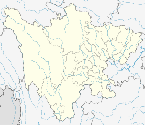 Huili Location in Sichuan | |
| Coordinates: 26°38′N 102°15′E / 26.633°N 102.250°ECoordinates: 26°38′N 102°15′E / 26.633°N 102.250°E | |
| Country | People's Republic of China |
| Province | Sichuan |
| Autonomous prefecture | Liangshan Yi Autonomous Prefecture |
| Township-level divisions |
6 towns 44 townships |
| County seat | Chengguan (城关镇) |
| Area | |
| • Total | 4,527 km2 (1,748 sq mi) |
| Elevation | 1,802 m (5,912 ft) |
| Population (2002) | |
| • Total | 440,000 |
| • Density | 97/km2 (250/sq mi) |
| Time zone | China Standard (UTC+8) |
| Area code(s) | 0834 |
Huili County (simplified Chinese: 会理县; traditional Chinese: 會理縣; pinyin: Huìlǐ Xiàn) is a county of southern Sichuan province, China. It is under the administration of the Liangshan Yi Autonomous Prefecture.
The county was severely affected by the 2008 Panzhihua earthquake.[1]
Geography and climate
Huili County is situated in southern Sichuan and is the southernmost division of the Liangshan Prefecture, bordering Sichuan's Panzhihua City and Yunnan. The county seat has an elevation of about 1,800 m (5,900 ft), although elevations range from 839 m (2,753 ft) along the Jinsha River to 3,920 m (12,860 ft) at Mount Beimu (贝母山).
Due to its southerly location in Sichuan and high elevation, Huili County has a subtropical highland climate (Köppen Cwa), with mild, very sunny and dry winters, and very warm, rainy summers. The monthly 24-hour average temperature ranges from 7.1 °C (44.8 °F) in January to 21.1 °C (70.0 °F) in June, and the annual mean is 15.07 °C (59.1 °F). Over 60% of the 1,150 mm (45 in) annual precipitation occurs from June to August. With monthly percent possible sunshine ranging from 34% in July to 72% in February, the county seat receives 2,348 hours of bright sunshine annually.
| Climate data for Huili County (1971−2000) | |||||||||||||
|---|---|---|---|---|---|---|---|---|---|---|---|---|---|
| Month | Jan | Feb | Mar | Apr | May | Jun | Jul | Aug | Sep | Oct | Nov | Dec | Year |
| Average high °C (°F) | 15.6 (60.1) |
17.9 (64.2) |
21.4 (70.5) |
24.5 (76.1) |
26.5 (79.7) |
26.0 (78.8) |
25.6 (78.1) |
25.7 (78.3) |
23.6 (74.5) |
21.4 (70.5) |
18.2 (64.8) |
15.4 (59.7) |
21.8 (71.3) |
| Average low °C (°F) | 0.1 (32.2) |
2.0 (35.6) |
5.1 (41.2) |
9.0 (48.2) |
13.8 (56.8) |
17.4 (63.3) |
17.6 (63.7) |
16.7 (62.1) |
15.1 (59.2) |
12.1 (53.8) |
6.2 (43.2) |
1.3 (34.3) |
9.7 (49.5) |
| Average precipitation mm (inches) | 7.2 (0.283) |
6.9 (0.272) |
11.9 (0.469) |
19.0 (0.748) |
79.8 (3.142) |
221.1 (8.705) |
278.0 (10.945) |
210.0 (8.268) |
190.0 (7.48) |
90.0 (3.543) |
27.7 (1.091) |
6.3 (0.248) |
1,147.9 (45.194) |
| Average precipitation days (≥ 0.1 mm) | 2.3 | 3.0 | 4.6 | 6.3 | 11.8 | 17.7 | 20.5 | 18.7 | 18.1 | 12.3 | 5.6 | 2.5 | 123.4 |
| Average relative humidity (%) | 65 | 58 | 54 | 58 | 61 | 74 | 82 | 82 | 83 | 80 | 76 | 72 | 70.4 |
| Mean monthly sunshine hours | 233.4 | 226.5 | 256.7 | 252.5 | 231.9 | 157.0 | 143.6 | 170.3 | 127.4 | 152.1 | 186.4 | 210.1 | 2,347.9 |
| Percent possible sunshine | 71 | 72 | 69 | 66 | 56 | 38 | 34 | 42 | 35 | 43 | 57 | 65 | 53 |
| Source: China Meteorological Administration | |||||||||||||
References
- ↑ "China: Earthquake in Sichuan and Yunnan" (PDF). International Federation of Red Cross and Red Crescent Societies. 2 September 2008. Retrieved 30 June 2011.