Litang County
| Litang County | |
|---|---|
| County | |
| Chinese transcription(s) | |
| • Simplified | 理塘县 |
| • Traditional | 理塘縣 |
| • Pinyin | Lǐtáng Xiàn |
| Tibetan transcription(s) | |
| • Tibetan script | ལི་ཐང་རྫོང |
| • Wylie | li tang rdzong |
| • THL | Litang Dzong |
|
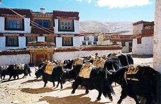
Yaks in the Ganden Thubchen Choekhorling monastery courtyard | |
.png) Litang County (red) in Garzê Prefecture (yellow) and Sichuan | |
 Litang Location of the seat in Sichuan | |
| Coordinates: 30°00′N 100°16′E / 30.000°N 100.267°ECoordinates: 30°00′N 100°16′E / 30.000°N 100.267°E | |
| Country | China |
| Province | Sichuan |
| Autonomous prefecture | Garzê Tibetan Autonomous Prefecture |
| County seat | Litang Town |
| Elevation | 3,954 m (12,972 ft) |
| Population (2001) | |
| • Total | 47,500 |
| Time zone | China Standard (UTC+8) |
| Website |
litang |
Litang or Lithang County (Wylie: ལི་ཐང་རྫོང ; Chinese: 理塘县) is in southwest of Garzê Tibetan Autonomous Prefecture, Sichuan, China. In 2001 it had a population of 47,500.
Before the Battle of Chamdo, Lithang was part of Kham, Tibet, and several famous Buddhist figures were born here, including the 7th Dalai Lama, the 10th Dalai Lama, the 11th Tai Situpa, four of the Pabalas, as well as the 5th Jamyang Zhépa of Labrang Monastery. Düsum Khyenpa, 1st Karmapa Lama, returned here and built two monasteries, Kampo Nénang Monastery next to the Genyen Massif, where he trained the important Kagyu teacher, Drogön Rechen (Wylie: 'gro mgon res pa chen po , 1148-1218) who recognised his tulku, and the Pangphuk Monastery, founded in 1169.
It also has strong connections with the eponymous hero of the Epic of King Gesar,[1]
Modern history
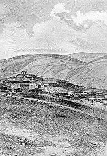
During the 1950s, the region around Litang was one of the main areas of Tibetan armed resistance to the presence of the People's Liberation Army. A resistance group called the Chushi Gangdruk was active in the area. In 1956 the monastery in Litang was bombed by the PLA.
Litang Town (the seat of the county) itself is located at an altitude of 4,014 metres. It is on open grassland and surrounded by snow-capped mountains and is about 400 meters higher than Lhasa, making it one of the highest towns in the world.[2]
In August, 2007, a horse-racing festival at Litang was the scene of an impromptu anti-government political speech by Runggye Adak, which was followed by protests calling for his release. A crackdown officially described as "patriotic education campaign" followed in autumn of 2007, including several politically motivated arrests and attempts to force local Tibetans to denounce the 14th Dalai Lama.[3]

Administrative divisions
Litang County administers one town and 23 more rural townships:
- Urban Town:Litang Town (理塘镇)
- Townships:Junba Township (君坝乡), Hayi Township (哈依乡), Juewu Township (觉吾乡), Moba Township (莫坝乡), Yahuo Township (亚火乡), Rongba Township (绒坝乡), Gake Township (呷柯乡), Benge Township (奔戈乡), Cunge Township (村戈乡), Heni Township (禾尼乡), Qudeng Township (曲登乡), Lamaya Township (喇嘛垭乡), Zhangna Township (章纳乡), Shangmula Township (上木拉乡), Xiamula Township (下木拉乡), Zhongmula Township (中木拉乡), Zhuosang Township (濯桑乡), Jiawa Township (甲洼乡), Cangba Township (藏坝乡), Gemu Township (格木乡), Labo Township (拉波乡), Maiwa Township (麦洼乡), Dezuo Township (德巫乡)
Climate
With an elevation of nearly 4,000 metres (13,000 ft), Litang has an alpine subarctic climate (Köppen Dwc), with long, cold, dry winters, and short, cool summers with very frequent rain. The monthly 24-hour average temperature ranges from −5.8 °C (21.6 °F) in January to only 10.6 °C (51.1 °F) in July; the annual mean is 3.25 °C (37.8 °F). Over 80% of the 722 mm (28.4 in) of annual precipitation is delivered from June to September. With monthly percent possible sunshine ranging from 38% in July to 83% in December, the county seat receives 2,643 hours of bright sunshine annually, with winter by far the sunniest season.
| Climate data for Litang (1971−2000) | |||||||||||||
|---|---|---|---|---|---|---|---|---|---|---|---|---|---|
| Month | Jan | Feb | Mar | Apr | May | Jun | Jul | Aug | Sep | Oct | Nov | Dec | Year |
| Average high °C (°F) | 3.5 (38.3) |
5.0 (41) |
8.0 (46.4) |
11.0 (51.8) |
15.3 (59.5) |
17.1 (62.8) |
16.8 (62.2) |
16.3 (61.3) |
15.1 (59.2) |
12.3 (54.1) |
7.8 (46) |
4.2 (39.6) |
11.0 (51.9) |
| Average low °C (°F) | −13.3 (8.1) |
−10.6 (12.9) |
−6.5 (20.3) |
−2.9 (26.8) |
1.5 (34.7) |
5.4 (41.7) |
6.3 (43.3) |
5.8 (42.4) |
3.9 (39) |
−0.8 (30.6) |
−7.5 (18.5) |
−12.7 (9.1) |
−2.6 (27.3) |
| Average precipitation mm (inches) | 1.4 (0.055) |
4.0 (0.157) |
10.1 (0.398) |
21.9 (0.862) |
52.5 (2.067) |
134.4 (5.291) |
185.1 (7.287) |
155.5 (6.122) |
115.2 (4.535) |
34.0 (1.339) |
5.2 (0.205) |
2.9 (0.114) |
722.2 (28.432) |
| Average precipitation days (≥ 0.1 mm) | 2.1 | 4.1 | 8.0 | 11.9 | 14.2 | 20.7 | 24.6 | 22.8 | 20.1 | 9.8 | 4.4 | 2.2 | 144.9 |
| Average relative humidity (%) | 40 | 43 | 47 | 54 | 55 | 67 | 75 | 76 | 74 | 63 | 51 | 44 | 57.4 |
| Mean monthly sunshine hours | 259.7 | 231.8 | 248.4 | 228.2 | 235.1 | 186.4 | 161.9 | 168.3 | 177.7 | 233.4 | 251.0 | 261.0 | 2,642.9 |
| Percent possible sunshine | 81 | 74 | 67 | 59 | 56 | 45 | 38 | 41 | 48 | 66 | 79 | 83 | 60 |
| Source: China Meteorological Administration | |||||||||||||
Transport
Notes
- ↑ Mayhew, Bradley and Kohn, Michael. (2005). Tibet. 6th Edition, p. 260. Lonely Planet. ISBN 1-74059-523-8.
- ↑ Buckley, Michael and Straus, Robert. (1986) Tibet: a travel survival kit, p, 219. Lonely Planet Publications. South Yarra, Victoria, Australia. ISBN 0-908086-88-1.
- ↑ "Crackdown in eastern Tibet."
External links
Further reading
- Tsering Shakya: The Dragon in the Land of Snows. A History of Modern Tibet Since 1947, London 1999, ISBN 0-14-019615-3
| County-level divisions | 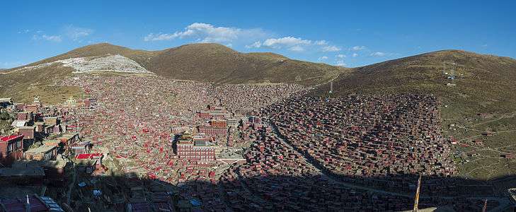  | |
|---|---|---|
| Towns and villages |
| |
| Geography | ||
| Landmarks | ||