Ichtegem
| Ichtegem | |||
|---|---|---|---|
| Municipality | |||
 | |||
| |||
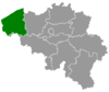
 Ichtegem Location in Belgium | |||
|
Location of Ichtegem in West Flanders 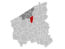 | |||
| Coordinates: 51°06′N 03°00′E / 51.100°N 3.000°ECoordinates: 51°06′N 03°00′E / 51.100°N 3.000°E | |||
| Country | Belgium | ||
| Community | Flemish Community | ||
| Region | Flemish Region | ||
| Province | West Flanders | ||
| Arrondissement | Ostend | ||
| Government | |||
| • Mayor | Karl Bonny (CD&V) | ||
| • Governing party/ies | CD&V, BLAUW | ||
| Area | |||
| • Total | 45.33 km2 (17.50 sq mi) | ||
| Population (1 January 2016)[1] | |||
| • Total | 13,945 | ||
| • Density | 310/km2 (800/sq mi) | ||
| Postal codes | 8480 | ||
| Area codes | 050, 051, 059 | ||
| Website | www.ichtegem.be | ||


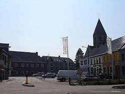
Ichtegem is a municipality located in the Belgian province of West Flanders 15 km southwest of Bruges. The municipality comprises the towns of Bekegem, Eernegem and Ichtegem proper. On January 1, 2006 Ichtegem had a total population of 13,423. The total area is 45.33 km² which gives a population density of 296 inhabitants per km². The current mayor is Karl Bonny.
In 2006, Ichtegem was declared the official Dorp van de Ronde (Town of the Tour) for the 90th annual road cycling race the Tour of Flanders.
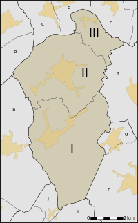 |
Map of Ichtegem, neighbourhoods within the municipality and its neighbours. The orange/yellow areas are urban areas. Ichtegem:
Neighbouring villages:
|
References
- ↑ Population per municipality as of 1 January 2016 (XLS; 397 KB)
External links
 Media related to Ichtegem at Wikimedia Commons
- Official website - Available only in Dutch
 |
Gistel | Oudenburg | Jabbeke | |
| Koekelare | |
Zedelgem | ||
| ||||
| | ||||
| Kortemark | Torhout |
This article is issued from Wikipedia - version of the 12/1/2016. The text is available under the Creative Commons Attribution/Share Alike but additional terms may apply for the media files.