Iliamna, Alaska
| Iliamna, Alaska | |
|---|---|
| CDP | |
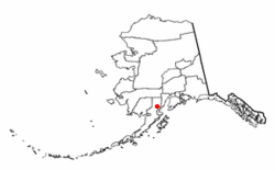 Location of Iliamna, Alaska | |
| Coordinates: 59°45′54″N 154°50′25″W / 59.76500°N 154.84028°WCoordinates: 59°45′54″N 154°50′25″W / 59.76500°N 154.84028°W | |
| Country | United States |
| State | Alaska |
| Borough | Lake and Peninsula |
| Government | |
| • Borough mayor | Glen Alsworth, Sr.[1] |
| • State senator | Lyman Hoffman (D) |
| • State rep. | Bryce Edgmon (D) |
| Area | |
| • Total | 36.5 sq mi (94.5 km2) |
| • Land | 35.9 sq mi (93.0 km2) |
| • Water | 0.6 sq mi (1.6 km2) |
| Population (2010) | |
| • Total | 109 |
| • Density | 3.0/sq mi (1.2/km2) |
| Time zone | Alaska (AKST) (UTC-9) |
| • Summer (DST) | AKDT (UTC-8) |
| ZIP codes | 99606, 99647 |
| Area code(s) | 907 |
| FIPS code | 02-35120 |
Iliamna (Dena'ina: Illiamna) is a census-designated place (CDP) in Lake and Peninsula Borough, Alaska, United States. The population was 109 at the 2010 census.
History
Iliamna was originally the name of an Athabaskan village at the point where the Iliamna River flows into Iliamna Lake, about 65 miles (105 km) from present-day Iliamna. That site is now called "Old Iliamna." In 1935, the residents of Old Iliamna moved to the present-day location.
The first sport fishing lodge in Iliamna was built in the 1930s and the second was built in the 1950s. Many more were built in the later 1900s. Iliamna's economy has two main elements: subsistence fishing and hunting and sport fishing lodges. Year-round residents largely pursue subsistence activities while summer workers from other areas work in the lodges.
Iliamna faces the prospect of developing into a mining town, as several multi-national companies plan to develop the area northwest of the village into one of North America's largest gold-copper-molybdenum mines. The first company to submit plans to the State of Alaska is Northern Dynasty Minerals, a wholly owned subsidiary of Hunter Dickinson. The Lake and Peninsula Borough, the region's governing body, passed a strong resolution in support of the mine's development, but the majority of the surrounding villages adamantly oppose it. Two non-profit organizations are leading the fight against open-pit mining in the Bristol Bay watershed - the Bristol Bay Alliance and the Renewable Resources Coalition. A study concluded in 2006 indicated the majority of Alaskans were opposed to the development.
Geography
Iliamna is located at 59°45′54″N 154°50′25″W / 59.76500°N 154.84028°W (59.765135, -154.840312).[2]
Present-day Iliamna is located on the northwest side of Iliamna Lake in southwest Alaska.
According to the United States Census Bureau, the CDP has a total area of 36.5 square miles (95 km2), of which, 35.9 square miles (93 km2) of it is land and 0.6 square miles (1.6 km2) of it (1.67%) is water.
Climate
Iliamna has a continental subarctic climate (Köppen Dfc).
| Climate data for Iliamna | |||||||||||||
|---|---|---|---|---|---|---|---|---|---|---|---|---|---|
| Month | Jan | Feb | Mar | Apr | May | Jun | Jul | Aug | Sep | Oct | Nov | Dec | Year |
| Record high °F (°C) | 49 (9) |
49 (9) |
50 (10) |
67 (19) |
80 (27) |
91 (33) |
84 (29) |
83 (28) |
70 (21) |
66 (19) |
52 (11) |
48 (9) |
91 (33) |
| Average high °F (°C) | 22.6 (−5.2) |
25.5 (−3.6) |
29.5 (−1.4) |
39.2 (4) |
50.6 (10.3) |
59 (15) |
62.5 (16.9) |
61 (16) |
54.1 (12.3) |
40.8 (4.9) |
29.9 (−1.2) |
23.1 (−4.9) |
41.5 (5.3) |
| Average low °F (°C) | 9.9 (−12.3) |
11.7 (−11.3) |
14.4 (−9.8) |
24.9 (−3.9) |
35.3 (1.8) |
43.2 (6.2) |
48.3 (9.1) |
48.1 (8.9) |
41.7 (5.4) |
29.3 (−1.5) |
18.4 (−7.6) |
10.5 (−11.9) |
28 (−2) |
| Record low °F (°C) | −47 (−44) |
−46 (−43) |
−30 (−34) |
−16 (−27) |
4 (−16) |
30 (−1) |
34 (1) |
31 (−1) |
21 (−6) |
−4 (−20) |
−20 (−29) |
−31 (−35) |
−47 (−44) |
| Average precipitation inches (mm) | 1.28 (32.5) |
1.13 (28.7) |
1.09 (27.7) |
1.05 (26.7) |
1.17 (29.7) |
1.52 (38.6) |
2.7 (69) |
4.59 (116.6) |
4.41 (112) |
3.08 (78.2) |
1.99 (50.5) |
1.55 (39.4) |
25.56 (649.2) |
| Average snowfall inches (cm) | 10.8 (27.4) |
9.5 (24.1) |
9.8 (24.9) |
5.3 (13.5) |
1 (3) |
0 (0) |
0 (0) |
0 (0) |
0 (0) |
2.5 (6.4) |
8.5 (21.6) |
11.8 (30) |
59.2 (150.4) |
| Average precipitation days | 9 | 10 | 8 | 8 | 9 | 10 | 13 | 16 | 16 | 13 | 11 | 10 | 133 |
| Source: [3] | |||||||||||||
Demographics
As of the census[4] of 2000, there were 102 people, 35 households, and 26 families residing in the CDP. The population density was 2.8 people per square mile (1.1/km²). There were 58 housing units at an average density of 1.6/sq mi (0.6/km²). The racial makeup of the CDP was 39.22% White, 50.00% Native American, and 10.78% from two or more races.
There were 35 households out of which 45.7% had children under the age of 18 living with them, 62.9% were married couples living together, 5.7% had a female householder with no husband present, and 25.7% were non-families. 20.0% of all households were made up of individuals and 2.9% had someone living alone who was 65 years of age or older. The average household size was 2.91 and the average family size was 3.42.
In the CDP the population was spread out with 34.3% under the age of 18, 6.9% from 18 to 24, 28.4% from 25 to 44, 28.4% from 45 to 64, and 2.0% who were 65 years of age or older. The median age was 32 years. For every 100 females there were 112.5 males. For every 100 females age 18 and over, there were 103.0 males.
The median income for a household in the CDP was $60,625, and the median income for a family was $61,250. Males had a median income of $38,333 versus $36,667 for females. The per capita income for the CDP was $19,741. There were no families and 3.1% of the population living below the poverty line, including no under eighteens and none of those over 64.
References
- ↑ 2015 Alaska Municipal Officials Directory. Juneau: Alaska Municipal League. 2015. p. 12.
- ↑ "US Gazetteer files: 2010, 2000, and 1990". United States Census Bureau. 2011-02-12. Retrieved 2011-04-23.
- ↑ "ILIAMNA, AK (503905)". Western Regional Climate Center. Retrieved November 19, 2015.
- ↑ "American FactFinder". United States Census Bureau. Retrieved 2008-01-31.
External links
- Bristol Bay Alliance
- Renewable Resources Coalition
- Subsistence harvests and uses of wild resources in Iliamna, Newhalen, Nondalton, Pedro Bay, and Port Alsworth, Alaska, 2004 / by James A. Fall ... [et al.]. Hosted by Alaska State Publications Program
Municipalities and communities of Lake and Peninsula Borough, Alaska, United States | ||
|---|---|---|
| Cities |  | |
| CDPs | ||
| Ghost town | ||