Illinois's 17th congressional district
| Illinois's 17th congressional district | ||
|---|---|---|
.tif.png) | ||
| Current Representative | Cheri Bustos (D–Moline) | |
| Area | 6,933 mi2 | |
| Distribution | 73.3% urban, 26.7% rural | |
| Population (2011 est.) | 711,719 | |
| Median income | $41,194 | |
| Ethnicity | 82.9% White, 11.5% Black, 1.0% Asian, 8.0% Hispanic, 0.4% Native American, 2.1% other | |
| Cook PVI | D+7[1] | |
The 17th Congressional District of Illinois is represented by Democrat Cheri Bustos. It includes most of the northwestern portion of the state, with most of its population living on the Illinois side of the Quad Cities, as well as parts of Peoria and Rockford.
The 17th congressional district has shifted northward after the 2012 redistricting. It lost Quincy and Decatur, as well as its share of Springfield. It was generally thought that the redrawn map would allow the district to revert to the Democrats, who held it without interruption from 1983 to 2011.[2] As expected, one-term Republican incumbent Bobby Schilling was defeated by Democratic opponent Cheri Bustos in the 2012 election cycle.[3]
2011 redistricting
The district covers parts of Peoria, Tazewell and Winnebago counties, and all of Carroll, Fulton, Henderson, Henry, Knox, Mercer, Rock Island, Stephenson, Warren and Whiteside counties, as of the 2011 redistricting which followed the 2010 census. All or parts of Canton, East Moline, Freeport, Galesburg, Kewanee, Moline, Peoria, Rock Island, Rockford, Pekin and Sterling are included.[4] The representatives for these districts were elected in the 2012 primary and general elections, and the boundaries became effective on January 5, 2013.
Elections
2012 election
History
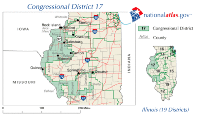
From 2003 to 2013 the district was known as "the rabbit on a skateboard" for its unusual shape devised as the outcome of gerrymandering.[5][6] The boundaries were drawn in a bipartisan deal to protect both Democratic incumbent Lane Evans and neighboring Republican incumbents. The lines of the district were drawn to move Republican voters into neighboring districts and to include Democratic neighborhoods in Springfield and Decatur.[7]
Election results from recent presidential races
| Year | Results |
|---|---|
| 2000 | Gore 53 - 43% |
| 2004 | Kerry 51 - 48% |
| 2008 | Obama 60 - 39%[1] |
| 2012 | Obama 57 - 41%[1] |
List of representatives
| Representative | Party | Years | Electoral history |
|---|---|---|---|
| District created March 4, 1873 | |||
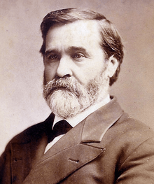 William R. Morrison William R. Morrison |
Democratic | March 4, 1873 – March 4, 1883 |
Redistricted to the 18th district |
 Samuel W. Moulton Samuel W. Moulton |
Democratic | March 4, 1883 – March 4, 1885 |
Redistricted from the 15th district |
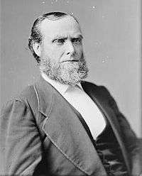 John R. Eden John R. Eden |
Democratic | March 4, 1885 – March 4, 1887 |
[Data unknown/missing. You can help!] |
 Edward Lane Edward Lane |
Democratic | March 4, 1887 – March 4, 1895 |
[Data unknown/missing. You can help!] |
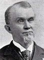 James A. Connolly James A. Connolly |
Republican | March 4, 1895 – March 4, 1899 |
[Data unknown/missing. You can help!] |
 Ben F. Caldwell Ben F. Caldwell |
Democratic | March 4, 1899 – March 4, 1903 |
Redistricted to the 21st district |
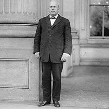 John A. Sterling John A. Sterling |
Republican | March 4, 1903 – March 4, 1913 |
[Data unknown/missing. You can help!] |
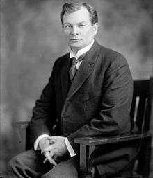 Louis Fitzhenry Louis Fitzhenry |
Democratic | March 4, 1913 – March 4, 1915 |
[Data unknown/missing. You can help!] |
 John A. Sterling John A. Sterling |
Republican | March 4, 1915 – October 17, 1918 |
Died |
| Vacant | October 17, 1918 – March 3, 1919 | ||
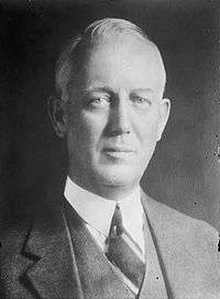 Frank L. Smith Frank L. Smith |
Republican | March 4, 1919 – March 4, 1921 |
[Data unknown/missing. You can help!] |
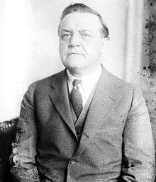 Frank H. Funk Frank H. Funk |
Republican | March 4, 1921 – March 4, 1927 |
[Data unknown/missing. You can help!] |
 Homer W. Hall Homer W. Hall |
Republican | March 4, 1927 – March 4, 1933 |
[Data unknown/missing. You can help!] |
 Frank Gillespie Frank Gillespie |
Democratic | March 4, 1933 – January 3, 1935 |
[Data unknown/missing. You can help!] |
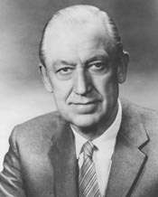 Leslie C. Arends Leslie C. Arends |
Republican | January 3, 1935 – January 3, 1973 |
Redistricted to the 15th district |
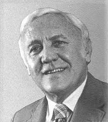 George M. O'Brien George M. O'Brien |
Republican | January 3, 1973 – January 3, 1983 |
Redistricted to the 4th district |
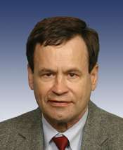 Lane Evans Lane Evans |
Democratic | January 3, 1983 – January 3, 2007 |
[Data unknown/missing. You can help!] |
 Phil Hare Phil Hare |
Democratic | January 3, 2007 – January 3, 2011 |
Lost re-election |
 Bobby Schilling Bobby Schilling |
Republican | January 3, 2011 – January 3, 2013 |
[Data unknown/missing. You can help!] |
 Cheri Bustos Cheri Bustos |
Democratic | January 3, 2013 – Present |
[Data unknown/missing. You can help!] |
Living former Members of the U.S. House of Representatives from Illinois's 17th congressional district
As of May 2015, two former members of the U.S. House of Representatives from Illinois's 17th congressional district are alive.
| Representative | Term in office | Date of birth (and age) |
|---|---|---|
| Phil Hare | 2007 - 2011 | February 21, 1949 |
| Bobby Schilling | 2011 - 2013 | January 23, 1964 |
See also
Notes
- 1 2 3 Barone, Michael; McCutcheon, Chuck (2013). The Almanac of American Politics 2014. Chicago: University of Chicago Press. pp. 593–595. ISBN 978-0-226-10544-4. Copyright National Journal.
- ↑ http://www.rrstar.com/carousel/x230662730/Chuck-Sweeny-Rockford-stands-to-lose-big-in-the-new-17th-District?photo=0
- ↑ "Bustos beats Schilling in redrawn 17th District". aledotimesrecord.com. Retrieved November 8, 2012.
- ↑ Illinois Congressional District 17, Illinois Board of Elections
- ↑ "Electoral boundaries in America". The Economist. October 7, 2010. Retrieved October 8, 2010.
- ↑ Aaron Blake (July 27, 2011). "Name that district! (Gerrymandering edition)". Washington Post. Retrieved July 28, 2011.
- ↑ "5 Ways to Tilt an Election" (PDF). The New York Times. September 25, 2010. Retrieved November 24, 2010.
References
- Martis, Kenneth C. (1989). The Historical Atlas of Political Parties in the United States Congress. New York: Macmillan Publishing Company.
- Martis, Kenneth C. (1982). The Historical Atlas of United States Congressional Districts. New York: Macmillan Publishing Company.
- Congressional Biographical Directory of the United States 1774–present
External links
- Washington Post page on the 17th District of Illinois
- U.S. Census Bureau - 17th District Fact Sheet
- "U.S. Census Bureau - 17th District map" (PDF). (6.29 MiB)
Coordinates: 41°23′22″N 90°13′07″W / 41.38944°N 90.21861°W