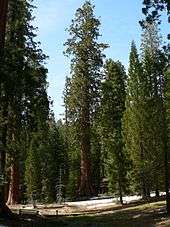
List of giant sequoia groves
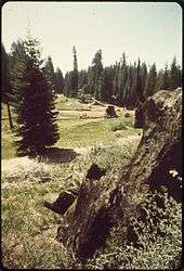
Big Stump Grove in 1972
The following is a list of giant sequoia groves. All naturally occurring groves of giant sequoias are located in moist, unglaciated ridges and valleys of the west slope of the Sierra Nevada range in California, United States. They occur between 1370 – 2000 meters (4500–6500 ft) elevation in the northern half of the range, and 1700–2250 m (5500–7500 ft) in the south.
Groves in the northern half of the range (north of the Kings River) are widely scattered and mostly small, while those south of the Kings River are more numerous. The total area of all the groves combined is approximately 14,416 ha (35,607 acres). The groves are listed from north to south in the list below.
This list is based on five different sources, with slightly varying views on what constitutes a discrete grove; the differing interpretations are noted in italics. The lists of groves were compiled by Rundel (1972; recognizing 75 groves), Flint (1987; recognizing 65 groves), Willard (1994; recognizing 65 groves), the Giant Sequoia National Monument Visitor's Guide (2003) and the Draft Giant Sequoia National Monument Plan 2010. Currently, the U.S. National Park Service cites Rundel's total of 75 groves in its visitor publications. The updated lists from Willard and Flint are now known to be more accurate, therefore some of Rundel's 75 groves have been removed from this list. Below compiles a list of 68 sequoia groves.[1]
North of the Kings River
Listed North to South
| Name |
Location |
Coordinates |
Elevation |
Comments |
|---|
|
|
|
(m) |
(ft) |
|
| Placer County Grove |
Tahoe National Forest, Placer County |
39°03′30″N 120°34′30″W / 39.05833°N 120.57500°W / 39.05833; -120.57500 (Placer County Grove) |
1,580 |
5,180 |
The northernmost grove, with only six trees, the largest 3.6 m (12 ft) in diameter |
| North Calaveras Grove |
Calaveras Big Trees State Park, Calaveras County |
38°17′N 120°18′W / 38.283°N 120.300°W / 38.283; -120.300 (North Calaveras Grove) |
1,450–1,480 |
4,760–4,860 |
The first grove documented, in 1852 |
| South Calaveras Grove |
Calaveras Big Trees State Park, Tuolumne County |
38°15′N 120°14′W / 38.250°N 120.233°W / 38.250; -120.233 (South Calaveras Grove) |
1,450–1,500 |
4,760–4,920 |
Includes the Agassiz tree. |
| Tuolumne Grove |
Yosemite National Park, Mariposa County |
37°46′N 119°48′W / 37.767°N 119.800°W / 37.767; -119.800 (Tuolumne Grove) |
1,700–1,800 |
5,600–5,900 |
|
| Merced Grove |
Yosemite National Park, Mariposa County |
37°45′N 119°50′W / 37.750°N 119.833°W / 37.750; -119.833 (Merced Grove) |
1,700–1,800 |
5,600–5,900 |
|
| Mariposa Grove |
Yosemite National Park, Mariposa County |
37°31′N 119°36′W / 37.517°N 119.600°W / 37.517; -119.600 (Mariposa Grove) |
1,750–2,050 |
5,740–6,730 |
Includes 'Grizzly Giant' tree |
| Nelder Grove |
Sierra National Forest, Madera County |
37°26′N 119°35′W / 37.433°N 119.583°W / 37.433; -119.583 (Nelder Grove) |
1,600–1,700 |
5,200–5,600 |
Three units, partially logged; site of the Shadow of the Giants National Recreation Trail |
| McKinley Grove |
Sierra National Forest, Fresno County |
37°01′N 119°06′W / 37.017°N 119.100°W / 37.017; -119.100 (McKinley Grove) |
1,900–1,950 |
6,230–6,400 |
|
Kings River watershed
The 16 groves in the Kings River watershed are in Kings Canyon National Park, the northern section of Giant Sequoia National Monument, or Sequoia National Forest, in southernmost Fresno County and Tulare County (listed alphabetically):
| Name |
Location |
Coordinates |
Elevation |
Comments |
|---|
|
|
|
(m) |
(ft) |
|
| Abbott Creek Grove |
SNF & GSNM |
36°46′N 118°58′W / 36.767°N 118.967°W / 36.767; -118.967 (Abbott Creek Grove) |
1,900 |
6,200 |
Listed by Rundel and Flint; very small (largely logged); too few trees to qualify as a grove according to Willard |
| Agnew Grove |
SNF & GSNM |
36°47′20″N 118°46′45″W / 36.78889°N 118.77917°W / 36.78889; -118.77917 (Agnew and Deer Meadow Grove) |
1,950–2,000 |
6,400–6,560 |
|
| Bearskin Grove |
SNF & GSNM |
36°45′0″N 118°54′40″W / 36.75000°N 118.91111°W / 36.75000; -118.91111 (Bearskin Grove) |
1,850–1,900 |
6,070–6,230 |
|
| Big Stump Grove |
KCNP, SNF & GSNM |
36°43′N 118°58′W / 36.717°N 118.967°W / 36.717; -118.967 (Big Stump Grove) |
1,850 |
6,070 |
Includes the Burnt Monarch, the remains of which are larger than any living tree. |
| Boulder Creek Grove |
SNF & GSNM |
36°45′N 118°49′W / 36.750°N 118.817°W / 36.750; -118.817 (Boulder Creek Grove) |
2,050 |
6,730 |
Part of Evans Grove complex |
| Cherry Gap Grove |
SNF & GSNM |
36°46′40″N 118°57′30″W / 36.77778°N 118.95833°W / 36.77778; -118.95833 (Cherry Gap Grove) |
2,070 |
6,790 |
Logged. Located between Converse Basin Grove and General Grant Grove, near McGee Overlook |
| Converse Basin Grove |
SNF & GSNM |
36°48′N 118°58′W / 36.800°N 118.967°W / 36.800; -118.967 (Converse Basin Grove) |
1,800–2,000 |
5,900–6,600 |
Once the second-largest grove, but much logged around 1890-1900. However, nearly 100 widely scattered old-growth Giant Sequoias remain (apparently bypassed by the loggers), also good regrowth of younger trees. Home of the Boole Tree which the loggers spared, as it was by far the largest tree in the grove, and now identified as the sixth-largest tree by volume. Also home of the Chicago Stump, the remnant of the General Noble Tree which was cut for the 1893 World Columbian Exposition. The General Noble Tree was the second largest tree in the grove (after the Boole Tree) and it was the largest tree ever cut down. Although not among the very largest Giant Sequoias, the General Noble Tree was perhaps among the top 30 largest Giant Sequoias before it was cut. |
| Deer Meadow Grove |
SNF & GSNM |
36°47′20″N 118°46′45″W / 36.78889°N 118.77917°W / 36.78889; -118.77917 (Agnew and Deer Meadow Grove) |
1,950–2,000 |
6,400–6,560 |
|
| Evans Grove |
SNF & GSNM |
36°48′0″N 118°49′30″W / 36.80000°N 118.82500°W / 36.80000; -118.82500 (Evans Grove) |
2,050–2,250 |
6,730–7,380 |
Heavily logged before 1920. Part of Evans Grove complex, which consists of Evans, Boulder, Little Boulder, Lockwood, Kennedy, and Horseshoe Bend Groves. |
| General Grant Grove |
KCNP, SNF & GSNM |
36°45′N 118°58′W / 36.750°N 118.967°W / 36.750; -118.967 (General Grant Grove) |
1,750–2,000 |
5,740–6,560 |
Includes 'General Grant' |
| Indian Basin Grove |
SNF & GSNM |
36°48′N 118°56′W / 36.800°N 118.933°W / 36.800; -118.933 (Indian Basin Grove) |
1,800–2,000 |
5,900–6,600 |
A mid-size grove, mostly logged. It can be accessed by paved roads. The grove contains many young sequoias approaching diameters of up to 10 feet. |
| Kennedy Grove |
KCNP, SNF & GSNM |
36°46′0″N 118°49′20″W / 36.76667°N 118.82222°W / 36.76667; -118.82222 (Kennedy Grove) |
2,050–2,250 |
6,730–7,380 |
Contains the 13th-largest giant sequoia in the world, The Ishi Giant. Part of Evans Grove complex. |
| Landslide Grove |
SNF & GSNM |
36°45′0″N 118°51′50″W / 36.75000°N 118.86389°W / 36.75000; -118.86389 (Landslide Grove) |
2,050–2,250 |
6,730–7,380 |
|
| Little Boulder Creek Grove |
SNF & GSNM |
36°45′10″N 118°49′0″W / 36.75278°N 118.81667°W / 36.75278; -118.81667 (Little Boulder Creek Grove) |
2,000 |
6,600 |
Part of Evans Grove complex |
| Lockwood Grove |
SNF & GSNM |
36°48′N 118°52′W / 36.800°N 118.867°W / 36.800; -118.867 (Lockwood Grove) |
1,700–1,800 |
5,600–5,900 |
Part of the Evans Complex |
| Monarch Grove |
SNF & GSNM |
36°47′30″N 118°46′45″W / 36.79167°N 118.77917°W / 36.79167; -118.77917 (Monarch Grove) |
1,600–1,900 |
5,200–6,200 |
Immediately north of the Agnew Grove, near Monarch Wilderness boundary. On Forest Service GSNM map. |
| Sequoia Creek Grove |
KCNP |
36°43′50″N 118°58′20″W / 36.73056°N 118.97222°W / 36.73056; -118.97222 (Sequoia Creek Grove) |
1,850 |
6,070 |
|
Kaweah River watershed
The 23 groves in the Kaweah River watershed are all in Sequoia National Park or in private ownership, except the northernmost in Sequoia National Forest & Kings Canyon National Park (listed North to South):
| Name |
Location |
Coordinates |
Elevation |
Comments |
|---|
|
|
|
(m) |
(ft) |
|
| Redwood Mountain Grove |
Sequoia National Forest Giant Sequoia National Monument & Kings Canyon National Park |
36°41′38″N 118°55′08″W / 36.69389°N 118.91889°W / 36.69389; -118.91889 (Redwood Mountain Grove) |
1,960 |
6,430 |
The largest grove, 1240 ha (3100 acres), with 15,800 sequoias 30 cm (one foot) or more in diameter at the base. |
| Lost Grove |
Sequoia National Park |
36°39′04″N 118°49′39″W / 36.65111°N 118.82750°W / 36.65111; -118.82750 (Lost Grove) |
2,030 |
6,660 |
Contains no very large trees, but one tree with a large flaring base, with a perimeter of 104.6 feet (31.9 m). |
| Muir Grove |
Sequoia National Park |
36°37′53″N 118°50′10″W / 36.63139°N 118.83611°W / 36.63139; -118.83611 (Muir Grove) |
2,070 |
6,790 |
Contains one tree of great size. |
| Skagway Grove |
Sequoia National Park |
36°37′00″N 118°50′55″W / 36.61667°N 118.84861°W / 36.61667; -118.84861 (Skagway Grove) |
1,820 |
5,970 |
|
| Pine Ridge Grove |
Sequoia National Park |
|
|
|
| Suwanee Grove |
Sequoia National Park |
36°35′21″N 118°47′53″W / 36.58917°N 118.79806°W / 36.58917; -118.79806 (Suwanee Grove) |
1,880 |
6,170 |
|
| Giant Forest |
Sequoia National Park |
36°33′45″N 118°45′05″W / 36.56250°N 118.75139°W / 36.56250; -118.75139 (Giant Forest) |
2,130 |
6,990 |
Includes half of the ten largest trees by volume, including the largest, 'General Sherman', and 8,400 others 30 cm (one foot) or more diameter at their base. |
| Redwood Meadow Grove |
Sequoia National Park |
36°31′47″N 118°38′38″W / 36.52972°N 118.64389°W / 36.52972; -118.64389 (Redwood Meadow Grove) |
1,690 |
5,540 |
|
| Castle Creek Grove |
Sequoia National Park |
36°31′11″N 118°41′06″W / 36.51972°N 118.68500°W / 36.51972; -118.68500 (Castle Creek Grove) |
1,610 |
5,280 |
|
| Atwell Mill Grove |
Sequoia National Park |
36°27′57″N 118°40′50″W / 36.46583°N 118.68056°W / 36.46583; -118.68056 (Atwell Mill Grove) |
2,100 |
6,900 |
The highest elevation giant sequoias are in this grove. This grove contains four trees (Diamond, AD, Dean and Arm) that are among the largest giant sequoias in the world. |
| Oriole Grove |
Sequoia National Park |
36°28′08″N 118°43′36″W / 36.46889°N 118.72667°W / 36.46889; -118.72667 (Oriole Grove) |
2,030 |
6,660 |
|
| New Oriole Grove |
Sequoia National Park |
|
|
|
| Eden Creek Grove |
Sequoia National Park |
36°24′34″N 118°43′55″W / 36.40944°N 118.73194°W / 36.40944; -118.73194 (Eden Creek Grove) |
1,720 |
5,640 |
|
| Horse Creek Grove |
Sequoia National Park |
36°25′02″N 118°41′37″W / 36.41722°N 118.69361°W / 36.41722; -118.69361 (Horse Creek Grove) |
1,840 |
6,040 |
|
| Cahoon Creek Grove |
Sequoia National Park |
|
|
|
| Case Mountain Grove |
7 1/2 miles southeast of Three Rivers, California, on lands administered by the Bureau of Land Management.[2] |
36°24′18″N 118°47′37″W / 36.40500°N 118.79361°W / 36.40500; -118.79361 (Case Mountain Grove) |
1,750 |
5,740 |
|
| Coffeepot Canyon Grove |
Sequoia National Park |
|
|
|
| Surprise Grove |
Sequoia National Park |
|
|
|
| Homers Nose Grove |
Sequoia National Park |
36°22′53″N 118°44′14″W / 36.38139°N 118.73722°W / 36.38139; -118.73722 (Homers Nose Grove) |
2,330 |
7,640 |
|
| Board Camp Grove |
Sequoia National Park |
|
|
|
| South Fork Grove |
Sequoia National Park |
36°21′28″N 118°43′05″W / 36.35778°N 118.71806°W / 36.35778; -118.71806 (South Fork Grove) |
1,630 |
5,350 |
|
| Garfield Grove |
Near Three Rivers, California |
36°20′00″N 118°43′06″W / 36.33333°N 118.71833°W / 36.33333; -118.71833 (Garfield Grove) |
2,030 |
6,660 |
Home of 'King Arthur', ninth-largest by volume. Now includes the Dillonwood Grove. |
| Devils Canyon Grove |
Sequoia National Park |
|
|
|
Tule River and Kern River watersheds
The 21 groves in the Tule River and Kern River watersheds are mostly in Giant Sequoia National Monument, with some areas in Sequoia National Park, Mountain Home Demonstration State Forest-California State Forest and Tule Indian Reservation; all in southern Tulare County. (listed alphabetically)
| Name |
Location |
Coordinates |
Elevation |
Comments |
|---|
|
|
|
(m) |
(ft) |
|
| Alder Creek Grove |
Giant Sequoia National Monument, Sequoia National Forest / private |
36°11′08″N 118°37′41″W / 36.18556°N 118.62806°W / 36.18556; -118.62806 (Alder Creek Grove) |
2,120 |
6,960 |
also known as Hossack, Pixley, or Ross Creek Grove. Home of 'Alonzo Stagg', the fifth-largest tree by volume. Also home to the Waterfall tree, which has the largest circumference and diameter at ground level of any sequoia. |
| Belknap Grove |
Giant Sequoia National Monument, Sequoia National Forest |
|
|
Part of Belknap Complex consisting of Belknap, Wheel Meadow, McIntyre and Carr Wilson Groves |
| Black Mountain Grove |
Giant Sequoia National Monument, Sequoia National Forest/Tule Indian Reservation / private |
36°06′16″N 118°39′19″W / 36.10444°N 118.65528°W / 36.10444; -118.65528 (Black Mountain Grove) |
1,950 |
6,400 |
Heavily logged in 1984, though mature sequoias were not cut. |
| Burro Creek Grove |
Giant Sequoia National Monument, Sequoia National Forest |
36°13′31″N 118°38′38″W / 36.22528°N 118.64389°W / 36.22528; -118.64389 (Burro Creek Grove) |
1,550 |
5,090 |
|
| Carr Wilson Grove |
Giant Sequoia National Monument, Sequoia National Forest |
|
|
also known as Bear Creek Grove. Part of Belknap Complex |
| Cunningham Grove |
Giant Sequoia National Monument, Sequoia National Forest |
35°58′56″N 118°34′06″W / 35.98222°N 118.56833°W / 35.98222; -118.56833 (Cunningham Grove) |
1,870 |
6,140 |
|
| Deer Creek Grove |
Giant Sequoia National Monument, Sequoia National Forest |
35°52′19″N 118°36′12″W / 35.87194°N 118.60333°W / 35.87194; -118.60333 (Deer Creek Grove) |
1,800 |
5,900 |
The southernmost grove |
| Dennison Grove |
Sequoia National Park |
|
|
|
| Dillonwood Grove |
Sequoia National Park, Sequoia National Forest, Giant Sequoia National Monument |
|
|
|
| Freeman Creek Grove |
Giant Sequoia National Monument, Sequoia National Forest |
36°08′22″N 118°30′33″W / 36.13944°N 118.50917°W / 36.13944; -118.50917 (Freeman Creek Grove) |
1,890 |
6,200 |
|
| Long Meadow Grove |
Giant Sequoia National Monument, Sequoia National Forest |
35°58′58″N 118°36′05″W / 35.98278°N 118.60139°W / 35.98278; -118.60139 (Long Meadow Grove) |
2,040 |
6,690 |
Site of the "Trail of 100 Giants" and one tree of great size |
| Maggie Mountain Grove |
Giant Sequoia National Monument, Sequoia National Forest |
|
|
|
| McIntyre Grove |
Giant Sequoia National Monument, Sequoia National Forest |
36°08′07″N 118°35′05″W / 36.13528°N 118.58472°W / 36.13528; -118.58472 (McIntyre Grove) |
1,720 |
5,640 |
Part of Belknap Complex |
| Middle Tule Grove |
Sequoia National Forest, Sequoia National Forest |
|
|
|
| Mountain Home Grove |
California State Forest / Giant Sequoia National Monument, Sequoia National Forest |
36°14′24″N 118°40′18″W / 36.24000°N 118.67167°W / 36.24000; -118.67167 (Mountain Home Grove) |
1,970 |
6,460 |
Home of the 'Genesis' tree, seventh-largest by volume, this grove also contains the smaller Middle Tule Grove in the Sequoia National Forest |
| Packsaddle Grove |
Giant Sequoia National Monument, Sequoia National Forest |
35°55′26″N 118°35′34″W / 35.92389°N 118.59278°W / 35.92389; -118.59278 (Packsaddle Grove) |
2,060 |
6,760 |
|
| Parker Peak Grove |
Tule Indian Reservation |
35°59′10″N 118°39′22″W / 35.98611°N 118.65611°W / 35.98611; -118.65611 (Parker Peak Grove) |
1,980 |
6,500 |
|
| Peyrone Grove |
Giant Sequoia National Monument, Sequoia National Forest/Tule Indian Reservation |
36°03′07″N 118°36′22″W / 36.05194°N 118.60611°W / 36.05194; -118.60611 (Peyrone Grove) |
1,880 |
6,170 |
|
| Powderhorn Grove |
Sequoia National Forest, Giant Sequoia National Monument |
|
|
Part of Starvation Creek Complex |
| Red Hill Grove |
Giant Sequoia National Monument, Sequoia National Forest / private |
36°04′17″N 118°36′46″W / 36.07139°N 118.61278°W / 36.07139; -118.61278 (Red Hill Grove) |
1,960 |
6,430 |
|
| Silver Creek Grove |
Giant Sequoia National Monument, Sequoia National Forest |
36°14′29″N 118°38′54″W / 36.24139°N 118.64833°W / 36.24139; -118.64833 (Silver Creek Grove) |
1,650 |
5,410 |
|
| South Peyrone Grove |
Giant Sequoia National Monument, Sequoia National Forest |
|
|
New discovery by Willard in 1992 |
| Starvation Creek Grove |
Giant Sequoia National Monument, Sequoia National Forest |
35°56′03″N 118°37′26″W / 35.93417°N 118.62389°W / 35.93417; -118.62389 (Starvation Creek Grove) |
1,730 |
5,680 |
Part of Starvation Complex consisting of Starvation Creek and Powderhorn Groves |
| Upper Tule Grove |
Giant Sequoia National Monument, Sequoia National Forest |
|
|
Included on Forest Service GSNM map |
| Wheel Meadow Grove |
Sequoia National Forest, Sequoia National Forest |
|
|
Part of Belknap Complex |
| Wishon Grove |
Giant Sequoia National Monument, Sequoia National Forest |
|
|
South of Silver Creek Grove. Included on Forest Service GSNM map |
See also
References
External links