National Highway (India)
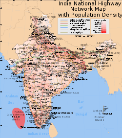
The national highways network of India is a network of highways that is managed and maintained by agencies of the Government of India. These highways measured over 100,087 km (62,191 mi) as of June 2016, including over 1,000 km (620 mi) of limited-access expressways (motorways). It is the second longest highway system in the world after China's (111,950 kilometres (69,560 mi)). Out of 1,00,087 km of national highways 26,200 plus km are at least 4 laned with the remaining 50,000 km 2 laned.[1][2] Indian government has set itself a target of construct and upgrade 30 km of highway per day (11,000 km per year) from 2017 and all new construction will be using cement concrete instead of bitumen.
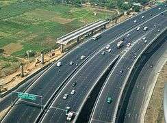
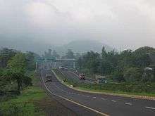
In India, National Highways are at-grade roads whereas Express Highways, commonly known as Expressways, are controlled-access highways, mostly 6-lane or above, where entrance and exit is controlled by the use of slip roads (ramps) that are incorporated into the design of the highway. The highways do not have shoulder lanes. The speed on highway is mostly unregulated and is mostly slowed by heavy trucks in middle lanes. The highways are also used by pedestrians and cyclists creating dangerous situations.
The National Highways Authority of India (NHAI) is the nodal agency responsible for building, upgrading and maintaining most of the national highways network. It operates under the Ministry of Road Transport and Highways. The National Highways Development Project (NHDP) is a major effort to expand and upgrade the network of highways. NHAI often uses a public-private partnership model for highway development, maintenance and toll-collection.
While national highways constitute 1.7% of Indian roads, they carry 40% of the traffic.[3] The majority of existing national highways are two-lane roads (one lane in each direction), though much of this is being expanded to four-lanes, and some to six or more lanes. Some sections of the network are toll roads. Over 30,000 km (19,000 mi) of new highways are planned or under construction as part of the NHDP, as of 2011. This includes over 2,600 km (1,600 mi) of expressways currently under construction.
Current system
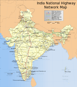
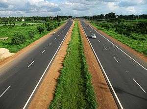
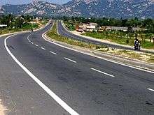
India has 100,087 km (62,191 mi) of national highways (NH) connecting all the major cities and state capitals as of June 2016. National highways comprise 1.7% of India's total road network, but carry about 40% of road traffic.[4] Most of them have two lanes. About 26,000 km (16,000 mi) have been widened to four lanes with two lanes in each direction as of May 2016. Only a few national highways are built with cement concrete. As of 2010, 19,064 km (11,846 mi) of national highways were still single-laned roads. The government is currently working to ensure that by December 2014 the entire national highway network consists of roads with two or more lanes.[5]
India has the distinction of having the world's second highest-altitude motor highway— Leh-Manali Highway, connecting Shimla to Leh in Ladakh, Kashmir.
National highways form the economic backbone of the country and have often facilitated development along their routes, and many new towns have sprung up along major highways. Highways also have large numbers of small restaurants and inns (known as dhabas) along their length. They serve popular local cuisine and serve as truck stops.
Ministry of Road Transport and Highways, Government of India adopted a new systematic numbering of national highways in April 2010. The new system will indicate the direction of national highways whether it is east-west (odd numbers) or north-south (even numbers) and also the geographical region where they are located, increasing from east to west and from north to south.[6]
Recent developments
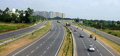
Under former Prime Minister Atal Bihari Vajpayee India launched a massive programme of highway upgrades, called the National Highways Development Project (NHDP), in which the main north-south and east-west connecting corridors and highways connecting the four metropolitan cities (Delhi, Mumbai, Chennai and Kolkata) have been fully paved and widened into four-lane highways. Some of the busier national highway sectors in India have been converted to four or six lane expressways – for example, Delhi-Agra, Delhi-Jaipur, Ahmedabad-Vadodara, Mumbai-Pune, Mumbai-Surat, Bangalore-Mysore, Bangalore-Chennai, Chennai-Tada, Delhi-Meerut Hyderabad-Vijayawada, Bhubaneswar-Puri and Guntur-Vijayawada. Phase V of the National Highway Development Project is to convert all 6,000 km (3,700 mi) of the Golden Quadrilateral Highways to 6-lane highways/expressways by 2012.
The National Highways Act, 1956[7] provides for private investment in the building and maintenance of the highways. Recently, a number of existing roads have been reclassified as national highways. Bypasses have recently been constructed around larger towns and cities to provide uninterrupted passage for highway traffic. The hugely varied climatic, demographic, traffic, and sometimes political situation in India results in national highways being single lane in places with low traffic to six lanes in places with heavy traffic. National highways are being upgraded or are under construction. Some national highways are long while some are short spurs off other national highways to provide connectivity to nearby ports or harbours.
The length of national highways in the country was 29,023 km in 1980, which expanded to 76,818 km by the end of 2012. Over 50% of the total road network or 23,814 was added under the Vajpayee government between 1997 and 2002, the largest construction of national highways during any five-year period since independence.[8] The UPA government added 18,000 km of highway in its ten-year administration between 2004 and 2014.[9][10]
The longest national highway is NH44,[11] which runs between Varanasi in Uttar Pradesh and Kanyakumari in Tamil Nadu, at the southernmost point of the Indian mainland, covering a distance of 2,369 km (1,472 mi). The shortest national highway is NH966B,[12][13] which spans 6 km (3.7 mi), to the Ernakulam - Kochi Port.

Indian road network
| Class | Length (km) |
|---|---|
| Expressways | 1,000 km (620 mi) |
| Total national highways | 100,087.00 km (62,191.18 mi) |
| State highways | 154,522 km (96,016 mi) |
| Major and other district roads | 2,577,396 km (1,601,520 mi) |
| Rural & other roads | 1,433,577 km (890,783 mi) |
| Total (approx) | 4,245,429 km (2,637,987 mi) |
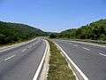
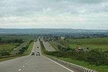
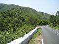
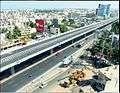
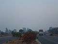
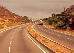
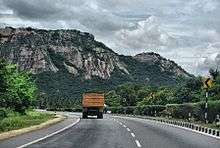
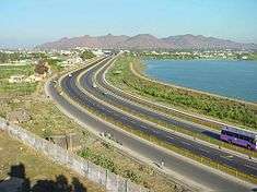
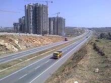
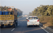
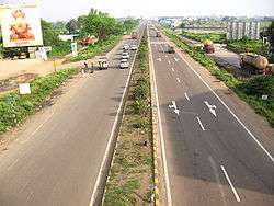
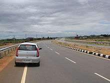
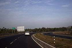
Gallery

_in_Karnataka.jpg)


References and notes
- ↑ "National Highways". New Delhi: NHAI. Retrieved 5 June 2016.
- ↑ "National Highways". New Delhi: NHAI. Retrieved 5 June 2016.
- ↑ "Indian road network". National Highways Authority of India. Retrieved 18 April 2015.
- ↑ Mahapatra, Dhananjay (2 July 2013). "NDA regime constructed 50% of national highways laid in last 30 years: Centre". The Times of India. Retrieved 18 April 2015.
- ↑ Balchand, K. (23 March 2010). "Two-laning of entire NH network by 2014". The Hindu. Chennai, India.
- ↑ "New numbers for national highways". The Times of India. 21 October 2011. Retrieved 18 April 2015.
- ↑ "The National Highways Act, 1956". Retrieved 2 December 2012.
- ↑ "NDA regime constructed 50% of national highways laid in last 30 years: Centre - The Times of India". The Times of India. Retrieved 2015-11-17.
- ↑ http://timesofindia.indiatimes.com/india/National-highways-to-grow-by-50000km-in-6-months/articleshow/48930651.cms
- ↑ http://indianexpress.com/article/india/india-others/national-highway-upgrade-22000-km-to-be-made-four-lane/
- ↑ India Road Maps. Maps of India.
- ↑ "List of highways in Kerala". ListKerala.com.
- ↑ "National Highway 47A". India9.com.
- ↑ "Annual report 2010-2011". Ministry of Road Transport and Highways. Retrieved 7 February 2012.
