Indiana State Road 250
| ||||
|---|---|---|---|---|
 | ||||
| Route information | ||||
| Maintained by INDOT | ||||
| Length: | 68.6 mi[1] (110.4 km) | |||
| Western segment | ||||
| Length: | 33.48 mi[1] (53.88 km) | |||
| West end: |
| |||
| Major junctions: |
| |||
| East end: |
| |||
| Eastern segment | ||||
| Length: | 35.15 mi[1] (56.57 km) | |||
| West end: |
| |||
| East end: |
| |||
| Location | ||||
| Counties: | Jackson, Jefferson, Jennings, Switzerland | |||
| Highway system | ||||
| ||||

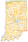
State Road 250 (SR 250) in the U.S. State of Indiana is a secondary route that runs from U.S. Route 50 (US 50) in Brownstown eastward toward the Ohio River at State Road 156 (SR 156) in Patriot in southeast Indiana. Towns include Uniontown, Paris Crossing, Canaan, and East Enterprise. SR 250 is split in two north of Madison due to the Big Oaks National Wildlife Refuge (formerly the Jefferson Proving Ground).
Route description
Most of the length of SR 250 is a rural two-lane highway.
Western section
SR 250 heads southeast from the western terminus in Brownstown towards State Road 39. At the intersection with SR 39, SR 250 turns east. Then SR 250 passes through an intersection with the southern terminus of the northern section of State Road 11 (SR 11). SR 250 then passes through an intersection with U.S. Route 31 (US 31) and an interchange with Interstate 65 (I-65). SR 250 heads east from I-65 and then has a concurrency with State Road 3. Then SR 250 heads east from the concurrency with SR 3 towards the eastern terminus of the western section. Then eastern terminus of this section is an intersection with State Road 7.[2]
Eastern section
The eastern section begins at an intersection with U.S. Route 421. SR 250 has a concurrency with State Road 62. Then SR 250 leaves the concurrency with SR 62 and then passes through intersections with State Road 129 and State Road 56. SR 250 then has an intersection with SR 156, this intersection is the eastern terminus of SR 250.[3]
History
SR 250 has a western section that went from US 50 toward State Road 37 in Mitchell.[4]
Major intersections
| County | Location | mi[1] | km | Destinations | Notes | ||
|---|---|---|---|---|---|---|---|
| Jackson | Brownstown | 0.00 | 0.00 | Western terminus of western section of SR 250 | |||
| Wegan | 2.51 | 4.04 | Northern terminus of the southern section of SR 39 | ||||
| Washington Township | 8.52 | 13.71 | Southern terminus of SR 11 | ||||
| Uniontown | 13.14 | 21.15 | |||||
| 13.52 | 21.76 | Exit number 41 on I-65 | |||||
| Jennings | Paris Crossing | 23.68 | 38.11 | Northern end of SR 3 concurrence | |||
| 23.94 | 38.53 | Southern end of SR 3 | |||||
| Jefferson | Middlefork | 33.48 | 53.88 | Eastern terminus of the western section of SR 250 | |||
| Gap in route | |||||||
| Jefferson | Belleview | 33.48 | 53.88 | Western terminus of the eastern section of SR 250 | |||
| 35.63 | 57.34 | Western end of SR 62 concurrence | |||||
| Canaan | 42.83 | 68.93 | Eastern end of SR 62 concurrence | ||||
| Switzerland | Pleasant Township | 46.72 | 75.19 | ||||
| East Enterprise | 57.69 | 92.84 | |||||
| Patriot | 68.63 | 110.45 | Eastern terminus of SR 250 | ||||
1.000 mi = 1.609 km; 1.000 km = 0.621 mi
| |||||||
References
- 1 2 3 4 "INDOT Roadway Referencing System" (PDF). staff.
- ↑ Google (2011-03-25). "overview map of the western section of SR 250" (Map). Google Maps. Google. Retrieved 2011-03-25.
- ↑ Google (2011-03-25). "overview map of the western section of SR 250" (Map). Google Maps. Google. Retrieved 2011-03-25.
- ↑ "Indiana Highway Ends - SR 250". Retrieved 2011-03-25.