Interstate 84 in Massachusetts
| ||||||||||
|---|---|---|---|---|---|---|---|---|---|---|
|
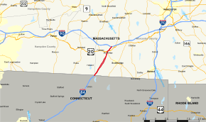
Map of southern Massachusetts with I-84 highlighted in red | ||||||||||
| Route information | ||||||||||
| Maintained by MassDOT | ||||||||||
| Length: | 7.7 mi (12.4 km) | |||||||||
| Existed: | 1958 – present | |||||||||
| History: | ||||||||||
| Major junctions | ||||||||||
| West end: |
| |||||||||
|
| ||||||||||
| East end: |
| |||||||||
| Location | ||||||||||
| Counties: | Worcester, Hampden | |||||||||
| Highway system | ||||||||||
| ||||||||||

Interstate 84 (I-84) in Massachusetts is the eastern-most segment of the eastern I-84 highway originating in Dunmore, Pennsylvania, (near Scranton). Within Massachusetts, I-84 exists in the towns of Holland and Sturbridge. Known as the Wilbur Cross Highway, it has also been signed as Massachusetts Route 15 between 1948 and 1980 as well as Interstate 86 between 1971 and 1984.
History
Origins as Parkway Extension
The highway originated as Route 15, an extension of Connecticut Route 15 (then known as the Wilbur Cross Parkway). The extension started in Holland, and within 1⁄4 mile (0.40 km), it entered Sturbridge as Mashapuag Road. It then followed Union Road to Sturbridge Center ending at Route 131.[1]
Upgrade to Interstate Highway
Between 1949 and 1952, the Massachusetts Department of Public Works (MassDPW) initiated construction of the Wilbur Cross Highway extension to US 20 in Sturbridge, with two lanes in each direction separated by a wide median and frequent U-turns.[2][3]
Between 1955 and 1957, an extension was created to connect Route 15 to the new Massachusetts Turnpike, which opened on May 15, 1957. In 1958, I-84 was co-signed with Route 15 north and east of East Hartford, Connecticut, into Massachusetts.
In late 1968, the Federal Highway Administration (FHWA) approved a new Interstate connection from Hartford to Providence, which was to become part of a rerouted I-84. As a result, the existing section of I-84 from Manchester, Connecticut, to I-90 (overlapping Route 15) was redesignated I-86.
Shortly thereafter, MassDPW embarked on a reconstruction of its portion of the highway with new and reconstructed carriageways providing three 12-foot-wide (3.7 m) lanes and standard shoulders. Both carriageways were separated by a wide, forested variable median. New bridges, interchanges and weigh stations were erected along the route. The $20 million reconstruction project was completed in 1973. (Similar improvements in Connecticut were not completed until the 1980s.)
On October 1, 1980, the Connecticut Department of Transportation decided to truncate Route 15 back to I-84 exit 57 (where it ends today), eliminating the overlap with I-86. Simultaneously, Massachusetts eliminated the overlap by decommissioning its Route 15 entirely.
Redesignation
When the planned portion of I-84 toward Providence ran into opposition in Rhode Island and was cancelled in 1983, I-86 was officially reverted to I-84. The I-86 numbering was officially deleted on December 12, 1984. Plans to connect I-84 along the present day I-384/US 6 corridor from Hartford to Providence were scuttled for environmental reasons. As a result, I-84 was rerouted back onto the completed I-86 freeway.
Exit list
MassDOT planned convert I-84, along with the rest of the state's interstates, to milepost based exits during 2016,[4] however this project has been indefinitely postponed. If the exit numbers are ever changed, the proposed new numbers would be 3, 5, 6A and 6B.[5]
| County | Location[6] | mi[6] | km | Exit[7] | Destinations[7] | Notes |
|---|---|---|---|---|---|---|
| Hampden | Holland | 0.000 | 0.000 | – | Continuation from Connecticut | |
| Worcester | Sturbridge | 0.289 | 0.465 | – | Mashapaug Road | Westbound entrance only; former Route 15 |
| 3.252 | 5.234 | 1 | Mashapaug Road – Southbridge, Sturbridge | Former Route 15 | ||
| 5.077 | 8.171 | 2 | ||||
| 6.550 | 10.541 | 3A | ||||
| 6.869 | 11.055 | 3B | ||||
| 7.5 | 12.1 | Toll plaza (in process of demolition) | ||||
| 7.710 | 12.408 | – | Exit 9 on I-90 | |||
1.000 mi = 1.609 km; 1.000 km = 0.621 mi
| ||||||
See also
 Massachusetts portal
 U.S. Roads portal
References
- ↑ 1946 topographic map sections:
- Wales, Mass.–Conn. (Map). 1:31,680. Topographic. Cartography by USGS. U.S. Geological Survey. 1946. Southeast corner. Retrieved October 8, 2013.
- Southbridge, Mass.–Conn. (Map). 1:31,680. Topographic. Cartography by USGS. U.S. Geological Survey. 1946. Southwest corner. Retrieved October 8, 2013.
- Southbridge, Mass.–Conn. (Map). 1:31,680. Topographic. Cartography by USGS. U.S. Geological Survey. 1946. Northwest corner. Retrieved October 8, 2013.
- ↑ 1952 topographic map sections:
- Wales, Mass.–Conn. (Map). 1:31,680. Topographic. Cartography by USGS. U.S. Geological Survey. 1952. Southeast corner. Retrieved October 8, 2013.
- Southbridge, Mass.–Conn. (Map). 1:31,680. Topographic. Cartography by USGS. U.S. Geological Survey. 1952. Southwest corner. Retrieved October 8, 2013.
- Southbridge, Mass.–Conn. (Map). 1:31,680. Topographic. Cartography by USGS. U.S. Geological Survey. 1952. Northwest corner. Retrieved October 8, 2013.
- ↑ Eastern Roads. "Wilbur Cross Highway (I-84)". Boston Roads. Self-published. Retrieved October 8, 2013.
- ↑ Commonwealth of Massachusetts Operational Services Division. "Project FAP# HSIP-002S(874X) Exit Signage Conversion to Milepost-Based Numbering System along Various Interstates, Routes, and the Lowell Connector". Retrieved January 2, 2016.
- ↑ Robert H. Malme. "I-84 Current and Future Exit List". Retrieved January 2, 2016.
- 1 2 MassDOT Planning Division. "Massachusetts Route Log Application". Massachusetts Department of Transportation. Retrieved August 21, 2014.
- 1 2 Staff (2012). "Exit Numbers and Names: Route I-84 (Holland to Sturbridge)". Massachusetts Department of Transportation. Retrieved August 21, 2014.
External links
| Previous state: Connecticut |
Massachusetts | Next state: Terminus |