Iowa Township, Cedar County, Iowa
| Iowa Township, Cedar County | |
|---|---|
| Township | |
 | |
| Coordinates: 41°38′56″N 091°12′05″W / 41.64889°N 91.20139°WCoordinates: 41°38′56″N 091°12′05″W / 41.64889°N 91.20139°W | |
| Country |
|
| State |
|
| County | Cedar |
| Area | |
| • Total | 37.65 sq mi (97.51 km2) |
| • Land | 37.05 sq mi (95.96 km2) |
| • Water | 0.6 sq mi (1.54 km2) |
| Elevation[1] | 748 ft (228 m) |
| Population (2000) | |
| • Total | 460 |
| • Density | 12.4/sq mi (4.8/km2) |
| FIPS code | 19-92055[2] |
| GNIS feature ID | 0468078 |
Iowa Township is one of seventeen townships in Cedar County, Iowa, USA. As of the 2000 census, its population was 460.
History
Iowa Township was organized in 1840[3] The first school in Iowa Township was established about 1845.[4] (or 1841[5]).
Geography
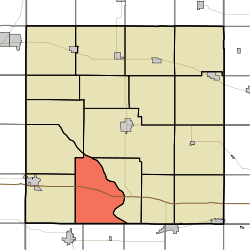
Iowa Township covers an area of 37.65 square miles (97.5 km2) and contains no incorporated settlements. According to the USGS, it contains six cemeteries: Bethel, Burnett, Dunfee, Gray's Ford, North Liberty and Pee Dee.
References
- ↑ "US Board on Geographic Names". United States Geological Survey. 2007-10-25. Retrieved 2008-01-31.
- ↑ "American FactFinder". United States Census Bureau. Retrieved 2008-01-31.
- ↑ The History of Cedar County, Iowa: Containing a History of the County, Its Cities, Towns, etc. Western Historical Company. 1878. p. 540.
- ↑ Aurner, Clarence Ray (1910). A Topical History of Cedar County, Iowa, Volume 1. S. J. Clarke. p. 156.
- ↑ The History of Cedar County, Iowa: Containing a History of the County, Its Cities, Towns, etc. Western Historical Company. 1878. p. 385.
External links
Municipalities and communities of Cedar County, Iowa, United States | ||
|---|---|---|
| Cities | ||
| Townships | ||
| CDP | ||
| Other unincorporated communities | ||
| Footnotes | ‡This populated place also has portions in an adjacent county or counties | |
This article is issued from Wikipedia - version of the 10/30/2016. The text is available under the Creative Commons Attribution/Share Alike but additional terms may apply for the media files.