Jacket, Missouri
Jacket (sometimes spelled Jackett) is an unincorporated community in the extreme southeastern corner of McDonald County, Missouri on Highway KK. It is in the Mountain Township and is very near the point where McDonald and Barry counties in Missouri and Benton County, Arkansas meet. Several homes, multiple cemeteries, a Church and a liquor store are located here. It is part of the Fayetteville–Springdale–Rogers, AR-MO Metropolitan Statistical Area. Located about five miles north of Pea Ridge, Arkansas, the Jacket community is rural in nature, with a low-density population and little formal planning involved in the area from its original settlement to the current day.
History
Founding
The hilly and rocky Ozark Mountains land that would become Jacket had served for centuries as a home to native tribes, but by the mid-19th century the native people had left and were replaced by pioneers from eastern states and other parts of Missouri and Arkansas.[1]
Though a lack of formal records has made the specifics difficult to trace, it is believed that the first pioneer to set up a permanent settlement in Jacket came to the area around 1840 or 1841 and was known as Clemons. Clemons built a water-powered corn cracker at the spot where Otter Creek, which flows north from Pea Ridge, runs into Big Sugar Creek.[2] Both the names of Big Sugar Creek and Jacket are believed to have been coined around this time, according to local legend Big Sugar Creek was named for the groves of sugar maples that grew on its banks and Jacket was in reference to the colonies of yellow jacket wasps that were populous in the area.[1]
Within a half dozen years of settling in the area, Clemons sold his corn cracker to Henry Schell (1810-1863) in 1846, a purchase which it was said was made possible by Schell selling a young slave boy for $400. Henry Schell had previously established the community of Shell Knob in Barry County, and he brought his wife, Elizabeth Yocum Schell, and their young children to make a claim on the large tracts of land that were open in that area for homesteading.[2] He built a grist mill at the site of the corn cracker and had a house built west of the mill out of lumber that had been sawed at the Van Winkle mill in War Eagle, Arkansas. By the time of his murder by bushwhackers in 1863, he had amassed landholdings of 1,000 acres.[2]
In the summer of 1863 the Civil War was in full swing and southwest Missouri and northwest Arkansas was an area torn by loyalties between the North and the South. Henry Schell’s four oldest sons were all fighting for the Confederate States of America.[2] On July 11, 1863 he was working in his mill when he either heard or saw a group of bushwhackers heading his way. He took off toward his house, but was shot as he went up the hill. His wife, daughters and some neighbor women took his body and prepared it for burial, using a meal box from the mill to serve as a coffin, and buried him in the front yard of his home. One of his sons, a blacksmith by trade, later put a wrought iron fence around it.[3] Following his death, his 1,000 acres was divided among his descendants, who built homes, started businesses and set aside land for churches, a cemetery and a school. Over time his descendants continued to subdivide their acreage and sold off plots to other families.[1]
Commerce & Social Life
Though Henry Schell's grist mill was destroyed by a flood a few years after his death, it was eventually replaced a quarter mile north on Big Sugar Creek.[2] And until its closure around 1950, the Jacket general store served as the center of the community. Like many old country stores, it was more than just a place to buy merchandise, but a place to meet and talk and, in its later years, to buy gas. There was also a blacksmith shop and across the road from the store was a small tomato canning operation, which had been owned by members of the Schell family, who also ran similar operations in Powell, Missouri and Pea Ridge[1] From 1911 to 1930 a branch of the U.S. Postal Service was even managed out of the old Jacket store,[4] until expanded rural postal delivery eliminated the need for it.[1]
For most of the last century both Antioch Church of Christ and Sugar Creek Baptist Church catered to the souls of the community, with the Church of Christ, with its distinctive flagstone exterior, still operating today, though the Baptist church closed in the 1980s.[1] In the early years of the last century, the grounds of the old Baptist church also served as the location for annual 4th of July celebrations and other community events.[2]
The Jacket school house, also known as the Pleasant View school, taught generations of Jacket area children from the first through the eighth grade until the rural schools were consolidated into a new building on the school district’s main campus in Washburn, Missouri in the late 1950s.[1] Around 1920 a bridge was built across Big Sugar Creek in Jacket, replacing the ford, which was unusable in high water. This single-lane, wooden bridge was built on concrete supports and was in use until being replaced by a modern bridge in the early 1993.[1]
Decline
Jacket’s heyday slowly faded following the construction of the bridge and the increase in automobile ownership, which provided the local residents with the option of leaving the community on a more regular business to do their shopping, work, or go to church. By 1960, the store, blacksmith shop, grist mill, post office, tomato plant and school were all shuttered. And by the late 1970s, the school building had already burned down, the tomato plant had been torn down and the store had been converted into a barn.[1]
Today
Though most people driving through Jacket may not recognize it as the small, yet thriving community it was 100 years ago, echos of its past remain. The old store building still stands, though it is only a ghost of the structure the Cline and Eva Carden ran their general merchandise business out of; Antioch Church of Christ still holds services; and the Antioch and Dent cemeteries still serve as open places for those wanting to be laid to rest among family or in the little community they called home in life.[1] The old Baptist Church is now a private residence and Henry Schell’s mill and home have long since disappeared, though his grave remains and is well-tended.[2] Two other cemeteries, both now unused, the Morgan Cemetery and the White Oak or Burnett Cemetery are also located in the Jacket area on private properties. Coordinates: 36°30′34″N 94°06′28″W / 36.50936°N 94.107692°W
References
- 1 2 3 4 5 6 7 8 9 10 Jacket Holds Rich Memories; The Times of Northeast Benton County; December 28, 2011
- 1 2 3 4 5 6 7 The Big Sugar Creek Country; Pea Ridge Graphic; December 7, 1967; Page 6
- ↑ http://www.findagrave.com/cgi-bin/fg.cgi?page=gr&GRid=33163060
- ↑ http://www.missouripostalhistory.org/mc127pe.htm
Municipalities and communities of McDonald County, Missouri, United States | ||
|---|---|---|
| Cities | 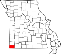 | |
| Villages | ||
| Unincorporated communities | ||
| Ghost town | ||