List of cities in Missouri

Missouri is a state located in the Midwestern United States. In Missouri, cities are classified into three types: Class 3, Class 4, and those under constitutional charters. A few older cities are incorporated under legislative charters (Carrollton, Chillicothe, LaGrange, Liberty, Miami, Missouri City, and Pleasant Hill) which are no longer allowed. The level at which they incorporate is determined by their population when they incorporate. They do not change if they gain or lose in population, unless a vote is held by the people.
A municipality incorporates as a Class 4 city if the population is between 500 and 2,999 (under 500, it must incorporate as a village - see list of villages in Missouri). It may incorporate as a Class 3 city if the population is between 3,000 and 29,999. There is more flexibility in government for Class 3 cities than Class 4.
Cities under constitution charters may operate under any form of municipal government if it is enacted in the city's charter.
Largest cities
-
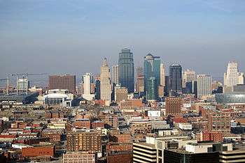
Skyline of Kansas City, the largest city in Missouri
-
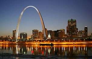
St. Louis, the second largest city in Missouri
-
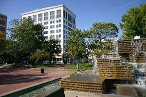
Downtown Springfield, Missouri's third largest city
-
.jpg)
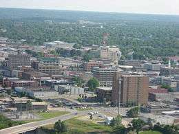
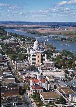
Aerial view of Independence, a satellite city of Kansas City
-

University of Missouri at Columbia, the fifth largest city in Missouri

Population data based on 2013 estimates.[1]
† County seat
†† State capital and county seat
| 2013 Rank | City | 2013 Estimate[2] | 2010 Census[3] | Change | County |
|---|---|---|---|---|---|
| 1 | Kansas City † | 467,007 | 459,787 | +1.57% | Jackson, Platte, Cass, Clay |
| 2 | St. Louis | 318,416 | 319,294 | −0.27% | none (independent city) |
| 3 | Springfield † | 164,122 | 159,498 | +2.90% | Greene |
| 4 | Independence † | 117,240 | 116,830 | +0.35% | Jackson |
| 5 | Columbia † | 115,276 | 108,500 | +6.25% | Boone |
| 6 | Lee's Summit | 93,184 | 91,364 | +1.99% | Jackson |
| 7 | O'Fallon | 82,809 | 79,329 | +4.39% | St. Charles |
| 8 | St. Joseph † | 77,147 | 76,780 | +0.48% | Buchanan |
| 9 | St. Charles † | 67,569 | 65,794 | +2.70% | St. Charles |
| 10 | St. Peters | 54,842 | 52,575 | +4.31% | St. Charles |
| 11 | Blue Springs | 53,294 | 52,575 | +1.37% | Jackson |
| 12 | Florissant | 52,363 | 52,158 | +0.39% | St. Louis |
| 13 | Joplin | 50,789 | 50,150 | +1.27% | Jasper |
| 14 | Chesterfield | 47,749 | 47,484 | +0.56% | St. Louis |
| 15 | Jefferson City †† | 43,330 | 43,079 | +0.58% | Cole |
| 16 | Cape Girardeau | 38,816 | 37,941 | +2.31% | Cape Girardeau |
| 17 | Wildwood | 35,787 | 35,517 | +0.76% | St. Louis |
| 18 | University City | 35,148 | 35,371 | −0.63% | St. Louis |
| 19 | Wentzville | 32,509 | 29,070 | +11.83% | St. Charles |
| 20 | Ballwin | 30,498 | 30,404 | +0.31% | St. Louis |
| 21 | Liberty † | 30,096 | 29,149 | +3.25% | Clay |
| 22 | Raytown | 29,510 | 29,526 | −0.05% | Jackson |
| 23 | Kirkwood | 27,596 | 27,540 | +0.20% | St. Louis |
| 24 | Maryland Heights | 27,436 | 27,472 | −0.13% | St. Louis |
| 25 | Gladstone | 26,157 | 25,410 | +2.94% | Clay |
| 26 | Hazelwood | 25,668 | 25,703 | −0.14% | St. Louis |
| 27 | Grandview | 25,307 | 24,475 | +3.40% | Jackson |
| 28 | Webster Groves | 23,203 | 22,995 | +0.90% | St. Louis |
| 29 | Belton | 23,175 | 23,116 | +0.26% | Cass |
| 30 | Sedalia † | 21,492 | 21,387 | +0.49% | Pettis |
| 31 | Arnold | 21,134 | 20,808 | +1.57% | Jefferson |
| 32 | Ferguson | 21,111 | 21,203 | −0.43% | St. Louis |
| 33 | Nixa | 20,195 | 19,022 | +6.17% | Christian |
| 34 | Warrensburg † | 19,927 | 18,838 | +5.78% | Johnson |
| 35 | Rolla † | 19,831 | 19,559 | +1.39% | Phelps |
| 36 | Raymore | 19,754 | 19,206 | +2.85% | Cass |
| 37 | Ozark † | 18,606 | 17,820 | +4.41% | Christian |
| 38 | Manchester | 18,186 | 18,094 | +0.51% | St. Louis |
| 39 | Hannibal | 17,883 | 17,916 | −0.18% | Marion |
| 40 | Creve Coeur | 17,865 | 17,833 | +0.18% | St. Louis |
| 41 | Farmington † | 17,796 | 16,240 | +9.58% | St. Francois |
| 42 | Kirksville † | 17,577 | 17,505 | +0.41% | Adair |
| 43 | Poplar Bluff † | 17,287 | 17,023 | +1.55% | Butler |
| 44 | Sikeston | 16,494 | 16,318 | +1.08% | Scott |
| 45 | Overland | 16,008 | 16,062 | −0.34% | St. Louis |
| 46 | Clayton † | 15,884 | 15,939 | −0.35% | St. Louis |
| 47 | Republic | 15,590 | 14,751 | +5.69% | Greene |
| 48 | Lake St. Louis | 14,831 | 14,545 | +1.97% | St. Charles |
| 49 | Lebanon † | 14,759 | 14,474 | +1.97% | Laclede |
| 50 | Jennings | 14,756 | 14,712 | +0.30% | St. Louis |
| 51 | Jackson † | 14,386 | 13,758 | +4.56% | Cape Girardeau |
| 52 | Carthage † | 14,232 | 14,378 | −1.02% | Jasper |
| 53 | Washington | 14,031 | 13,982 | +0.35% | Franklin |
| 54 | Moberly | 13,746 | 13,974 | −1.63% | Randolph |
| 55 | Grain Valley | 13,125 | 12,854 | +2.11% | Jackson |
| 56 | Marshall † | 13,010 | 13,065 | −0.42% | Saline |
| 57 | St. Ann | 12,971 | 13,020 | −0.38% | St. Louis |
| 58 | Fulton † | 12,760 | 12,790 | −0.23% | Callaway |
| 59 | Dardenne Prairie | 12,324 | 11,494 | +7.22% | St. Charles |
| 60 | West Plains † | 12,268 | 11,986 | +2.35% | Howell |
| 61 | Neosho | 12,157 | 11,835 | +2.72% | Newton |
| 62 | Maryville † | 12,062 | 11,972 | +0.75% | Nodaway |
| 63 | Crestwood | 11,942 | 11,912 | +0.25% | St. Louis |
| 64 | Festus | 11,829 | 11,602 | +1.96% | Jefferson |
| 65 | Bridgeton | 11,686 | 11,550 | +1.18% | St. Louis |
| 66 | Mexico † | 11,530 | 11,543 | −0.11% | Audrain |
| 67 | Excelsior Springs | 11,418 | 11,084 | +3.01% | Clay |
| 68 | Troy † | 11,211 | 10,540 | +6.37% | Lincoln |
| 69 | Branson | 11,064 | 10,520 | +5.17% | Taney |
| 70 | Webb City | 10,989 | 10,996 | −0.06% | Jasper |
| 71 | Town and Country | 10,922 | 10,815 | +0.99% | St. Louis |
| 72 | Kennett † | 10,916 | 10,932 | −0.15% | Dunklin |
| 73 | Bellefontaine Neighbors | 10,823 | 10,860 | −0.34% | St. Louis |
| 74 | Union † | 10,577 | 10,204 | +3.66% | Franklin |
| 75 | Bolivar † | 10,487 | 10,325 | +1.57% | Polk |
| 76 | Eureka | 10,467 | 10,189 | +2.73% | St. Louis |
| 77 | Harrisonville † | 10,001 | 10,019 | −0.18% | Cass |
| 78 | Cameron | 9,868 | 9,933 | −0.65% | Clinton |
| 79 | Chillicothe † | 9,318 | 9,515 | −2.07% | Livingston |
| 80 | Ellisville | 9,173 | 9,133 | +0.44% | St. Louis |
| 81 | Berkeley | 9,099 | 8,978 | +1.35% | St. Louis |
| 82 | Kearney | 9,038 | 8,381 | +7.84% | Clay |
| 83 | Clinton † | 9,026 | 9,008 | +0.20% | Henry |
| 84 | Smithville | 8,954 | 8,425 | +6.28% | Clay |
| 85 | Monett | 8,940 | 8,873 | +0.76% | Barry |
| 86 | Park Hills | 8,674 | 8,759 | −0.97% | St. Francois |
| 87 | Ladue | 8,560 | 8,521 | +0.46% | St. Louis |
| 88 | Sunset Hills | 8,522 | 8,496 | +0.31% | St. Louis |
| 89 | Richmond Heights | 8,508 | 8,603 | −1.10% | St. Louis |
| 90 | Des Peres | 8,466 | 8,373 | +1.11% | St. Louis |
| 91 | Boonville † | 8,370 | 8,319 | +0.61% | Cooper |
| 92 | Perryville † | 8,334 | 8,225 | +1.33% | Perry |
| 93 | Nevada † | 8,280 | 8,386 | −1.26% | Vernon |
| 94 | Pleasant Hill | 8,218 | 8,113 | +1.29% | Cass |
| 95 | Warrenton † | 8,039 | 7,880 | +2.02% | Warren |
| 96 | Brentwood | 8,032 | 8,055 | −0.29% | St. Louis |
| 97 | Maplewood | 7,968 | 8,046 | −0.97% | St. Louis |
| 98 | Dexter | 7,938 | 7,864 | +0.94% | Stoddard |
| 99 | Oak Grove | 7,861 | 7,795 | +0.85% | Jackson |
| 100 | Olivette | 7,823 | 7,737 | +1.11% | St. Louis |
| 101 | Carl Junction | 7,551 | 7,445 | +1.42% | Jasper |
| 102 | Aurora | 7,495 | 7,508 | −0.17% | Lawrence |
| 103 | Bonne Terre | 7,232 | 6,864 | +5.36% | St. Francois |
| 104 | Pacific | 7,077 | 7,002 | +1.07% | Franklin, St. Louis |
| 105 | Sullivan | 7,075 | 7,081 | −0.08% | Franklin, Crawford |
A-C
D-F
|
D
E |
F |
G-K
L-N
O-R
S-W
See also
References
- ↑ "Annual Estimates of the Resident Population for Incorporated Places". census.gov. Retrieved 2014-06-15.
- ↑ "Annual Estimates of the Resident Population: April 1, 2010 to July 1, 2013". United States Census Bureau. Retrieved 15 June 2014.
- ↑ "2010 Census Redistricting Data (Public Law 94-171) Summary File". American FactFinder2. U.S. Census Bureau, 2010 Census. Retrieved 31 January 2014.
- Official Manual State of Missouri 2005-2006. Issued by the Secretary of State. Jefferson City, Missouri.
- "Missouri Revised Statutes – Chapter 72: Classification and Consolidation of Cities, Towns and Villages". Missouri General Assembly. August 28, 2011.
- "Missouri Revised Statutes – Chapter 77: Third Class Cities". Missouri General Assembly. August 28, 2011.
- "Missouri Revised Statutes – Chapter 79: Fourth Class Cities". Missouri General Assembly. August 28, 2011.
- "Missouri Revised Statutes – Chapter 80: Towns and Villages". Missouri General Assembly. August 28, 2011.
- "Missouri Revised Statutes – Chapter 81: Special Charter Cities and Towns". Missouri General Assembly. August 28, 2011.
- "Missouri Revised Statutes – Chapter 82: Constitutional Charter Cities". Missouri General Assembly. August 28, 2011.