Jagannadhapuram, Krishna district
| Jagannadhapuram జగన్నాధపురం | |
|---|---|
| Village | |
|
Road to Kanchikacherla | |
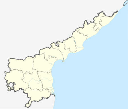
 Jagannadhapuram  Jagannadhapuram Location in Andhra Pradesh, India | |
| Coordinates: 16°43′43″N 80°24′35″E / 16.728669°N 80.409776°ECoordinates: 16°43′43″N 80°24′35″E / 16.728669°N 80.409776°E | |
| Country |
|
| State | Andhra Pradesh |
| Region | Krishna |
| Government | |
| • Type | Gram panchayat |
| • Body | Jagannadhapuram Grama panchayat |
| Area[1] | |
| • Total | 2.82 km2 (1.09 sq mi) |
| Population (2015)[1] | |
| • Total | 816 |
| • Density | 290/km2 (750/sq mi) |
| Languages | |
| • Official | Telugu |
| Time zone | IST (UTC+5:30) |
| Pincode(s) | 521181 |
| Vehicle registration | AP 16 |
Jagannadhapuram is a village in Krishna District of the Indian state of Andhra Pradesh. It is located in veerullapadu mandal of Vijayawada revenue division.[1]
It is situated 30 km north-west of vijayawada. It is a minor panchayat. It belongs to Andhra region . It is located 123 km towards west from District headquarters Machilipatnam. It is 248 km from Hyderabad and 15 km from Amaravati.Jagannadhapuram is surrounded by Yerrupalem Mandal towards East, Madhira Mandal towards North, Nandigama Mandal towards west, Kanchikacherla Mandal towards South .
Jaggaiahpet, Vijayawada, Mangalagiri, Nuzvid are the nearby Cities to Jagannadhapuram.
It is in the border of the Krishna district and Khammam District. Khammam district Yerrupalem is East towards this place .
It is near to the Telangana State Border.
History
It is believed that a man named "jagannadham" first settled in this village along with his family.It is from him that the village acquired its name. Initially Hindus from ponnavaram settled in jagannadhapuram. After them families of Thanam, Thumma, Syamala, Bandi, Udumula, Thirumalareddy, Yeruva came from Paatibandla in Guntur district and settled here. Merugumala, vemula families also live here.
Religion
Christianity and Hinduism are more prevalent.Hinduism first came to this place when it was first settled by people from ponnavaram,then gradually in 1899 a priest named "Opelio Negre" introduced Christianity. In 1952 jagannadhapuram got its status as a parish.The church that we see today was built in 1976. In 2003 a 5 storey tower "Rakshanagiri" was built by "Fr. Thanam Marreddy" which is the main attraction during different occasions.
Transport
The village is 5 km away from Kanchikacherla bus station,with many buses connecting to the nearby villages and towns.It is located about 42.7 km from the city of Vijayawada on National Highway 9 (India)(old numbering).APSRTC also operates buses along the main route.
HOW TO REACH Jagannadhapuram
By Road
Vijayawada is the Nearest Town to Jagannadhapuram. Vijayawada is 54 km from Jagannadhapuram. Road connectivity is there from Vijayawada to Jagannadhapuram.
By Rail
Tondalagpavaram Rail Way Station, Errupalem Rail Way Station are the very nearby railway stations to Jagannadhapuram. Also you can consider railway Stations from Near By town Vijayawada. Ramavarappadu Rail Way Station, S Narayanapuram Rail Way Station are the railway Stations near to Vijayawada. You can reach from Vijayawada to Jagannadhapuram by road after . How ever Vijayawada Junction railway station is major railway station 45 km near to Jagannadhapuram
By Bus
Madhira APSRTC Bus Station, Nandigum APSRTC Bus Station, Nandigama APSRTC Bus Station are the nearby Bus Stations to Jagannadhapuram .APSRTC runs Number of buses from major cities to these stations.
Education
Jagannadhapuram, Krishna district has a government school along with Anganwadi.
It also has a St joseph's English medium school set up and operated by Christian Nun's.
Politics
Gram panchayat seat was won by YSR Congress Party.
Jagannadhapuram, Krishna district under Veerullapadu mandal is represented by Nandigama (SC) (Assembly constituency), which in turn represents Vijayawada (Lok Sabha constituency) of Andhra Pradesh. The present MLA representing Nandigama (SC) (Assembly constituency) is Tangirala Sowmya of Telugu Desam Party.
References
- 1 2 3 "District Census Handbook - Krishna" (PDF). Census of India. p. 16,388. Retrieved 17 February 2016.
