Jamuniya, Janakpur
| Jamuniya जमुनिया | |
|---|---|
| Village development committee | |
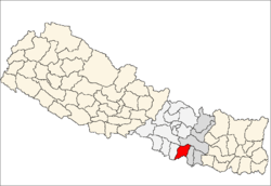
 Jamuniya Location in Nepal | |
| Coordinates: 26°55′0″N 85°31′0″E / 26.91667°N 85.51667°ECoordinates: 26°55′0″N 85°31′0″E / 26.91667°N 85.51667°E | |
| Country |
|
| Zone | Janakpur Zone |
| District | Sarlahi District |
| Population (1991) | |
| • Total | 5,399 |
| Time zone | Nepal Time (UTC+5:45) |
Jamuniya is a village development committee in Sarlahi District in the Janakpur Zone of south-eastern Nepal. At the time of the 1991 Nepal census it had a population of 5399 people living in 914 individual households.[1]
Though there is no any documented evidence, but as per the villagers, the village was settled around 18th century by group of Gwalas (Yadav) migrated from Bansghatgonra ( a village, whchich has become a part of today's Patna). The group was led by Chhitnu Ray Yadav, who became the first land lord of the village. The village was settled by clearing the Jungle area predominant with the trees of Jamun, hence named Jamuniya.
The last Land lord of Jamuniya was Nandipat Ray. Late Mr. Ramdhyaan Ray (ex-minister of state HMG-Nepal) is the most famous personality in Sarlahi District. Though the majority of population in the VDC is poor and farmers like in other villages of Nepal, it has also produced some eminent personalities like:-
- Late Mr. Sanjay Yadav ( Martyr- Madheshi Pepoples' Movement)
- Prof.Dr. Ramswarth Ray (ex-campus chief RRM Campus Janakpur)
- Prof. Krishna Deo Yadav (ex-campus chief Sarlahi Campus Malangwa)
- Honourable Khobhari Ray (minister of state Nepal)
- Mr. Brahmadeo Ray (Social worker)
Gadhi Mai Temple, Deval Baba Temple and Madanpur Math are some important landmark of Sarlahi district, which are located in Jamuniya VDC.
References
- ↑ "Nepal Census 2001". Nepal's Village Development Committees. Digital Himalaya. Retrieved November 1, 2008.
External links
UN map of the municipalities of Sarlahi District