Sarlahi District
| Sarlahi सर्लाही जिल्ला | |
|---|---|
| District | |
 | |
 | |
| Country | Nepal |
| Region | Central (Madhyamanchal) |
| Zone | Janakpur |
| Headquarters | Malangwa |
| Area | |
| • Total | 1,259 km2 (486 sq mi) |
| Population (2011) | |
| • Total | 769,729 |
| • Density | 610/km2 (1,600/sq mi) |
| Time zone | NPT (UTC+5:45) |
| Main language(s) | Bajjika, Maithili, Nepali , |
| Website |
www |
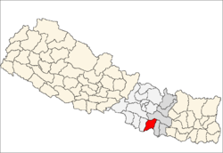
Sarlahi (Nepali: ne:सर्लाही![]() Listen ), a part of Province No. 2, is one of the seventy-five districts of Nepal. The district, with Malangwa as its district headquarters, covers an area of 1,259 km² and had a population of 635,701 in 2001 and 769,729 in 2011.[1] It is bordered to the west by the Bagmati River, to the east by Mahottari District, to the north by the Sivalik Hills, and to the south by Bihar State of india, a country in Asia. Actor Nikhil Upreti, actress Saranga Shrestha and famous Indian Tele actress Sriti Jha are from Sarlahi.
Listen ), a part of Province No. 2, is one of the seventy-five districts of Nepal. The district, with Malangwa as its district headquarters, covers an area of 1,259 km² and had a population of 635,701 in 2001 and 769,729 in 2011.[1] It is bordered to the west by the Bagmati River, to the east by Mahottari District, to the north by the Sivalik Hills, and to the south by Bihar State of india, a country in Asia. Actor Nikhil Upreti, actress Saranga Shrestha and famous Indian Tele actress Sriti Jha are from Sarlahi.
Etymology
Generally, the people of Sarlahi believe that the Sarlahi name comes from the name of Sarlahi Devi temple. The Sarlahi Devi temple is situated in Hempur village in the Sarlahi district. There is a believe that if someone goes to the temple at night with a light then that person will die. That is why people still do not go at night to that temple with light. Still there is no residence around this temple.[2]
Famous for
The district is famous for a couple of things. One of them is tomato production and supply. Lalbandi is the place of this district which is famous for supplying tomato demand of whole country. Scientific tomato farming was practiced in Sarlahi district at Bagwani Kendra Nawalpur, Netragunj. Farhadwa is the village which is famous for fish production and export. The production of sugarcane is also seems to be significant in the district. The INDUSHANKAR CHINI UDHYOG LTD.(Chini means Sugar, Sugar factory) is a notable factory in the district.[2]
Geography and Climate
| Climate Zone[3] | Elevation Range | % of Area |
|---|---|---|
| Lower Tropical | below 300 meters (1,000 ft) | 88.3% |
| Upper Tropical | 300 to 1,000 meters 1,000 to 3,300 ft. |
11.7% |
Geographical division
According to geographical texture Sarlahi district is divided into three parts.[4]
- Chure mountain of north
- Bhanwar region of middle
- Terai region of south
Chure mountain
In north side of this district from east to west there is the mountain range known as the Sivalik Hills. They have an average height of 900 metres (3,000 ft), reaching 1,350 metres (4,430 ft) in places. This range separates the terai from the inner terai and harbours the fossilised remains of many mammals no longer typical of Eurasia.[5]
Bhanwar region
This region is between what is north of the Sivalik hills and the southern Terai region, in the local language, it is also called as char koshe jhadi and thethi. The height of this region is from 150 m to 300 m. Mahendra Highway is touching this area so nowadays people settlement is increasing, in this region water source level is always at very low, even the following water is disappears because of sandiness. It is very difficult to obtain water by digging. So in this region irrigation system is problematic one.[4]
Terai region
This region is start from middle of district to south and goes to India's bihar. From ancient time this region has large public density and good place for farming, so this region is called Treasurer of grain.; [4]
Rivers
There are main three rivers flowing in this district into India.
It is biggest river, blowing in the western side of district, it separates Rautahat district from sarlahi.
This river is largest river inside the district, it is about 64 meter long. it originates from the Sivalik hills and passes into india by touching simara VDC of this district.
- Jhim river
Originated from north east side of Chure mountains of this districts into Phuljor river and Kalinjor river joins at the Vairawpur village of Jabdi VDC, then it becomes Jhim river. it is 29 km long and by flowing into districts passes into india, and in india this river is known as Adhwara river. Adhwara river was the east border of Makwanpur reign.
There are also many rivers in this district including the Adhwara River of the east which empties into the Jhim River, Manushmara river (which is formed by mixing Harion, Sotara and Pathlaiya rivers), and in middle of the district Dhangra and Bhumi rivers.[4]
Demographics
According to 2011 census Total population of district is 769,729, among them male population is 389,756 and female population is 379,973. Total Hindus population is 658,611, which is about 85% of total population, while total Muslim population is 60,679, which is about 8% of total population and total population of Buddhism is 44,011, which is about 5.71% of total population while total Christian population is 1,752 which is about 0.22% of total population.[6]
Media
From sarlahi district publishing Newspaper and FM radio station are as follows.[7]
| News Paper | Type |
|---|---|
| Madhesh Post | Daily |
| Suchna Saugat | Weekly |
| Nawa Paricharcha | Weekly |
| Sarlahi Awaz | Weekly |
| Sarlahi Times | Weekly |
| Parivesh News | weekly |
| Janwakalat | Weekly |
| Avashar | Weekly |
| Naya Surung | Monthly |
| Name | Frequency Range | Location | Status→←≥ |
|---|---|---|---|
| Samudayak Radio Sarlahi | 105.6 MHz | Hariyon | Broadcast |
| Mai FM | 107.6 MHz | Malangwa | Broadcast |
| Radio Madhesh | 89.3 MHz | Malangwa | Broadcast |
| Radio Ekta | 92.4 MHz | Lalbandi | Broadcast |
| Radio Dhukdhuki | 95.6 MHz | Lalbandi | Broadcast |
| Radio Mukteshower | 100.4 MHz | Barahatwa | Broadcast |
Sarlahi Constituencies
There are total 6 Electoral Constituencies in sarlahi named kshetra no:-1 to 6.[8]
Municipality in Sarlahi
Village Development Committees (VDCs)
|
See also
- Zones of Nepal
- "Districts of Nepal". Statoids.
References
- ↑ "National Population and Housing Census 2011 (National Report)" (PDF). Central Bureau of Statistics. Retrieved November 2012. Check date values in:
|access-date=(help) - 1 2 "जिविसको वस्तुगत स्थितिको झलक". Retrieved 2013-12-12.
|first1=missing|last1=in Authors list (help) - ↑ The Map of Potential Vegetation of Nepal - a forestry/agroecological/biodiversity classification system (PDF), . Forest & Landscape Development and Environment Series 2-2005 and CFC-TIS Document Series No.110., 2005, ISBN 87-7903-210-9, retrieved Nov 22, 2013 horizontal tab character in
|series=at position 91 (help) - 1 2 3 4 "भौगोलिक अवस्थिति". Retrieved 2013-12-12.
|first1=missing|last1=in Authors list (help) - ↑ "Geography of Nepal". Retrieved 2013-12-12.
|first1=missing|last1=in Authors list (help) - ↑ http://unstats.un.org/unsd/demographic/sources/census/2010_PHC/Nepal/Nepal-Census-2011-Vol1.pdf
- ↑ "News Paper Publish in Sarlahi District". Retrieved 2013-12-12.
|first1=missing|last1=in Authors list (help) - ↑ http://election.gov.np/election/uploads/files/document/%E0%A4%AE%E0%A4%A4%E0%A4%A6%E0%A4%BE%E0%A4%A8_%E0%A4%95%E0%A5%87%E0%A4%A8%E0%A5%8D%E0%A4%A6%E0%A5%8D%E0%A4%B01.pdf

Coordinates: 26°51′21″N 85°33′44″E / 26.855712°N 85.562360°E
| Wikimedia Commons has media related to Sarlahi District. |