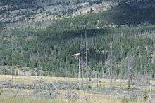
Jasper Airport
| Jasper Airport | |||||||||||
|---|---|---|---|---|---|---|---|---|---|---|---|
 | |||||||||||
| IATA: YJA – ICAO: CYJA | |||||||||||
| Summary | |||||||||||
| Airport type | Private | ||||||||||
| Operator | Superintendent, Jasper National Park | ||||||||||
| Location | Jasper, Alberta | ||||||||||
| Time zone | MST (UTC−07:00) | ||||||||||
| • Summer (DST) | MDT (UTC−06:00) | ||||||||||
| Elevation AMSL | 3,350 ft / 1,021 m | ||||||||||
| Coordinates | 52°59′48″N 118°03′34″W / 52.99667°N 118.05944°WCoordinates: 52°59′48″N 118°03′34″W / 52.99667°N 118.05944°W | ||||||||||
| Map | |||||||||||
 CYJA Location in Alberta | |||||||||||
| Runways | |||||||||||
| |||||||||||
|
Source: Canada Flight Supplement[1] | |||||||||||
Jasper Airport, (IATA: YJA, ICAO: CYJA), is located 7.2 nautical miles (13.3 km; 8.3 mi) north of Jasper, Alberta, Canada. It is mainly used for diversions and military use.
See also
References
- ↑ Canada Flight Supplement. Effective 0901Z 15 September 2016 to 0901Z 10 November 2016
External links
- Accident history for YJA: Jasper-Metropolitan Area Airport at Aviation Safety Network
- Page about this airport on COPA's Places to Fly airport directory
| By name | |
|---|---|
| By location indicator | |
| By province/territory | |
| By region | |
| National Airports System | |
| Related | |
| |
This article is issued from Wikipedia - version of the 12/4/2016. The text is available under the Creative Commons Attribution/Share Alike but additional terms may apply for the media files.