Jefferson Avenue (Staten Island Railway station)
| Jefferson Avenue | |||||||||||
|---|---|---|---|---|---|---|---|---|---|---|---|
| Staten Island Railway rapid transit station | |||||||||||
|
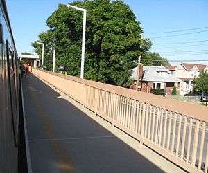
Northbound platform | |||||||||||
| Station statistics | |||||||||||
| Address |
Jefferson Avenue and North Railroad Avenue Staten Island, NY 10306 | ||||||||||
| Borough | Staten Island | ||||||||||
| Locale | Midland Beach | ||||||||||
| Coordinates | 40°35′02″N 74°06′11″W / 40.5838°N 74.1030°WCoordinates: 40°35′02″N 74°06′11″W / 40.5838°N 74.1030°W | ||||||||||
| Services | SIR Main Line | ||||||||||
| Structure | Embankment | ||||||||||
| Platforms | 2 side platforms | ||||||||||
| Tracks | 2 | ||||||||||
| Other information | |||||||||||
| Opened | 1937[1][2]–1939[3] | ||||||||||
| Rebuilt | 1965-1968 | ||||||||||
| Station succession | |||||||||||
| |||||||||||
Jefferson Avenue is a Staten Island Railway station between the neighborhoods of Grant City and Dongan Hills, in Staten Island, New York.
Station layout
| P Platforms |
Side platform, doors will open on the right | |
| Southbound | ← Main toward Tottenville (Grant City) | |
| Northbound | → Main toward St. George (Dongan Hills) → | |
| Side platform, doors will open on the right | ||
| G | Street level | Exit/Entrance |
The station opened between the years of 1935[1][2] and 1939.[3] Prior to 1965, the Jefferson Avenue crossing was at grade level. It only had a single warning bell for approaching trains. In the mid-1960s construction began on eliminating the crossings from Jefferson Avenue to New Dorp. The track was displaced onto South Railroad Avenue and the station as well as the crossing were temporarily relocated to Adams Avenue. Jefferson Avenue and the adjacent intersections were dropped below grade and the current station was built.
Currently, the station is located on an embankment at Jefferson Avenue and Railroad Avenue on the main line. This station has two side platforms. There is no station house and the only exit is at the northeast end, which leads to Jefferson Avenue. From north to south, Jefferson Avenue station begins the descent from the embankment to the open cut.
This is the only station on the Staten Island Railway that is named for the street it serves rather than the neighborhood.[4]
References
- 1 2 "Staten Island Rapid Transit Ticket 1935". Flickr - Photo Sharing!. Retrieved 4 May 2016.
- 1 2 "Staten Island Rapid Transit Railway Map 1937". Flickr - Photo Sharing!. Retrieved 4 May 2016.
- 1 2 "Staten Island Rapid Transit Ticket 1939". Flickr - Photo Sharing!. Retrieved 4 May 2016.
- ↑ "Subway Map" (PDF). Metropolitan Transportation Authority. November 2016. Retrieved 2016-11-07.
External links
- Staten Island Railway station list
- Staten Island Railway general information
- Jefferson Avenue entrance from Google Maps Street View
| Lines | 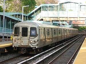 | ||||||||||
|---|---|---|---|---|---|---|---|---|---|---|---|
| Stations |
| ||||||||||
| Infrastructure |
| ||||||||||
| Rolling Stock | |||||||||||
| Other | |||||||||||