Jesenské, Rimavská Sobota District
| Jesenské | |
| Village | |
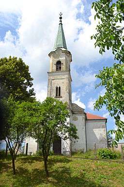 The Reformed Church in Jesenské | |
| Country | Slovakia |
|---|---|
| Region | Banská Bystrica |
| District | Rimavská Sobota |
| Elevation | 186 m (610 ft) |
| Coordinates | SK 48°18′N 20°04′E / 48.300°N 20.067°ECoordinates: SK 48°18′N 20°04′E / 48.300°N 20.067°E |
| Area | 17.139332 km2 (6.62 sq mi) |
| Population | 2,193 (2011) |
| Density | 128/km2 (332/sq mi) |
| First mentioned | 1274 |
| Postal code | 980 02 |
| Area code | +421-47 |
| Car plate | RS |
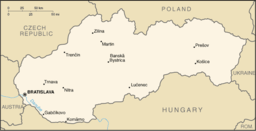 Location of Jesenské in Slovakia | |
 Location of Jesenské in the Banská Bystrica Region | |
| Statistics: MOŠ/MIS | |
| Website: www.jesenske.sk | |
Jesenské (Hungarian: Feled) is a village and municipality in the Rimavská Sobota District of the Banská Bystrica Region of southern Slovakia.[1]
History
The first mention is from 1274. In 1424, the village is noticed as property of the Feledys. As early as the Middle Ages, the village was important agricultural centre of the region. In 1553 was the village pilleged. From 1938 to 1945, it belonged to Hungary. Jesenské had been in 20th century seat of the Jesenské District.
Economy and infrastructure
Municipal office had been built in 1936. The village is important railway crossroad, as the Bratislava-Košice line crosses with a Jesenské-Tisovec line. In 2012 small reconstruction of the village center began.[2] In 1922 a football club was established, which is one of the best sport clubs in the village.[3]
See also
References
- ↑ "Statistical Office of the slovak Republic" (PDF). Výsledky SODB 2011. Štatistický úrad SR. Retrieved 9.8.2012. Check date values in:
|access-date=(help) - ↑ http://www.inprost.sk/v-jesenskom-zacnu-revitalizovat-centrum
- ↑ http://www.sport.rimava.sk/futbal/jesenske-v-obci-oslavia-90-rokov-futbaloveho-klubu-odohraju-zapasy-s-okresnym-mestom/
Genealogical resources
The records for genealogical research are available at the state archive "Statny Archiv in Banska Bystrica, Slovakia"
- Roman Catholic church records (births/marriages/deaths): 1768-1878 (parish A)
- Reformated church records (births/marriages/deaths): 1786-1878 (parish B)
External links
- Jesenské news at www.sme.sk
- http://www.jesenske.gemer.org
- http://www.e-obce.sk/obec/jesenske/jesenske.html
- Surnames of living people in Jesenske