Jessup, Pennsylvania
| Borough of Jessup | |
| Settlement | |
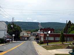 Church Street in Jessup | |
| Named for: Judge William Jessup | |
| Country | United States |
|---|---|
| State | Pennsylvania |
| County | Lackawanna |
| Elevation | 853 ft (260.0 m) |
| Coordinates | 41°28′16″N 75°33′44″W / 41.47111°N 75.56222°WCoordinates: 41°28′16″N 75°33′44″W / 41.47111°N 75.56222°W |
| Area | 6.75 sq mi (17.5 km2) |
| - land | 6.7 sq mi (17 km2) |
| - water | 0.05 sq mi (0 km2), 0.74% |
| Population | 4,676 (2010) |
| Density | 697.9/sq mi (269.5/km2) |
| Settled | 1849 |
| - Incorporated | December 1876 |
| Mayor | Tara Sweeney |
| Timezone | EST (UTC-5) |
| - summer (DST) | EDT (UTC-4) |
| Zip Code | 18434 |
| Area code | 570 |
 Location of Jessup in Pennsylvania | |
 Location of Pennsylvania in the United States | |
Jessup is a borough in Lackawanna County, Pennsylvania, United States. The population was 4,676 at the 2010 census.
Geography
Jessup is located at 41°28′16″N 75°33′44″W / 41.47111°N 75.56222°W (41.471131, -75.562171).[1]
According to the United States Census Bureau, the borough has a total area of 6.75 square miles (17.5 km2), of which, 6.7 square miles (17 km2) of it is land and 0.05 square miles (0.13 km2) of it (0.74%) is water.
History
Settled in 1849, the town of Jessup was named after Judge William Jessup. It was presented to the Luzerne County Court for incorporation as the Borough of Winton in December 1876. Two years later, Lackawanna County was incorporated. The early 1890s were very significant for the little town, as numerous new mining operations were opened. Shortly after these were opened, immigrants from Europe were lured to the area by the work available in the booming anthracite coal fields.
Demographics
| Historical population | |||
|---|---|---|---|
| Census | Pop. | %± | |
| 1880 | 905 | — | |
| 1890 | 1,797 | 98.6% | |
| 1900 | 3,425 | 90.6% | |
| 1910 | 5,280 | 54.2% | |
| 1920 | 7,583 | 43.6% | |
| 1930 | 8,508 | 12.2% | |
| 1940 | 7,989 | −6.1% | |
| 1950 | 6,280 | −21.4% | |
| 1960 | 5,456 | −13.1% | |
| 1970 | 4,948 | −9.3% | |
| 1980 | 4,974 | 0.5% | |
| 1990 | 4,605 | −7.4% | |
| 2000 | 4,718 | 2.5% | |
| 2010 | 4,676 | −0.9% | |
| Est. 2015 | 4,495 | [2] | −3.9% |
| Sources:[3][4][5] | |||
As of the census[6] of 2010, there were 4,676 people, 2,007 households, and 1,272 families residing in the borough. The population density was 697.9 people per square mile (269.5/km²). There were 2,134 housing units at an average density of 318.5 per square mile (124.4/km²). The racial makeup of the borough was 96.9% White, 0.8% African American, 0.2% American Indian, 0.4% Asian, 0.05% Pacific Islander, 0.4% from other races, and 1.2% from two or more races. Hispanic or Latino of any race were 1.9% of the population.
There were 2,007 households, out of which 24.7% had children under the age of 18 living with them, 45.9% were married couples living together, 12.7% had a female householder with no husband present, and 36.6% were non-families. 31.4% of all households were made up of individuals, and 15.4% had someone living alone who was 65 years of age or older. The average household size was 2.33 and the average family size was 2.92.
In the borough the population was spread out, with 20.2% under the age of 18, 61.6% from 18 to 64, and 18.2% who were 65 years of age or older. The median age was 42.5 years.
The median income for a household in the borough was $32,201, and the median income for a family was $43,013. Males had a median income of $36,339 versus $25,267 for females. The per capita income for the borough was $17,189. About 8.0% of families and 10.4% of the population were below the poverty line, including 11.3% of those under age 18 and 12.8% of those age 65 or over.
References
- ↑ "US Gazetteer files: 2010, 2000, and 1990". United States Census Bureau. 2011-02-12. Retrieved 2011-04-23.
- ↑ "Annual Estimates of the Resident Population for Incorporated Places: April 1, 2010 to July 1, 2015". Retrieved July 2, 2016.
- ↑ "Census of Population and Housing". U.S. Census Bureau. Retrieved 11 December 2013.
- ↑ "American FactFinder". United States Census Bureau. Retrieved 2008-01-31.
- ↑ "Incorporated Places and Minor Civil Divisions Datasets: Subcounty Resident Population Estimates: April 1, 2010 to July 1, 2012". Population Estimates. U.S. Census Bureau. Retrieved 11 December 2013.
- ↑ "American FactFinder". United States Census Bureau. Retrieved 2011-05-14.
External links
Municipalities and communities of Lackawanna County, Pennsylvania, United States | ||
|---|---|---|
| Cities | 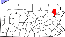 | |
| Boroughs | ||
| Townships | ||
| CDPs | ||
| Unincorporated communities |
| |