Jhunir
| Jhunir | |
|---|---|
| town | |
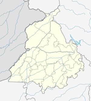 Jhunir  Jhunir Location in Punjab, India | |
| Coordinates: 29°48′29″N 75°20′44″E / 29.808°N 75.3455°ECoordinates: 29°48′29″N 75°20′44″E / 29.808°N 75.3455°E | |
| Country |
|
| State | Punjab |
| District | Mansa |
| Talukas | Sardulgarh |
| Population (2001) | |
| • Total | 6,289 |
| Languages | |
| • Official | Punjabi (Gurmukhi) |
| • Regional | Punjabi |
| Time zone | IST (UTC+5:30) |
| PIN | 151506[1] |
| Telephone code | 01659-26***** |
| Vehicle registration | PB31 |
| Nearest city | Mansa |
| Sex ratio | 1000/883 ♂/♀ |
Jhunir, sometimes spelled Jhuner, is a town in the Sardulgarh tehsil of Mansa district in Punjab, India. It is also a block of the district.
Geography
Jhunir is located at 29°48′29″N 75°20′44″E / 29.80806°N 75.34556°E[2] on State Highway 13, in the Mansa district of Indian Punjab. Mansa is the nearest railway station, lying 20 kilometres (12 mi) to its north, Sardulgarh (17 km) to the southwest, the city and district of Bathinda to the northeast and the city and district of Sangrur to the northeast.[2] The block has the total area of 34,488 square kilometres (13,316 sq mi).[3]
Demographics
At the 2001 census, Jhunir had a total population of 6,289 with 1,190 households, 3,340 males and 2,949 females.[4] Thus males constituted 53% and females 47% of the population with the sex ratio of 883 females per thousand males.
As a development block
As a development block of the district it has many villages under it including, Raipur, Khiali Chehlan Wali, Bire Wala Jattan and Ullak.
See also
- Chachohar
- Khiali Chehlan Wali
- Lakhmir Wala
- sarpanch gulab singh chakiwala S/o darshan singh chakiwala
References
- ↑ "Jhunir - PIN code and Post office details". www.pincodes.net.in. Retrieved 26 January 2012.
- 1 2 Google maps
- ↑ "Mansa District area details". www.mansa.nic.in. Retrieved 26 January 2012.
- ↑ "Jhunir census data 2001 (Sr. No. 38)". Government of India. www.censusindia.gov.in. 2001. Retrieved 26 January 2012.