Jiribam
| Jiribam | |
|---|---|
| Town | |
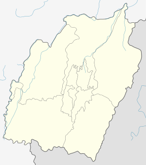 Jiribam  Jiribam Location in Manipur, India | |
| Coordinates: 24°48′N 93°07′E / 24.80°N 93.12°ECoordinates: 24°48′N 93°07′E / 24.80°N 93.12°E | |
| Country |
|
| State | Manipur |
| District | Imphal East |
| Population (2011) | |
| • Total | 43,838 |
| Languages | |
| • Official | Meiteilon (Manipuri) |
| Time zone | IST (UTC+5:30) |
| Vehicle registration | MN |
| Website |
manipur |
Jiribam is a town and a municipal council in Imphal East district in the Indian state of Manipur.The town is located on the western most boundary of the State, adjoining Cachar district of Assam. It is also known as the western gate of Manipur. Jiribam is inhabited by various communities such as tribes belonging to various communities such as Meteis, Meitei-Pangan, Bengali-Muslims,Bengali- Hindus,Nagas, Kukis, Thadou, Kabui, Tangkhul, Hmar ,Vishnupriya etc. inhabit the area of which the Meitei dominates. It is one of the fastest growing town in Manipur.
History
History of Jiribam: The history of Jiribam mainly begins with the colonial rule. A number of tribes and people of other religions began to migrate to the river side area in the beginning of the 19th century. The Jiri River was very famous during this era and Jiribam was a major trade centre. The entire area was then ruled by Maharaja Churachand from 1891 - 1941, who was then a minor. In the year 1907, the Manipur State Durbar was established to assist the Maharaja in the administration of the area. His son, Maharaja Budhachandra Singh ruled the area from 1941 - 1955 AD. In 1940, Jiribam became a Mauzar and the office of the Mauzardar of Jiribam was converted into S.D.C. office in 1950. Post-independence, an agreement was signedbetween the Government of India and the Maharaja of Manipur on 2 September 1949 and Manipur was merged with Indian Union on 15 October 1949. Manipur become one of the union Territories under the union Territories Act, 1956. Imphal city was declared as the capital city.[1]
Geography
Jiribam is located at 24°48′N 93°07′E / 24.80°N 93.12°E.[2]
Climate
According to the prevailing weather condition, there are three seasons namely, Dry season, rainy season and Cold weather season. Jiribam town enjoys moderate climate following its tropical location. It is influenced by S-W monsoon. The climate is humid tropical characterised by short winter and long summer with heavy rainfall. It is neither too hot nor too cold throughout the year.
Rainfall
Jiribam town lies under the direct influence of S-W monsoon and rainfall is abundant compared to other places of the state. Most of the rainfall (90%) is in the form of precipitation. About 20-30% of annual rainfall occurs during the pre-monsoon season in the month of May whereas about 60-70% of rainfalls occur in rainy seasons, second half of June to September, ranging from 1000mm to 1600mm. It continues till November in small quantity while that of pre-monsoon is in the form of thunder and showers. A meager quantity of frost is also found in between second half of December.
Temperature
Jiribam is humid with moderately hot temperature. Dry season falls in the month of May and June which is the hottest season. The hottest temperature is recorded in May, which is about 40’C.Temperature falls down from this period and is very pleasant in autumn season, which falls around September to November. The coldest/ lowest temperature is recorded in the period between second half of December to first half of January (i.e., below 2.78’C) at late night. However, days are comfortably warm even in this period, which is the same even in the rainy season.
Demographics
As of 2001 India census,[3] Jiribam had a population of 6426. Males constitute 49% of the population and females 51%. Jiribam has an average literacy rate of 73%, higher than the national average of 59.5%: male literacy is 80%, and female literacy is 66%. In Jiribam, 13% of the population is under 6 years of age.
Economy
The existing function of the Jiribam town consists of administrative headquarters of the subdivision and as a growth centre, which provides medical, educational and commercial facilities to the region in and around. According to 2001 census 80% of its working population is engaged in non agricultural activities and the main function of the town is categorised as “Services”. The important sector is tertiary sector where Government servants played a vital role. About 20% of the population engaged in Government offices which resulted more income than the secondary sector.[4]
Transport
Jiribam has Manipur's first railway station.[5] Jiribam is currently connected to the rest of India by recently converted Broad Gauge track towards Silchar. Goods services have resumed. A project to connect Imphal through Jiribam-Tupul-Imphal rail project is being executed and is expected to complete by 2018. It is on the alignment of a railway line proposed to connect with Myanmar. There are 2 highways which connect with Imphal,the capital of Manipur and the other with Assam and Meghalaya.
Politics
Jiribam is part of Outer Manipur (Lok Sabha constituency).[6]
References
- ↑ http://www.hoparoundindia.com/manipur/history-of-jiribam.aspx
- ↑ "Yahoo maps location of Jiribam". Yahoo maps. Retrieved 30 December 2008.
- ↑ "Census of India 2001: Data from the 2001 Census, including cities, villages and towns (Provisional)". Census Commission of India. Archived from the original on 16 June 2004. Retrieved 1 November 2008.
- ↑ http://townplanningmanipur.nic.in/documents/IHSDP_DPR_jiribam
- ↑ http://news.oneindia.in/2011/01/21/imphaljiribam-railway-line-spearheadinginfrastruc-aid0121.html
- ↑ "Assembly Constituencies - Corresponding Districts and Parliamentary Constituencies" (PDF). Manipur. Election Commission of India. Retrieved 7 October 2008.