Jufra District
| Jufra (الجفرة) | |
| District | |
 | |
| Country | |
|---|---|
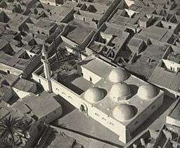
| Capital | Hun |
| Area | 117,410 km2 (45,332 sq mi) |
| Population | 52,342 (2006) [1] |
| Density | 0/km2 (0/sq mi) |
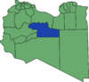
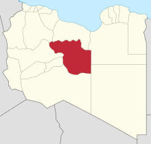 Map of Libya with Jufra district highlighted | |
Jufra or Jofra (Arabic: الجفرة Al Jufrah) is one of the districts of Libya. It is in the centre of the country. Its capital is Hun. Jufra was originally one of the 25 baladiya in the administrative system of Libya established in 1988. In 2001 It became a Shabiya, and its territorial extension was reduced. In 2007, under the new 22-shabiya system, its original boundaries were reintroduced. Jufra borders Sirte in the north, Al Wahat in northeast, Kufra in east, Murzuq in south, Sabha in southwest, Wadi al Shatii in west and Jabal al Gharbi in northwest.
Per the estimates of 2012, the total population in the region was 157,747 with 150,353 Libyans. The average size of the household in the country was 6.9, while the average household size of non-Libyans being 3.7. There were totally 22,713 households in the district, with 20,907 Libyan ones. The population density of the district was 1.86 persons per sq. km. Per 2006 census, there were totally 20,127 economically active people in the district.
Geography
Jufra is part of Fezzen geographical division of Libya and is mostly full of deserts. The region receives an annual rainfall of 2.5 in (64 mm). There are no perennial rivers in the region, but the region is abundant with groundwater aquifers.[2] Libya has mostly a flat undulating plain and occassional plateau, with an average elevation of around 423 m (1,388 ft). Around 91 per cent of the land is covered by desert, with only 8.8 per cent agricultural land (with only 1 % arable lands) and 0.1 per cent of forests. The major resources are petroleum, gypsum and natural gas. Along the coastal regions, the climate is Mediterranean in coastal areas, while it is desert climate in all other parts. Dust storms lasting four to eight days is pretty common during Spring.[3] Triplotania is the northwest region, while it is Cyrenacia in the east and Fezzen in southwest.[4]
Demographics
Per the estimates of 2012, the total population in the region was 157,747 with 150,353 Libyans. The average size of the household in the country was 6.9, while the average household size of non-Libyans being 3.7. There were totally 22,713 households in the district, with 20,907 Libyan ones. The population density of the district was 1.86 persons per sq. km. Per 2006 census, there were totally 20,127 economically active people in the district. There were 11,057 government employees, 2,315 employers, 6,000 first level workers and 000 second level workers. There were 5,348 workers in state administration, 2,715 in agriculture, animal husbandary and forestry, 3,056 in agriculutre & hunting, 4,714 in education, 1,515 in private enterprises, 763 in health & social work, 1,453 in production, 4,808 in technical work and 729 service workers. The total enrollment in schools was 15,876 and the number of people above secondary stage and less than graduation was 992.[5] As per the report from World Health Organization (WHO), there were no communicable disease centres, one dental clinic, one general clinics, no in-patient clinics, three out-patient clinics, 12 pharmacies, 12 PHC centres, no polyclinics, one rural clinic and no specialized clinics.[6]
Local administration
Libya became independent in 1951 from the colonial empire and generally known for its oil rich resources. All the powers rested centrally with the President Gaddafi for 42 years till the 2011 armed rebellion which topple him.[7] As per the constitution, Libya is the most decentralized Arab nation, but practically all powers are vested on central government on account of control over the oil revenues. Local governmental institutions manage the administration of education, industry, and communities. As a part of decentralization in 2012, the country is administratively split into 13 regions from the original 25 municipalities, which were further divided in 1,500 communes.[8] Since 2015, the chief of the state is a Chariman of Presidential Council, while the Prime Minister is the head of the state. The House of Representatives is an elected body that is elected on universal suffrage and popular vote. As of 2016, there were 22 administrative divisions in the country in the form of districts.[3]
References
- ↑ "Districts of Libya". statoids.com. Retrieved 27 October 2009.
- ↑ McColl, R. W. (2014). Encyclopedia of World Geography, Volume 1. Infobase Publishing. p. 543. ISBN 9780816072293.
- 1 2 "Libya profile". 2016. Retrieved 23 November 2016.
- ↑ Otman, Waniss; Karlberg, Erling (2007). The Libyan Economy: Economic Diversification and International Repositioning. Springer Science & Business Media,. pp. 1–3. ISBN 9783540464631.
- ↑ "Census of Libya". General Information Authority, Libya. 2012. Retrieved 17 November 2016.
- ↑ "Health statistics of Libya". World Health Organization (WHO). 2007. Retrieved 17 November 2016.
- ↑ "Libya profile - Timeline". BBC. 2 August 2016. Retrieved 20 November 2016.
- ↑ Great Socialist People's Libyan Arag Jamahiriya Public Administration and Country profile (PDF) (Report). Department of Economic and Social Affairs (DESA), United Nations. 2004. p. 9. Retrieved 17 November 2016.
External links
Coordinates: 28°N 17°E / 28°N 17°E