Kamni Vrh, Litija
| Kamni Vrh | |
|---|---|
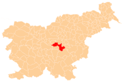
 Kamni Vrh Location in Slovenia | |
| Coordinates: 45°59′45.04″N 14°56′40.14″E / 45.9958444°N 14.9444833°ECoordinates: 45°59′45.04″N 14°56′40.14″E / 45.9958444°N 14.9444833°E | |
| Country |
|
| Traditional region | Lower Carniola |
| Statistical region | Central Sava |
| Municipality | Litija |
| Area | |
| • Total | 1.2 km2 (0.5 sq mi) |
| Elevation | 473.6 m (1,553.8 ft) |
| Population (2002) | |
| • Total | 41 |
| [1] | |
Kamni Vrh (pronounced [ˈkaːmni ˈvəɾx]; German: Steinberg[2]) is a settlement west of Gabrovka in the Municipality of Litija in central Slovenia. Traditionally the area was part of Lower Carniola and is now included with the rest of the municipality in the Central Sava Statistical Region; until January 2014 the municipality was part of the Central Slovenia Statistical Region.[3]
References
- ↑ Statistical Office of the Republic of Slovenia
- ↑ Leksikon občin kraljestev in dežel zastopanih v državnem zboru, vol. 6: Kranjsko. 1906. Vienna: C. Kr. Dvorna in Državna Tiskarna, p. 94.
- ↑ Litija municipal site
External links
This article is issued from Wikipedia - version of the 3/12/2016. The text is available under the Creative Commons Attribution/Share Alike but additional terms may apply for the media files.