Tepe, Litija
| Tepe | |
|---|---|
 | |
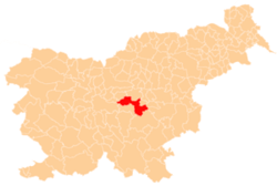
 Tepe Location in Slovenia | |
| Coordinates: 46°4′40.45″N 14°56′30.54″E / 46.0779028°N 14.9418167°ECoordinates: 46°4′40.45″N 14°56′30.54″E / 46.0779028°N 14.9418167°E | |
| Country |
|
| Traditional region | Lower Carniola |
| Statistical region | Central Sava |
| Municipality | Litija |
| Area | |
| • Total | 5.3 km2 (2.0 sq mi) |
| Elevation | 480.4 m (1,576.1 ft) |
| [1] | |
Tepe (pronounced [ˈteːpɛ]) is a settlement in the Municipality of Litija in central Slovenia. Traditionally the area was part of Lower Carniola and is now included with the rest of the municipality in the Central Sava Statistical Region.[2] It includes the hamlets of Zgornje Tepe (German: Obertepe[3]), Srednje Tepe, Spodnje Tepe (German: Untertepe[3]), Žamboh, Kleviše (German: Klewisch[3]), Graben (in older sources also V Grabnu,[3] German: Im Graben[3]), and Pasjek.[4] The hamlet of Nova Gora (German: Neuberg) is also mentioned in some sources.[3]
The local church is dedicated to Saint Lawrence and belongs to the Parish of Polšnik. It was built in the 16th century.[5]
References
- ↑ Statistical Office of the Republic of Slovenia
- ↑ Litija municipal site
- 1 2 3 4 5 6 Leksikon občin kraljestev in dežel zastopanih v državnem zboru, vol. 6: Kranjsko. 1906. Vienna: C. Kr. Dvorna in Državna Tiskarna, p. 95.
- ↑ Savnik, Roman, ed. 1971. Krajevni leksikon Slovenije, vol. 2. Ljubljana: Državna založba Slovenije, pp. 285–286.
- ↑ Slovenian Ministry of Culture register of national heritage reference number ešd 2157
External links
This article is issued from Wikipedia - version of the 3/22/2016. The text is available under the Creative Commons Attribution/Share Alike but additional terms may apply for the media files.