Karya, Lefkada
| Karya Καρυά | |
|---|---|
 Karya | |
|
Location within the regional unit 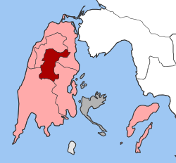 | |
| Coordinates: 38°45′N 20°39′E / 38.750°N 20.650°ECoordinates: 38°45′N 20°39′E / 38.750°N 20.650°E | |
| Country | Greece |
| Administrative region | Ionian Islands |
| Regional unit | Lefkada |
| Municipality | Lefkada |
| Districts | 3 |
| • Municipal unit | 30.867 km2 (11.918 sq mi) |
| Population (2011)[1] | |
| • Municipal unit | 871 |
| • Municipal unit density | 28/km2 (73/sq mi) |
| Time zone | EET (UTC+2) |
| • Summer (DST) | EEST (UTC+3) |
| Postal code | 310 81 |
| Area code(s) | 26290 |
| Vehicle registration | EY |
| Website | www.karya.gr |
Karya (Greek: Καρυά) is a former municipality on the island of Lefkada, Ionian Islands, Greece. Since the 2011 local government reform it is part of the municipality Lefkada, of which it is a municipal unit.[2] It lies in the central part of Lefkada. It has a land area of 30.867 km²[3] and a population of 871 (2011 census). A large part of the population live in the former municipal seat, the town of Karyá (pop. 589).
The village Karya is located on the slopes of Pyrgos at 500 m above sea level. The highest point in the municipal unit is the mountain Stavrota, elevation 1,158 m. There are four villages in the municipal unit: Karyá, Pigadisánoi (pop. 157), Egklouví (106), and Ammókampos (19).
Subdivisions
The municipal unit Karya is subdivided into the following communities (constituent villages in brackets):
- Egklouvi (Egklouvi, Ammokampos)
- Karya
- Pigadisanoi
Population
| Year | Village population | Municipality population |
|---|---|---|
| 1981 | 1,152 | - |
| 1991 | 957 | 1,497 |
| 2001 | 989 | 1,247 |
| 2011 | 589 | 871 |
Notable people
- Apostolos Kaklamanis (1936-) politician
See also
References
- ↑ "Απογραφή Πληθυσμού - Κατοικιών 2011. ΜΟΝΙΜΟΣ Πληθυσμός" (in Greek). Hellenic Statistical Authority.
- ↑ Kallikratis law Greece Ministry of Interior (Greek)
- ↑ "Population & housing census 2001 (incl. area and average elevation)" (PDF) (in Greek). National Statistical Service of Greece.
External links
- Official website (English) (Greek)
- Karya (municipality) on GTP Travel Pages (in English and Greek)
- Karya (village) on GTP Travel Pages (in English and Greek)