Kavumannam
| Kavumannam | |
|---|---|
| village | |
|
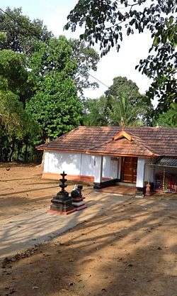
Paradhevatha Temple, Kavumannam | |
| Coordinates: 11°38′0″N 76°0′30″E / 11.63333°N 76.00833°ECoordinates: 11°38′0″N 76°0′30″E / 11.63333°N 76.00833°E | |
| Country |
|
| State | Kerala |
| District | Wayanad |
| Population (2001) | |
| • Total | 9,984 |
| Languages | |
| • Official | Malayalam, English |
| Time zone | IST (UTC+5:30) |
| PIN | 6XXXXX |
| Vehicle registration | KL- |
Kavumannam is a village near Padinharethara in Wayanad district in the state of Kerala, India.[1]
History
Tipu Sultan of Mysore built a road in Wayanad by the name Kuthirappandy Road. The British converted this carriage track into a motorable road. The old village of Thariyode is situated on the side of this ancient road and its old name was Edathara. Thariyode panchayath was formed in 1962 by dividing Vythiri panchayath. In 1925, the village got its first school and it was called Kallattummal School.
Demographics
As of 2001 India census, Kavumannam had a population of 9984 with 5008 males and 4976 females.[1]
Important Landmarks
- Government Highschool, Thariode
- Homeo Hospital, Thariode
- Ayurvedha Hospital, Thariode
- Sahrdhaya Library, Kavumannam
- Table Tennis Stadium, Kavumannam
- Louis Mount Psychiatric Hospital, Kavumannam
- Karlad Lake, Kavumannam
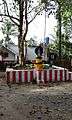
Image Gallery
 Paradevata temple
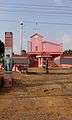 Kavumannam Church
References
- 1 2 "Census of India : Villages with population 5000 & above". Retrieved 2008-12-10.
|first1=missing|last1=in Authors list (help)
This article is issued from Wikipedia - version of the 7/7/2016. The text is available under the Creative Commons Attribution/Share Alike but additional terms may apply for the media files.