W. K. Kellogg Airport
| W. K. Kellogg Airport | |||||||||||||||||||
|---|---|---|---|---|---|---|---|---|---|---|---|---|---|---|---|---|---|---|---|
| IATA: BTL – ICAO: KBTL – FAA LID: BTL | |||||||||||||||||||
| Summary | |||||||||||||||||||
| Airport type | Public | ||||||||||||||||||
| Owner | City of Battle Creek | ||||||||||||||||||
| Serves | Battle Creek, Michigan | ||||||||||||||||||
| Elevation AMSL | 952 ft / 290 m | ||||||||||||||||||
| Coordinates | 42°18′23″N 85°15′00″W / 42.30639°N 85.25000°WCoordinates: 42°18′23″N 85°15′00″W / 42.30639°N 85.25000°W | ||||||||||||||||||
| Website | www.BattleCreekMI.gov/... | ||||||||||||||||||
| Map | |||||||||||||||||||
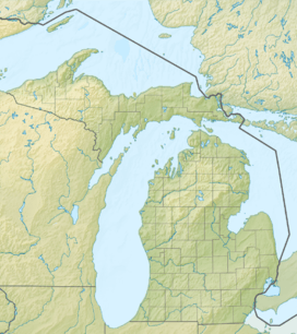 BTL  BTL Location of airport in Michigan/United States | |||||||||||||||||||
| Runways | |||||||||||||||||||
| |||||||||||||||||||
| Statistics (2009) | |||||||||||||||||||
| |||||||||||||||||||
W. K. Kellogg Airport[1][2] (IATA: BTL, ICAO: KBTL, FAA LID: BTL) is a city owned, public use, joint civil-military airport located three nautical miles (6 km) west of the central business district of Battle Creek, a city in Calhoun County, Michigan, United States.[1] The airport is accessible by road from Helmer Road, and is located near I-94. It is included in the Federal Aviation Administration (FAA) National Plan of Integrated Airport Systems for 2017–2021, in which it is categorized as a regional general aviation facility.[3] It is also known as W. K. Kellogg Regional Airport.[4][5]
It addition to general aviation, the airport supports air cargo and corporate flight operations. It is home to Western Michigan University College of Aviation, Duncan Aviation – the nation’s largest family-owned aircraft refurbishing company, WACO Classic Aircraft Corporation, Federal Express regional truck distribution facility, and other aviation businesses. The Battle Creek Field of Flight Air Show and Balloon Festival is also held annually at Kellogg Airport.
The 110th Attack Wing[6] (110 ATKW), a unit of the Michigan Air National Guard, uses part of the facilities, known as the Battle Creek Air National Guard Base. The 110th Attack Wing is operationally gained by the Air Combat Command (ACC).
This airport should not be confused with the W.K. Kellogg Airport in Pomona, California, which operated from 1928 to 1932 and was then the largest privately owned airport in the country.[7]
History
During World War II the airfield was used by the United States Army Air Forces.
In May 2010, construction began on a new $7.2 million, 4,100 feet (1,250 m) long by 75 feet (23 m) wide runway parallel to existing runway 5/23.[8] The new runway designated 5R-23L opened July 7, 2011.[9]
Facilities and aircraft
W. K. Kellogg Airport covers an area of 1,500 acres (607 ha) at an elevation of 952 feet (290 m) above mean sea level. It has three asphalt paved runways: 5L/23R is 10,004 by 150 feet (3,049 x 46 m); 5R/23L is 4,100 by 75 feet (1,250 x 23 m); 13/31 is 4,835 by 100 feet (1,474 x 30 m).[1]
For the 12-month period ending December 31, 2009, the airport had 92,841 aircraft operations, an average of 254 per day: 98% general aviation, 2% military, and <1% air taxi. At that time there were 93 aircraft based at this airport: 73% single-engine, 15% multi-engine, 7% jet, 1% helicopter, and 4% military.[1]
See also
References
- 1 2 3 4 5 FAA Airport Master Record for BTL (Form 5010 PDF). Federal Aviation Administration. Effective May 31, 2012.
- 1 2 "W.K. Kellogg Airport". City of Battle Creek. Retrieved July 7, 2012.
- ↑ "List of NPIAS Airports" (PDF). FAA.gov. Federal Aviation Administration. 21 October 2016. Retrieved 25 November 2016.
- ↑ "Battle Ck, W. K. Kellogg (BTL)" (PDF, 66.1 KB). Airport Directory. State of Michigan.
- ↑ "Battle Creek-WK Kellogg Regional Airport, MI profile". Aviation Safety Network, Flight Safety Foundation. Retrieved July 8, 2012.
- ↑ http://www.110aw.ang.af.mil/
- ↑ Roeder, Walter H. (Fall 1989). "The W. K. Kellogg Airport". The Cal Poly Scholar. University Library. 2: 129–134. Retrieved March 15, 2012.
- ↑ Willis, Elizabeth (May 4, 2010). "New airport runway poised for takeoff". Battle Creek Enquirer. Retrieved May 10, 2010.
- ↑ "W.K. Kellogg Airport: New Parallel Runway 5R-23L". City of Battle Creek. Retrieved July 7, 2012.
External links
|
|