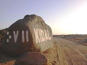
Kidal Cercle
| Kidal | |
|---|---|
| Cercle | |
 | |
 Kidal Cercle in Mali | |
| Country |
|
| Region | Kidal Region |
| Capital | Kidal |
| Area[1] | |
| • Total | 21,353 km2 (8,244 sq mi) |
| Population (2009)[2] | |
| • Total | 33,087 |
| • Density | 1.5/km2 (4.0/sq mi) |
| Time zone | GMT (UTC+0) |
Kidal Cercle is an administrative subdivision of the Kidal Region of Mali. The administrative center (chef-lieu) is the town of Kidal. The cercle is divided into rural and urban communes, and below this, quarters/villages. In 2009 the cercle had a population of 33,087.[2]
The climate is typical Saharian with very little rainfall and large fluctuations in temperature. The average annual rainfall is around 130 mm but there are large year-to-year variations with 204 mm recorded in 1999 and only 66 mm in 1990.[1]
The mountain region of Adrar des Ifoghas was taken by French and Chadian forces on 22 February 2013 as part of the Northern Mali conflict. The area of In Arab, near Anefif, was captured by MNLA forces on 29-30 March 2013.
Communes
The Kidal Cercle contains the following communes:[3]
References
- 1 2 Programme de renforcement des capacités nationales pour une gestion stratégique du développement (PRECAGED): Schéma d'aménagement et de développement du Cercle de Kidal, République du Mali: Ministère de l'économie programme des nations unies et des finances, 2002
- 1 2 Resultats Provisoires RGPH 2009 (Région de Kidal) (PDF), République de Mali: Institut National de la Statistique
- ↑ Communes de la Région de Kidal (PDF) (in French), Ministère de l’administration territoriale et des collectivités locales, République du Mali.
| Kayes Region | 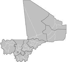 | |
|---|---|---|
| Koulikoro Region | ||
| Sikasso Region | ||
| Ségou Region | ||
| Mopti Region | ||
| Tombouctou Region | ||
| Gao Region | ||
| Kidal Region | ||
| Bamako Capital District | ||
Capital: Kidal | ||
| Abeibara Cercle |  | |
| Kidal Cercle | ||
| Tessalit Cercle |
| |
| Tin-Essako Cercle | ||
Coordinates: 18°30′N 1°25′E / 18.500°N 1.417°E