Kilbeggan (civil parish)
| Kilbeggan Cill Bheagáin | |
|---|---|
| Civil parish | |
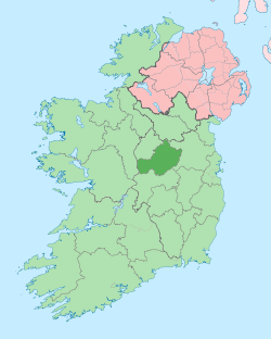
 Kilbeggan Location of Kilbeggan within County Westmeath in the Republic of Ireland | |
| Coordinates: 53°22′12″N 7°29′37″W / 53.37000°N 7.49361°WCoordinates: 53°22′12″N 7°29′37″W / 53.37000°N 7.49361°W | |
| Country |
|
| Province | Leinster |
| County | County Westmeath |
| Irish grid reference | N401372 |
Kilbeggan (Irish: Cill Bheagáin)[1] is a civil parish in County Westmeath, Ireland. It is located about 19.86 kilometres (12 mi) south–south–west of Mullingar.
Kilbeggan is one of 8 civil parishes in the barony of Moycashel in the Province of Leinster. The civil parish covers 6,103.6 acres (24.700 km2).
Kilbeggan civil parish comprises the town of Kilbeggan and 29 townlands: Aghamore, Aghuldred, Ardnaglew, Ballinderry Big, Ballinderry Little, Ballinwire, Ballymacmorris, Ballynasudder, Ballyoban, Brownscurragh, Camagh, Clonaglin, Coola, Demesne or Mearsparkfarm, Grange and Kiltober, Grangegibbon, Greenan, Guigginstown, Hallsfarm, Kilbeggan, Kilbeggan North, Kilbeggan South, Kiltober and Grange, Loughanagore, Meadowpark, Meeldrum, Meeniska, Meersparkfarm or Demesne, Shureen and Ballynasuddery, Skeahanagh, Stonehousefarm and Tonaphort.
The neighbouring civil parishes are: Castletownkindalen to the north, Newtown to the east, Rahugh to the east and south, Durrow to the south and Ardnurcher or Horseleap to the west.[2][3]
References
- ↑ Kilbeggan civil parish The Placenames Database of Ireland. Retrieved on 14 July 2015.
- ↑ Kilbeggan civil parish, Co. Westmeath townlands.ie Retrieved on 14 July 2015.
- ↑ Kilbeggan civil parish, Co. Westmeath The IreAtlas Townland Data Base. Retrieved on 14 July 2015.
External links
- Kilbeggan civil parish at the IreAtlas Townland Data Base
- Kilbeggan civil parish at townlands.ie
- Kilbeggan civil parish at The Placenames Database of Ireland