Killua (civil parish)
| Killua Chill Dalua | |
|---|---|
| Civil parish | |
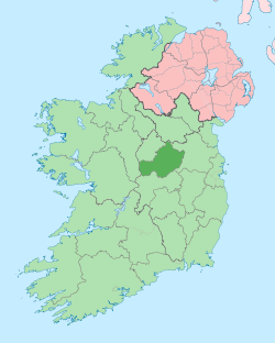
 Killua Location of Killua within County Westmeath in the Republic of Ireland | |
| Coordinates: 53°38′53″N 6°59′50″W / 53.64806°N 6.99722°WCoordinates: 53°38′53″N 6°59′50″W / 53.64806°N 6.99722°W | |
| Country |
|
| Province | Leinster |
| County | County Westmeath |
| Irish grid reference | N663669 |
Killua (Irish: Chill Dalua)[1] is a civil parish in County Westmeath, Ireland. It is located about 26.69 kilometres (17 mi) north–east of Mullingar.
Killua is one of 7 civil parishes in the barony of Delvin in the Province of Leinster. The civil parish covers 5,262.2 acres (21.295 km2). The largest population centre is the small town of Clonmellon.
Killua civil parish comprises 12 townlands: Ballinlough, Clonmellon, Cloran & Corcullentry, Corcullentry aka Cloran & Corcullentry, Dervotstown, Heathstown, Killua, Kilrush Lower, Kilrush Upper, Knock Killua, Moygrehan Lower, Moygrehan Upper and Paristown.
The neighbouring civil parishes are: Killallon and Kilskeer (both County Meath) to the north, Girley (County Meath} to the east and Delvin to the south and west.[1][2][3]
References
- 1 2 Killua civil parish The Placename Database of Ireland. Retrieved on 7 July 2015.
- ↑ Killua civil parish townlands.ie Retrieved on 7 July 2015.
- ↑ Killua civil parish The IreAtlas Townland Database. Retrieved on 7 July 2015
External links
- Killua civil parish at the IreAtlas Townland Data Base
- Killua civil parish at townlands.ie
- Killua civil parish at The Placename Database of Ireland