Killucan (civil parish)
| Killucan Cill Liúcainne | |
|---|---|
| Civil parish | |
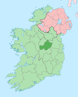
 Killucan Location of Killucan within County Westmeath in the Republic of Ireland | |
| Coordinates: 53°30′10″N 7°8′27″W / 53.50278°N 7.14083°WCoordinates: 53°30′10″N 7°8′27″W / 53.50278°N 7.14083°W | |
| Country |
|
| Province | Leinster |
| County | County Westmeath |
| Irish grid reference | N570506 |
Killucan (Irish: Cill Liúcainne)[1] is a civil parish in County Westmeath, Ireland. It is located about 13.68 kilometres (9 mi) east of Mullingar.
Killucan is the sole civil parish in the barony of Farbill in the Province of Leinster. The civil parish covers 35,625.3 acres (144.170 km2).
Killucan civil parish comprises 77 townlands: Aghamore, Annaskinnan, Balleighter Lowtown, Ballinla, Balloughter Hightown, Ballyhaw, Balrowan (Pakenham), Balrowan (Rowely) & Kerinstown, Banagher, Brutonstown, Brutonstown Little, Castledown, Chanonstown, Cloghanstown, Clonbore, Cloncrave, Cloncullen, Clonfad, Clonreagh, Coolcahan, Corbally, Corbetstown, Correllstown, Craddanstown, Creggstown, Crossanstown, Curristown, Cushinstown, Derryboy, Derrymore, Edmondstown, Glebe, Grange Beg, Grange More, Greatdown, Greenan, Grehanstown, Griffinstown, Heathstown, Higginstown, Hightown Balloughter, Hodgestown, Huntingdon, County Westmeath, Hydepark, Joristown Lower, Joristown Upper, Kerinstown & Balrowan (Rowley), Killucan, Kinnegad, Knockaville, Knockmant, Knocksimon, Lisnabin, Lowtown Balleighter, Lunestown, Mill Land, Millerstown, County Westmeath, Monganstown, Mucklin, Mylestown, Newdown, Porterstown (Cooke), Porterstown (Napper), Priesttown, Raharney, Raharney Little, Rathbrack, Rathnarrow, Rathwire Lower, Rathwire Upper, Ratrass, Rattin, Riverdale, Riverstown, Sarsfieldstown, Simonstown, Sionhill, Thomastown, Wadestown, Wardenstown and Wooddown. Greenan and Mucklin townlands are in the barony of Delvin.
The neighbouring civil parishes are: Killagh, Killulagh and Rathconnell to the north, Killaconnigan and Killyon (both in County Meath) to the east, Clonard (in County Meath) to the south and Enniscoffey, Lynn, Mullingar and Pass of Kilbride to the west.[2][3]
References
- ↑ Killucan civil parish Placenames Database of Ireland Retrieved on 29 June 2015.
- ↑ Killucan civil parish, County Westmeath Townlands.ie Retrieved on 29 June 2015.
- ↑ Killucan civil parish, County Westmeath The IreAtlas Townland Data Base Retrieved on 29 June 2015.
External links
- Killucan civil parish at the IreAtlas Townland Data Base
- Killucan civil parish at Townlands.ie
- Killucan civil parish at the Placenames Database of Ireland