Kimaka
| Kimaka | |
|---|---|
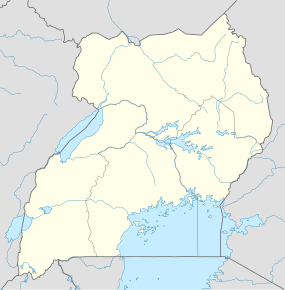 Kimaka Map of Uganda showing the location of Kimaka. | |
| Coordinates: 00°27′01″N 33°11′30″E / 0.45028°N 33.19167°E | |
| Country |
|
| Region | Eastern Uganda |
| Sub-region | Busoga sub-region |
| District | Jinja District |
| Elevation | 1,190 m (3,900 ft) |
| Time zone | EAT (UTC+3) |
Kimaka is a neighborhood in the city of Jinja, in the Eastern Region of Uganda.
Location
Kimaka is bordered by to the west by the Nile River, (from Nalubaale Power Station to Bujagali Power Station), to the south by the Kampala-Jinja Highway (from Nalubaale Power Station to the first roundabout as one enters Jinja from Kampala), to the east by Qaddafi Barracks and to the north by the area north of the Jinja Airport. This location is about 3.6 kilometres (2.2 mi), by road, from the central business district of Jinja.[1] The coordinates of Kimaka are:0°27'01.0"N, 33°11'30.0"E (Latitude:0.450278; Longitude:33.191667).[2]
Overview
Kimaka is divided into the Eastern Zone, east of the Jinja-Budondo Road, and the Western Zone, to the west of that road. The Eastern Zone is dominated by Jinja Airport and the Uganda Senior Command and Staff College. The Western Zone is primarily composed of middle class residential neighborhoods and, closer to the River Nile, by the three hydroelectric dams from south to north: Nalubaale, Kiira, and Bujagali. Kimaka Power Station, a 50MW thermal power plant that uses heavy fuel oil, is located adjacent to Kiira Power Station.
Landmarks
The landmarks in Kimaka or near its borders include:
- Jinja Airport, a military and civilian airport that serves Jinja
- Uganda Senior Command and Staff College, located adjacent to the airport[3]
- Nalubaale Power Station located at the southwestern border of Kimaka
- Kiira Power Station located at the southwestern border of Kimaka, adjacent to Nalubaale Power Station
- Bujagali Power Station located approximately 5 kilometres (3.1 mi), downstream of Nalubaale Power Station.[4]
- Victoria Nile - Forms the western border of Kimaka
- The Jinja-Budondo Road - Bisects Kimaka into the Eastern and Western Zones
- Kimaka Power Station - A thermal power station operated by Invespro, a private power company[5]
- The Kampala-Jinja Highway - The highway forms the southern border of the neighbourhood
See also
References
- ↑ Road Distance Between Jinja And Kimaka With Map
- ↑ Google (6 July 2015). "Location of Kimaka At Google Maps" (Map). Google Maps. Google. Retrieved 6 July 2015.
- ↑ The USCSC Located at Kimaka
- ↑ About Bujagali Power Station
- ↑ Invespro to Install 50MW Thermal Plant at Kimaka in 2010
External links
Capital: Buwenge | ||
| Counties and sub-counties | Butembe County | 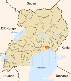 |
| Towns and villages | ||
| Economy |
| |
| Energy | ||
| Notable landmarks | ||
| Education |
| |
| Transport | ||
| Health | ||
| Notable people |
| |
Coordinates: 00°27′01″N 33°11′30″E / 0.45028°N 33.19167°E