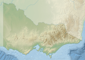
King River (Victoria)
The King River, a perennial river[2] of the North-East Murray catchment of the Murray-Darling basin, is located in the alpine and Hume regions of Victoria, Australia. It flows from the northwestern slopes of the Alpine National Park in the Australian Alps, through the King Valley, and joining with the Ovens River at the rural city of Wangaratta.[3]
Location and features
The King River rises below Mount Buggery, within Mansfield Shire, at an elevation exceeding 1,460 metres (4,790 ft) above sea level. The river flows generally north by northwest, most of its course through remote parts of the Alpine and Mount Buffalo national parks, and then descending into the King Valley, joined by eight minor tributaries, before reaching its confluence with the Ovens River at Wangaratta. The river descends 1,320 metres (4,330 ft) over its 126-kilometre (78 mi) course.[3]
The river is impounded by the William Hovell Dam to form Lake William Hovell, that provides water for approximately 24 square kilometres (9.3 sq mi) for irrigated crops, vineyards and grazing properties along the King River from Cheshunt to Wangaratta.[4][5] A small 1.6-megawatt (2,100 hp) hydro-electric generator is driven by the river's outflow from the dam, with an average annual output of 3.7 gigawatt-hours (13 TJ).[5][6]
Etymology
The river was named by Hamilton Hume and William Hovell, explorers of the region, in honour of Captain Philip Gidley King, the third Governor of New South Wales, in office from 1800 to 1806.[1]
In the Australian Aboriginal Waywurru language, the river is named Poodumbeyer, with no defined meaning.[1]
Recreation
Kayaking enthusiasts access the river for the many level 2 and level 3 rapids. In 2008 the site for the Victorian and Australian Downriver Championships.
See also
References
- 1 2 3 4 "King River: Historical Information". Vicnames. 12 August 2011. Retrieved 11 July 2014.
- 1 2 "King River: 18811". Vicnames. Retrieved 11 July 2014.
- 1 2 3 "Map of King River, VIC". Bonzle Digital Atlas of Australia. Retrieved 11 July 2014.
- ↑ "Lake William Hovell". Goulburn-Murray Water. Retrieved 11 July 2014.
- 1 2 "Register of Large Dams in Australia" (Excel (requires download)). Dams information. Australian National Committee on Large Dams. 2010. Retrieved 11 July 2014.
- ↑ "Victorian hydro plants". Projects: Operations. Pacific Hydro. 2011. Retrieved 11 July 2014.
External links
![]() Media related to King River (Victoria) at Wikimedia Commons
Media related to King River (Victoria) at Wikimedia Commons
