Kisar
| Native name: <span class="nickname" ">Yotowawa | |
|---|---|
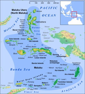 Kisar in the south of Maluku Islands as a part of the Barat Daya Islands | |
| Geography | |
| Location | South East Asia |
| Coordinates | 8°04′S 127°11′E / 8.06°S 127.18°E |
| Area | 81.83 km2 (31.59 sq mi)[1] |
| Administration | |
|
Indonesia | |
| Provinsi | Maluku |
| Kabupaten | Maluku Barat Daya |
| Kecamatan | Pulau-Pulau Terselatan |
Kisar, also known as Yotowawa, is a small island in the Southwestern Moluccas in Indonesia. It is one of the 92 officially listed outlying islands of Indonesia.
Description

It is located to the northeast of Timor Island in an area of active tectonics.[2]
The Oirata language,[3] (closely related to Fataluku) and the unrelated Kisar,[4] a trade language (also locally known as Yotowawa or Meher), are spoken here.
The Timor Monitor (Varanus timorensis) is found in Kisar.
History
1665 the Dutch VOC built a military base and named the island after the Kisar word for white sand. From the European outpost on Kisar a relatively large Indo Eurasian community developed named the 'Mestizo from Kisar' to this day their descendants live as Rajas and chiefs on Kisar. Surviving family names include: Joostenz, Wouthuysen, Caffin, Lerrick, Peelman, Lander, Ruff, Bellmin-Belder, Coenradi, van Delsen, Schilling and Bakker.
In 1795 Kisar was under British rule, in 1803 it was under Dutch/French rule and in 1810 again under English rule. 1817 Kisar was returned to the Dutch until the outpost was abandoned in 1819. After that time Kisar upheld close ties with their Portuguese, Topasses and Timorese neighbours on Timor.
After WWII and Indonesia's independence the island was temporarily considered part of the segregated RMS, but ultimately became part of the unitary Indonesian state.
Nobility

The current and 12th Raja (king) of Kisar, Johannes J. Bakker, succeeded his father Raja Hairmere Philipus Zacharias Bakker.[5] The first Raja Cornelis Bakker, who also ruled Wetar, Roma and Leti island via his brothers, was crowned ca. 1665.
Nowadays the Raja is respected as a traditional dignitary, but has no political power. The present Raja is well educated and for 5 years worked as a government official in nearby East-Timor, when part of Indonesia. There he met his wife Maria Antonette Ribeiru.[5]
Transport
The small and remote Pulau Kisar has a small airport, near desa Purpura on the north side of the island, that receives flights from Ambon (Maluku), Kupang (East Nusatenggara), and Surabaya in East Java. Passenger ships also call at Pulau Kisar from Ambon, Kupang and Surabaya.
Academic study
In 1928 the German Professor E.Rodenwaldt published his study "Die Mestizen auf Kisar", "Mikroskopische Beobachtungen an den Haaren der Kisaresen und Kisarbastarde".[6] His work is published in two German language volumes, one volume details measurements and photographs of the observed Mestizos. It contains a family tree showing the very complicated inter-marriages between the descendants of Mestizo families, as well as indicating skin, eye, and hair colour heredity. The study shows a unique natural experiment spanning over two centuries and is considered an essential academic work in the area of human heredity.[7][8]
Geography and geology
Kisar is similar geographically and geologically to the nearby islands of Timor, Leti, and Moa. The interior of the island is hilly, with several small mountains lined roughly east-west. The highest of these, Gunung Taitulu, rises approximately 300 metres (980 ft) above sea level, and from the top, nearby Wetar and Timor are easily seen. The entire island is encircled by a series of rugged limestone cliffs that look like giant stairsteps rising from the coast. These uplifted terraces represent former coral reefs that have been thrust from the sea due to the active tectonics of the region. Those terraces are also gently warped. An uplift rate of the island of approximately 0.5 mm/yr over the past several hundred thousand years has been calculated by obtaining ages of coral samples from the terraces.[9]
The rocks exposed in the interior of the island are primarily composed of low to medium-grade metamorphosed sedimentary rocks, with scattered amphibolites. The metasedimentary rocks are quartz-rich and the amphibolites represent mafic igneous intrusions. Age analyses of detrital minerals, petrology, and geochemistry all indicate that the island belongs geologically with the other islands of the Outer Banda Arc.[10] This series of islands formed when the northern edge of the Australian continent was upthrust in collision with southeast Asia. These islands are paralleled by the Inner Banda Arc, a series of active and extinct volcanic islands, including neighboring Wetar. The islands in the Banda Arc are arranged in a distinct horseshoe shape and represent a young, emerging mountain belt. Thus, Kisar represents one peak of a new mountain range rising from the sea.
References
- ↑ http://www.ppk-kp3k.kkp.go.id/direktoripulau/index.php?option=mod_pulau&id=preview&id_pulau=9091
- ↑ Jonathan R. Major, THE TECTONIC EVOLUTION AND REGIONAL SIGNIFICANCE OF KISAR ISLAND, INDONESIA, Geologic Sciences, Brigham Young University
- ↑ http://www.ethnologue.com/show_language.asp?code=oia
- ↑ Ethnoloque, world languages website.
- 1 2 Indonesia Pusaka website
- ↑ Book in Open Library.
- ↑ Mixed Race Studies Website.
- ↑ Family website. (Dutch)
- ↑ "Quaternary hinterland evolution of the active Banda Arc: Surface uplift and neotectonic deformation recorded by coral terraces at Kisar, Indonesia". Journal of Asian Earth Sciences. 73: 149–161. doi:10.1016/j.jseaes.2013.04.023.
- ↑ Major, Jonathan (2011). Evolution and Emergence of the Hinterland in the Active Banda Arc-Continent Collision: Insights From the Metamorphic Rocks and Coral Terraces of Kisar, Indonesia (thesis). Brigham Young University. Retrieved 2 March 2016.
External links
| Wikimedia Commons has media related to Kisar. |
- Antara News - Harmonious relations among Kisar, Timor Leste people
- Pusaka Collection - article on ikat textiles of Kisar