Knockbody
| Knockbody Cnoc an Bhodaigh | |
|---|---|
| Townland | |
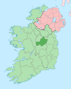
 Knockbody Location of Knockbody within County Westmeath in the Republic of Ireland | |
| Coordinates: 53°37′1″N 7°19′8″W / 53.61694°N 7.31889°WCoordinates: 53°37′1″N 7°19′8″W / 53.61694°N 7.31889°W | |
| Country |
|
| Province | Leinster |
| County | County Westmeath |
| Irish grid reference | N451632 |
Knockbody (Irish: Cnoc an Bhodaigh, meaning "the hill of the low-bred person")[1] is a townland in County Westmeath, Ireland. It is located about 10.37 kilometres (6 mi) north of Mullingar.
Knockbody is one of 11 townlands of the civil parish of Stonehall in the barony of Corkaree in the Province of Leinster. The townland covers 350.44 acres (1.4182 km2).
The neighbouring townlands are: Monintown to the north, Martinstown to the south, Blackmiles to the south–west and Stonehall to the west. Knockbody borders the southern end of Lough Derravaragh.[2][3]
In the 1911 census of Ireland there were 3 houses[4] and 22 inhabitants[5] in the townland.
References
- ↑ Knockbody Townland, Co. Westmeath The Placenames Database of Ireland Retrieved on 14 August 2015.
- ↑ Knockbody Townland, Co. Westmeath Townlands.ie Retrieved on 14 August 2015.
- ↑ Knockbody Townland, Co. Westmeath IreAtlas Townland Data Base. Retrieved on 14 August 2015.
- ↑ Houses in Knockbody. Census of Ireland 1911. Retrieved on 14 August 2015.
- ↑ Inhabitants in Knockbody. Census of Ireland 1911. Retrieved on 14 August 2015.
External links
- Map of Knockbody at openstreetmap.org
- Knockbody at the IreAtlas Townland Data Base
- Knockbody at Townlands.ie
- Knockbody at The Placenames Database of Ireland
This article is issued from Wikipedia - version of the 8/14/2015. The text is available under the Creative Commons Attribution/Share Alike but additional terms may apply for the media files.