Koh e Hindaki
| Koh e Hindaki | |
|---|---|
| (Persian: کوه هندکی ) | |
 Koh e Hindaki Location in the Hindu Kush | |
| Highest point | |
| Elevation | 2,199 m (7,215 ft) |
| Parent peak | Hindu Kush |
| Coordinates | 34°27′26.7″N 69°11′30″E / 34.457417°N 69.19167°ECoordinates: 34°27′26.7″N 69°11′30″E / 34.457417°N 69.19167°E |
| Geography | |
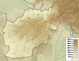
| Location | Bagrami District, Kabul Province |
| Parent range | Hindu Kush |
Koh e Hindaki (Persian: کوه هندکی ), also spelled Hendaki, Endakī, Indikki, Indiki, or Hindka’i,[1] is a mountain in the Hindu Kush range in Afghanistan. The name means "Mountain of the Hindu Region". It is located near Bagrami District in Kabul Province.[2]
Koh e Hindaki is an important religious site for Hindus and members of other Indo-Iranian religions, such as Zoroastrianism. Historically, the surrounding area has been home to a variety of temples.[3][4]
See also
- Koh e Hindu
- Kush (Mountain)
- Rigvedic rivers
- Rigveda
- Vedic Sanskrit
- Indo-Aryan languages
- Avesta
- Bundahishn
- Gathas
- Zend
References
- ↑ Chehel Sotoun Kabul see also Chehel Sotoun in Iran
- ↑ Fayż Muḥammad Kateb Hazara: Siraj al-tawarikh (Kabul 1933 Persian), p. 2081, at Google Books translate by R. D. McChesney in English and ed. M. M. Khorrami Endlish “The History of Afghanistan”, Leiden-Boston , 2013 ISBN 978-90-04-25606-4
- ↑ Joseph von Hammer-Purgstall: Anzeige des Siebenmeers: nebst einem Verzeichnisse mit Wörtern, p. 76, at Google Books Gerold, Wien, 1831, p.p 76
- ↑ Thomas Hyde: (1770) Veterum Persarum et Parthorum et Medorum religionis historia at Google Books, Historia religionis veterum Persarum eorum que magorum, p.p. 102, 103, 303–305
Further reading
- William Ouseley, Travels in Various Countries of the East: More Particularly Persia Vo. I, London, 1819
- (PDF; 1,8 MB)
- Ithihaasa, p. 231, at Google Books, Bloomington, 2013, Indiana S. 231
- Joseph von Hammer-Purgstall, Anzeige des Siebenmeers: nebst einem Verzeichnisse mit Wörtern Germanischer […], Wien, 1831
- Prairies d’or, texte arabe et traduction française du Muruj al-dhahab par Barbier de Meynard et Pavet de Courteille, Paris 1861–1877
- Vol. 4 de 9
External links
- Koh-e Hindaki
- Shewaki Stupa near Hindaki mountain
- Stupa at Topdara, Stupa at Shewaki, Stupa at Guldara, Stupa and monastic remains at Guldara
Photos
- Phototeca Afghanica
- Le palais jahan numa transformé par l’émir Habibullah à hendaki
- Chehel Sotoun Kabul
- Chehel Sotoun Kabul
- Hendaki Jahan-numa Palace Hindaki, the Emir's residence, Kabul
This article is issued from Wikipedia - version of the 5/28/2016. The text is available under the Creative Commons Attribution/Share Alike but additional terms may apply for the media files.