Kollam Cantonment
| Kollam Cantonment കന്റോണ്മെന്റ് | |
|---|---|
| Neighbourhood | |
 Kollam Cantonment | |
| Coordinates: 8°52′52″N 76°35′57″E / 8.881160°N 76.599078°E | |
| Country |
|
| State | Kerala |
| City | Kollam |
| Time zone | IST (UTC+5.30) |
| Area code(s) | 0474 |
| Lok Sabha constituency | Kollam |
| Civic agency | Kollam Municipal Corporation |
| Avg. summer temperature | 34 °C (93 °F) |
| Avg. winter temperature | 22 °C (72 °F) |
| Website | http://www.kollam.nic.in |
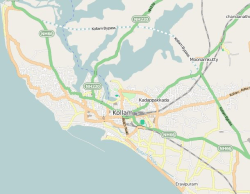
Kollam Cantonment (Malayalam: കൊല്ലം കന്റോണ്മെന്റ്) (originally Quilon Cantonment) is a residential neighbourhood in the city of Kollam. It arose as a cantonment of the British Raj in the 17th century. It is now a thickly populated area of the city of Kollam. Some of the important business centres, shopping complexes and Government offices are located here.[1] Kollam Junction railway station is also located near to cantonment area.
History
City of Kollam(Quilon) was a famous trade hub in British India. Kollam Port was a flourishing and favorite port of Phoenicians, Arabs and Chinese traders. Old Quilon city was conquered by Portuguese, Dutch and British people during 16th to 18th centuries.[2][3][4][5][6] As Kollam was an important town with public offices, a British garrison was stationed in Kollam which was subsequently reduced to a native regiment, as a protective force for the then Maharaja of the erstwhile state of Travancore. The garrison was situated at the Cantonment Maidan during those days.[7]
Public/Private institutions situated at Kollam Cantonment area

- Corporation office, Kollam
- Kollam Junction railway station
- Kollam Armed Reserve Police Force Camp (ARPF Camp)
- Kollam Public Library
- Sopanam Auditorium
- Sri Moolam Thirunal Palace(SMP Palace)
- Lal Bahadur Shastri Stadium
- Cantonment Maidan
- Kollam Passport Seva Kendra
- Bhima Jewellers
- Quilon Athletic Club(QAC)
- Kerala Water Authority Office
- Al-Manama Supermarket
References
- ↑ "Kollam cantonment - Pincodes.info". Retrieved 25 November 2014.
- ↑ Thangassery, Kollam - Kerala Tourism
- ↑ About the City of Kollam
- ↑ New proof for Pre-Portuguese mission in Kollam
- ↑ "Tourmet - Thangassery, Kollam". Retrieved 6 January 2014.
- ↑ "History of Kollam". Retrieved 15 January 2014.
- ↑ A place in history - The Hindu