Komsomolsky, Chukotka Autonomous Okrug
| Komsomolsky (English) Комсомольский (Russian) | |
|---|---|
|
- Urban-type settlement[1] - Work settlement[1] (abolished) | |
|
| |
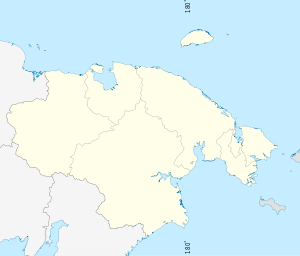
.svg.png) Location of Chukotka Autonomous Okrug in Russia | |
 Komsomolsky | |
|
| |
| Administrative status (as of October 2009) | |
| Country | Russia |
| Federal subject | Chukotka Autonomous Okrug[2] |
| Administrative district | Chaunsky District[2] |
| Statistics | |
| Population (2002 Census) | 597 inhabitants[2] |
| Population (June 2005 est.) | 508 inhabitants[3] |
| Time zone | PETT (UTC+12:00)[4] |
| Founded | 1959[5] |
| Abolished | 1998[6] |
| Postal code(s)[7] | 689415 |
Komsomolsky (Russian: Комсомо́льский) is an inhabited locality (an urban-type settlement) in Chaunsky District of Chukotka Autonomous Okrug, Russia, located about 100 kilometers (62 mi) south-west of Pevek, the administrative centre of the district. Population: 597 (2002 Census);[2] 3,794 (1989 Census).[8] According to an environmental impact report produced for the Kupol Gold Project, by 2005 the population had fallen further to just 508.[3]
Geography
Komsomolsky is located at the base of the Ichuvuveyem Hills, on the banks of the Ichuveyem River. The river's name is from the Chukchi for "river with rich pastures",[5] an increasingly ironic derivation considering that the main economic driver in the area is now gold mining which is destroying the reindeer's pastures.
History
Soviet Period
Komsomolsky is one of a number of inhabited localities of varying size throughout the former Soviet Union named after the Komsomol, the Soviet youth movement. Indeed, it was members of the Komsomol who were the first settlers in the area, who all volunteered, at least initially, to come to Chukotka to start mining when the settlement was founded in 1959 or were prisoners or deportees without the right to leave,[9] and the mine soon became one of the largest in the country. Barely thirty years later, it was decided that it was no longer economically viable and the settlement was mostly depopulated by 1998. Though the number of people in the settlement has shrunk considerably, there is still a population, with most of the remaining populous employees of the Chukotka Industrial Co-operative,[5] or part of Quasar, the other gold mining enterprise in the area.[9] As of 2009, however, Komsomolsky is included in the list of settlements currently in the process of being liquidated.[1]
Post-Soviet Period
In recent years, Komsomolsky has benefited from increased spending in the region, particularly in the realm of transportation, where part of a 3.5 billion-ruble bridge building and road construction project improved transport connections with Pevek and Bilibino as part of a Chukotka-wide project.[10] The ultimate goal of this project is to provide a direct road link between the Sakha Republic, Magadan Oblast, and Chukotka.[9]
The immediate environment has been shaped significantly by industry, though visitors to the area may see a rare piece of equipment, a gold-washing dredge, being used. Due to the short gold-washing season caused by the arctic climate, the dredge is used 24 hours a day.[5]
Population
The mines were declared unprofitable and that there was no possibility of developing any other form of economy in 1999 and the settlement was closed along with a number of others in Chukotka.[6] The Russian government guaranteed funds to transport non-working pensioners and the unemployed in liquidated settlements including Komsomolsky from Chukotka to other parts of Russia.[6] The Ministry of railways was obliged to lease containers for the transportation of the migrants' goods to the Chukotkan administration and ensure that they were delivered to the various settlements.[6] The population table below shows the impact on the settlement as a result of the closure of the mines.
| 1959 | 1970 | 1979 | 1989 | 2002 | 2005 |
|---|---|---|---|---|---|
| 470 | 1642[11] | 2166[12] | 3794[13] | 597[14] | 508[3] |
Transport
Komsomolsky is connected via a road network to Pevek, Bystry and Krasnoarmeysky along with a number of other local settlements, but it is not connected by permanent road to any other part of the district or Chukotka. There is however, a small road network within the settlement including:[15]
- Улицa Артеева (Ulitsa Arteeva)
- Улицa Ватапваамовская (Ulitsa Vatapvaamovskaya - the Vatapvaam is a local river)
- Улицa Горняцкая (Ulitsa Gornyatskaya)
- Улицa Заречная (Ulitsa Zarechnaya)
- Улицa Комсомольская (Ulitsa Komsomolskaya, lit. Komsomol Street)
- Улицa Космодемьянской (Ulitsa Kosmodemyanskoye)
- Улицa Красноармейская (Ulitsa Krasnoarmeyskaya, li. Red Army Street)
- Улицa Ленина (Ulitsa Lenina, lit. Lenin Street)
- Улицa Новая (Ulitsa Novaya, lit. New Street)
- Улицa Строительная (Ulitsa Stroitelnaya, lit. Construction Street)
- Улицa Терешковой (Ulitsa Tereshkovoye)
- Улицa Титова (Ulitsa Titova)
- Улицa Чукотка (Ulitsa Chukotka, lit. Chukotka Street)
- Улицa Южная (Ulitsa Yuzhnaya, lit. South Street)
Climate
Komsomolsky has a Tundra climate (ET)[16] because the warmest month has an average temperature between 0 °C (32 °F) and 10 °C (50 °F).
| Climate data for Komsomolsky | |||||||||||||
|---|---|---|---|---|---|---|---|---|---|---|---|---|---|
| Month | Jan | Feb | Mar | Apr | May | Jun | Jul | Aug | Sep | Oct | Nov | Dec | Year |
| Record high °C (°F) | −2 (28) |
−0.8 (30.6) |
0 (32) |
28.1 (82.6) |
18.1 (64.6) |
28.1 (82.6) |
29.8 (85.6) |
24.7 (76.5) |
18 (64) |
16 (61) |
9 (48) |
9 (48) |
29.8 (85.6) |
| Average high °C (°F) | −15.9 (3.4) |
−17.6 (0.3) |
−16.1 (3) |
−10.7 (12.7) |
0 (32) |
9.3 (48.7) |
11.3 (52.3) |
8 (46) |
1.6 (34.9) |
−7.4 (18.7) |
−14.1 (6.6) |
−17 (1) |
−4.3 (24.3) |
| Average low °C (°F) | −20.4 (−4.7) |
−23.3 (−9.9) |
−22.3 (−8.1) |
−17.1 (1.2) |
−4.5 (23.9) |
3.6 (38.5) |
5.7 (42.3) |
2.8 (37) |
−1.9 (28.6) |
−10.5 (13.1) |
−17.5 (0.5) |
−20 (−4) |
−10.5 (13.1) |
| Record low °C (°F) | −45 (−49) |
−46 (−51) |
−42.3 (−44.1) |
−36.7 (−34.1) |
−26 (−15) |
−6 (21) |
−2.2 (28) |
−6.8 (19.8) |
−19.3 (−2.7) |
−42 (−44) |
−41 (−42) |
−43 (−45) |
−46 (−51) |
| Average rainfall mm (inches) | 36 (1.42) |
6 (0.24) |
6 (0.24) |
3 (0.12) |
3 (0.12) |
6 (0.24) |
21 (0.83) |
12 (0.47) |
12 (0.47) |
6 (0.24) |
9 (0.35) |
12 (0.47) |
132 (5.2) |
| Average snowy days | 15 | 11 | 10 | 11 | 9 | 2 | 1 | 3 | 11 | 15 | 15 | 15 | 118 |
| Source: [17] | |||||||||||||
See also
References
Notes
- 1 2 3 Law #33, Article 14.2
- 1 2 3 4 Russian Federal State Statistics Service (May 21, 2004). "Численность населения России, субъектов Российской Федерации в составе федеральных округов, районов, городских поселений, сельских населённых пунктов – районных центров и сельских населённых пунктов с населением 3 тысячи и более человек" [Population of Russia, Its Federal Districts, Federal Subjects, Districts, Urban Localities, Rural Localities—Administrative Centers, and Rural Localities with Population of Over 3,000] (XLS). Всероссийская перепись населения 2002 года [All-Russia Population Census of 2002] (in Russian). Retrieved August 9, 2014.
- 1 2 3 Bema Gold Corporation, p.87
- ↑ Правительство Российской Федерации. Федеральный закон №107-ФЗ от 3 июня 2011 г. «Об исчислении времени», в ред. Федерального закона №271-ФЗ от 03 июля 2016 г. «О внесении изменений в Федеральный закон "Об исчислении времени"». Вступил в силу по истечении шестидесяти дней после дня официального опубликования (6 августа 2011 г.). Опубликован: "Российская газета", №120, 6 июня 2011 г. (Government of the Russian Federation. Federal Law #107-FZ of June 31, 2011 On Calculating Time, as amended by the Federal Law #271-FZ of July 03, 2016 On Amending Federal Law "On Calculating Time". Effective as of after sixty days following the day of the official publication.).
- 1 2 3 4 Strogoff, p. 109
- 1 2 3 4 Постановление Правительства РФ от 2 февраля 1998 г. N 128 О мерах социальной защиты населения ликвидируемых поселков золотодобытчиков в Чукотском автономном округe (Russian Federation Government resolution dated February 2, 1998 No. 128 on measures of social protection of the population of liquidating estates gold miners in the Chukotka Autonomous Okrug "Russian Federation Government resolution dated February 2, 1998 No. 128 on measures of social protection of the population of liquidating estates gold miners in the Chukotka Autonomous Okrug).
- ↑ Почта России. Информационно-вычислительный центр ОАСУ РПО. (Russian Post). Поиск объектов почтовой связи (Postal Objects Search) (Russian)
- ↑ Demoscope Weekly (1989). "Всесоюзная перепись населения 1989 г. Численность наличного населения союзных и автономных республик, автономных областей и округов, краёв, областей, районов, городских поселений и сёл-райцентров" [All Union Population Census of 1989: Present Population of Union and Autonomous Republics, Autonomous Oblasts and Okrugs, Krais, Oblasts, Districts, Urban Settlements, and Villages Serving as District Administrative Centers]. Всесоюзная перепись населения 1989 года [All-Union Population Census of 1989] (in Russian). Институт демографии Национального исследовательского университета: Высшая школа экономики [Institute of Demography at the National Research University: Higher School of Economics]. Retrieved August 9, 2014.
- 1 2 3 Dead-cities.ru. Entry on Komsomolsky (Russian)
- ↑ Official website of Chukotka Autonomous Okrug. Road building (Russian)
- ↑ Перепись населения СССР 1970 года Archived March 23, 2012, at the Wayback Machine. 1970 census of the Soviet Union
- ↑ Перепись населения СССР 1979 года Archived March 23, 2012, at the Wayback Machine. 1979 census of the Soviet Union
- ↑ Всесоюзная перепись населения 1989 г. Численность городского населения РСФСР, ее территориальных единиц, городских поселений и городских районов по полу All-Union census, the constituent entities of the Russian Federation, in the federal districts, towns, rural settlements and regional centres with a population of more than 3,000.
- ↑ Численность населения России, субъектов Российской Федерации в составе федеральных округов, районов, городских поселений, сельских населённых пунктов – районных центров и сельских населённых пунктов с населением 3 тысячи и более человек Archived March 5, 2012, at the Wayback Machine. 2002 Russian Census
- ↑ Komsomolsky - Chaunsky District - Pochtovik Mail Delivery Company
- ↑ McKnight and Hess, pp.235-7
- ↑ "Weather averages for Komsomolsky from meoweather.com". meoweather.com. Retrieved October 1, 2012.
Sources
- Bema Gold Corporation, Environmental Impact Assessment, Kupol Gold Project, Far East Russia June 2005.
- McKnight, Tom L; Hess, Darrel (2000). "Climate Zones and Types". Physical Geography: A Landscape Appreciation. Upper Saddle River, NJ: Prentice Hall. ISBN 0-13-020263-0.
- Дума Чукотского автономного округа. Закон №33-ОЗ от 30 июня 1998 г. «Об административно-территориальном устройстве Чукотского автономного округа», в ред. Закона №55-ОЗ от 9 июня 2012 г. «О внесении изменений в Закон Чукотского автономного округа "Об административно-территориальном устройстве Чукотского автономного округа"». Вступил в силу по истечении десяти дней со дня его официального опубликования. Опубликован: "Ведомости", №7 (28), 14 мая 1999 г. (Duma of Chukotka Autonomous Okrug. Law #33-OZ of June 30, 1998 On the Administrative-Territorial Structure of Chukotka Autonomous Okrug, as amended by the Law #55-OZ of June 9, 2012 On Amending the Law of Chukotka Autonomous Okrug "On the Administrative-Territorial Structure of Chukotka Autonomous Okrug". Effective as of after ten days from the day of the official publication.). (Russian)
- M Strogoff, P-C Brochet, and D. Auzias Petit Futé: Chukotka (2006). "Avant-Garde" Publishing House.
External links
- Aerial view of the settlement, showing the effects of gold extraction.
- Komsomolsky photo gallery
- More photos of Komsomolsky
Administrative center: Anadyr | ||
| Cities and towns | ||
| Urban-type settlements | ||
| Administrative districts (raions) | ||