Kosmas, Greece
| Kosmas Κοσμάς | |
|---|---|
 | |
 Kosmas | |
|
Location within the regional unit 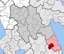 | |
| Coordinates: 37°06′N 22°44′E / 37.100°N 22.733°ECoordinates: 37°06′N 22°44′E / 37.100°N 22.733°E | |
| Country | Greece |
| Administrative region | Peloponnese |
| Regional unit | Arcadia |
| Municipality | South Kynouria |
| • Municipal unit | 85.22 km2 (32.90 sq mi) |
| Population (2011)[1] | |
| • Municipal unit | 362 |
| • Municipal unit density | 4.2/km2 (11/sq mi) |
| Time zone | EET (UTC+2) |
| • Summer (DST) | EEST (UTC+3) |
| Vehicle registration | TP |
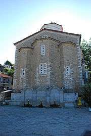
Kosmas (Greek: Κοσμάς) is a mountain village and a former community in Arcadia, Peloponnese, Greece. It is considered a traditional settlement. Since the 2011 local government reform it is part of the municipality South Kynouria, of which it is a municipal unit.[2] The municipal unit has an area of 85.220 km2.[3] In 2011 its population was 362.[1] Kosmas is situated in the southeastern part of the Parnon mountains, at about 1150 m elevation, on the road from Skala (Laconia) to Leonidio. It is 13 km southwest of Leonidio, 28 km east of Sparti, 28 km northeast of Skala, 35 km south of Argos and 57 km southeast of Tripoli. Kosmas has a school, a church and a library.
Population
| Year | Population |
|---|---|
| 1981 | 594 |
| 1991 | 657 |
| 2001 | 591 |
| 2011 | 362 |
History
In the area which is now known as Kosmas was the ancient city of Selinous, which had a temple of Apollo. Kosmas was first mentioned in 1592 in a letter of Gennadios, metropolitan of Monemvasia. Many inhabitants of Kosmas participated in the Greek War of Independence. The village suffered destruction during World War II and the Greek Civil War (1946-1949).[4]
See also
External links
References
- 1 2 "Απογραφή Πληθυσμού - Κατοικιών 2011. ΜΟΝΙΜΟΣ Πληθυσμός" (in Greek). Hellenic Statistical Authority.
- ↑ Kallikratis law Greece Ministry of Interior (Greek)
- ↑ "Population & housing census 2001 (incl. area and average elevation)" (PDF) (in Greek). National Statistical Service of Greece.
- ↑ Information about the community