Kranidi
| Kranidi Κρανίδι | |
|---|---|
 | |
 Kranidi | |
|
Location within the regional unit 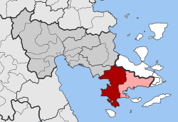 | |
| Coordinates: 37°23′N 23°10′E / 37.383°N 23.167°ECoordinates: 37°23′N 23°10′E / 37.383°N 23.167°E | |
| Country | Greece |
| Administrative region | Peloponnese |
| Regional unit | Argolis |
| Municipality | Ermionida |
| • Municipal unit | 252.9 km2 (97.6 sq mi) |
| Elevation | 92 m (302 ft) |
| Population (2011)[1] | |
| • Municipal unit | 9,452 |
| • Municipal unit density | 37/km2 (97/sq mi) |
| Community[1] | |
| • Population | 4,441 (2011) |
| Time zone | EET (UTC+2) |
| • Summer (DST) | EEST (UTC+3) |
| Postal code | 213 00 |
| Area code(s) | 27540 |
| Vehicle registration | AP |
Kranidi (Greek: Κρανίδι, Katharevousa: Κρανίδιον) is a town and a former municipality in Argolis, Peloponnese, Greece. Since the 2011 local government reform it is part of the municipality Ermionida, of which it is the seat and a municipal unit.[2] The municipal unit has an area of 252.938 km2.[3] Some say the name is derived from the word Koronida, while others claim it is from the word Kranaos, which means "rocky trough". It is situated in the eastern part of Argolis, on the easternmost "finger" of the Peloponnese peninsula. It is 8 km west of Ermioni, 28 km south of Epidaurus and 38 km southeast of Nafplio.
Kranidi is known for being the location of second homes of several prominent celebrities, including Sir Sean Connery and the Dutch royal couple king Willem-Alexander and queen Máxima.
Geography
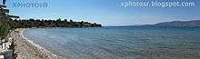
The area around Kranidi consists of low hills, covered with olive groves and small forests. The town itself is about 4 km from the coast. Several villages of the municipal unit Kranidi are on the Aegean Sea coast, including Koilada, Portocheli and the small beach settlement Doroufi.
History

The place of Kranidi has been inhabited for thousands of years. Very close to town is located the Phrancthi Cave that was the dwelling of prehistoric man. During the Homeric era, in this place there were two cities, Hermion (in place of modern Ermioni) and Masis (in place of the modern village of Koilada). In the classical era, a few kilometers south, the city of Halieis was built, in place of modern Porto Heli. Kranidi is first mentioned in the 16th century after the Turkish name Kato Nahagie, which means low province.[4] Kranidi was one of the centers of the Greek uprising of 1777. After the failure of the rebellion, however, many locals abandoned the area in order to avoid persecution by the Muslim Ottomans. Many of them sought refuge away from the Peloponnese, in Europe and Russia. Many also migrated to Cyprus. The modern name derives either from ancient the Greek name Kranaos or from the name of the nearby islet of Koronida.[4] This name was corrupted to Kranida and after Kranidi. The residents of Kranidi took part in the Greek War of Independence. One local guerilla was the priest Arsenios Krestas. In 1823, before breaking the first Greek Civil War, Kranidi became the seat of the legislature part of Greek government.[5] After the independence Kranidi was appointed the seat of Ermionida province. Nowadays Kranidi is a flourishing small town with a rich nautical tradition and developed touristic services.
Historical population
| Year | Community | Municipal unit |
|---|---|---|
| 1981 | 3,949 | - |
| 1991 | 3,959 | 8,973 |
| 2001 | 4,912 | 10,347 |
| 2011 | 4,441 | 9,452 |
References
- 1 2 "Απογραφή Πληθυσμού - Κατοικιών 2011. ΜΟΝΙΜΟΣ Πληθυσμός" (in Greek). Hellenic Statistical Authority.
- ↑ Kallikratis law Greece Ministry of Interior (Greek)
- ↑ "Population & housing census 2001 (incl. area and average elevation)" (PDF) (in Greek). National Statistical Service of Greece.
- 1 2 "Κρανίδι". ARGOLIKOS ARCHIVAL LIBRARY HISTORY AND CULTURE. Retrieved 28 September 2014.
- ↑ "Κυβέρνηση στο Κρανίδι (1823)". ARGOLIKOS ARCHIVAL LIBRARY HISTORY AND CULTURE. Retrieved 28 September 2014.
 |
Asini | Epidavros | Troizina | |
| Argolic Gulf | |
Ermioni | ||
| ||||
| | ||||
| Aegean Sea |