Kumara, New Zealand
| Kumara | |
|---|---|
|
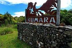
Sign beside SH6 on the outskirts of Kumara | |
 Kumara | |
| Coordinates: 42°37′52″S 171°11′13″E / 42.63111°S 171.18694°E | |
| Country | New Zealand |
| Region | West Coast |
| District | Westland District |
| Electorates |
West Coast-Tasman Te Tai Tonga |
| Population (2013) | |
| • Total | 309 |
| Time zone | NZST (UTC+12) |
| • Summer (DST) | NZDT (UTC+13) |
| Postcode | 7832 |
| Area code(s) | 03 |
Kumara is a town on the West Coast of the South Island of New Zealand. It is located 30 kilometres (19 mi) south of Greymouth, close to the western end of State Highway 73, which leads across Arthur's Pass to Christchurch. The Taramakau River flows past to the north.[1][2]
The population was 309 in the 2013 Census, a decrease of 6 from 2006.[3]
The name may come from the Māori language Kohe mara, which is the blossom of the tātarāmoa, or bush lawyer.[4]
The Coast to Coast annual multisport race starts at Kumara Beach.[5]
History
Kumara was founded and became one of the country's chief gold mining centres following the discovery of gold at Dillmanstown, about 3 kilometres (2 mi) to the south-east, in 1876. The tramline from Greymouth to Paroa was extended to Kumara the following year. The population was 4,220 in October 1877. The town became a borough in 1877.[4] Kumara Hospital was operating by 1881[6] and continued into the twentieth century.[7] In 1882, the Kumara volunteer fire brigade was formed.[8]
Kumara was the home town of prominent politician Richard Seddon, who was elected mayor of the town in 1877,[9] and served as Prime Minister of New Zealand from 1893 until his death in 1906.
In 1925, the manager of Pearns Hotel in Kumara was charged by police after she refused to supply accommodation to two visiting temperance lecturers.[10] The Pearn's Brewery became part of Westland Ales around this time.[11]
Although the town once had 50 pubs, the numbers dwindled. In June 2009, the last remaining pub, the Empire Hotel, had its licence cancelled by the Liquor Licensing Authority.[12] In 2010, the last store of the town faced closure, with only a few hundred inhabitants left, but it was hoped that one of the New Zealand Cycle Trails to run through the town would lift the settlement's fortunes again.[13] In November 2012 the Theatre Royal Hotel reopened as the only pub serving Kumara, and in November 2013 the West Coast Wilderness Trail cycleway running from Greymouth to Ross was officially opened with a ceremony in Kumara.[14]
Education
Kumara School is a coeducational full primary school (years 1–8), with a decile rating of 5 and a roll of 20.[15] The school celebrated 120 years of education in the district in 1997.[16]
References
| Wikimedia Commons has media related to Kumara, New Zealand. |
- ↑ Peter Dowling (editor) (2004). Reed New Zealand Atlas. Reed Books. map 69. ISBN 0-7900-0952-8.
- ↑ Roger Smith, GeographX (2005). The Geographic Atlas of New Zealand. Robbie Burton. map 156. ISBN 1-877333-20-4.
- ↑ 2013 Census QuickStats about a place:Kumara, New Zealand
- 1 2 Dollimore, Edward Stewart. - "Kumara, Westland". - Encyclopedia of New Zealand (1966).
- ↑ "Race profile: Speight's Coast to Coast". Coast to Coast. 2014. Retrieved 13 January 2015.
- ↑ "Kumara Hospital". West Coast Times. 6 August 1881. p. 2.
- ↑ Rogers, Anna (2005). Illustrated History of the West Coast. Auckland: Reed Books. p. 113. ISBN 0-7900-1022-4.
- ↑ Rogers, p. 115.
- ↑ Rogers, pp. 71-72.
- ↑ Brien, Bill. "Tales from the Past - a look at the history of HANZ". Retrieved 2008-08-13.
- ↑ Rogers, p. 160.
- ↑ "Residents angry after town's only pub shut down". The New Zealand Herald. 11 June 2009.
- ↑ "Hope rests on cycleway". The Press. 18 March 2010. Retrieved 31 March 2010.
- ↑ "West Coast welcomes cyclists". The Press. 18 November 2013. Retrieved 13 January 2015.
- ↑ "Te Kete Ipurangi - Kumara School". Ministry of Education.
- ↑ "Jubilees & reunions: Goldfields Schools" (– Scholar search). Education Gazette New Zealand. 76 (9). 26 May 1997.
Coordinates: 42°38′S 171°11′E / 42.633°S 171.183°E