Lueta
| Lueta Lövéte | |
|---|---|
| Commune | |
|
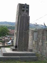
Székely Gate | |
 Location of Lueta | |
 Lueta Location of Lueta | |
| Coordinates: 46°16′0″N 25°29′0″E / 46.26667°N 25.48333°ECoordinates: 46°16′0″N 25°29′0″E / 46.26667°N 25.48333°E | |
| Country |
|
| County | Harghita County |
| Status | Commune |
| Government | |
| • Mayor | Zoltán Lázár Boros (Ind.) |
| Area | |
| • Total | 101.64 km2 (39.24 sq mi) |
| Population (2011) | |
| • Total | 3,383 |
| • Density | 34.66/km2 (89.8/sq mi) |
| Time zone | EET (UTC+2) |
| • Summer (DST) | EEST (UTC+3) |
| Postal Code | 537140 |
| Area code(s) | +40 266 |
| Website | www.lovete.ro |

Lueta (Hungarian: Lövéte, Hungarian pronunciation: [ˈløveːtɛ]) is a commune in Harghita County, Romania. It lies in the Székely Land, an ethno-cultural region in eastern Transylvania, and is composed of two villages:
- Băile Chirui / Kirulyfürdő
- Lueta / Lövéte
History
The name of the commune was first recorded in 1332 when its priest was mentioned as "sacerdos de Lueche". In 1567, it was mentioned as Leöwete. The name derives from the ancient form of the Hungarian name Levente worn by several members of the Árpád dynasty.[1]
The villages belonged to Udvarhelyszék district until the administrative reform of Transylvania in 1876, when they fell within the Udvarhely County in the Kingdom of Hungary. After the Treaty of Trianon of 1920, they became part of Romania and fell within Odorhei County during the interwar period. In 1940, the second Vienna Award granted Northern Transylvania to Hungary and the villages were held by Hungary until 1944. After Soviet occupation, the Romanian administration returned and the commune became officially part of Romania in 1947. Between 1952 and 1960, the commune fell within the Magyar Autonomous Region, between 1960 and 1968 the Mureş-Magyar Autonomous Region. In 1968, the province was abolished, and since then, the commune has been part of Harghita County.
Demographics
The commune has an absolute Székely (Hungarian) majority. According to the 2011 census it has a population of 3,383; of which 99.76% or 3,375 are Hungarian.
Twinning
The villages are twinned with:
References
- ↑ János András Vistai. "Tekintő – Erdélyi Helynévkönyv". Transylvanian Toponym Book
