La Blanca, San Marcos
| La Blanca | |
|---|---|
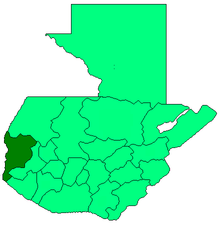
 La Blanca Location in Guatemala | |
| Coordinates: 14°34′45″N 92°08′29″W / 14.57917°N 92.14139°W | |
| Country |
|
| Department |
|
| Government | |
| • Mayor (2016-2020) | Haroldo Cordero[1] (PP) |
| Climate | Aw |
La Blanca is a municipality in the San Marcos department of Guatemala on the Pacific Ocean shore. In 2014, when it was created, had ca. 25.000 inhabitants.[2] The municipality was created on 23 January 2014, when it split from Ocos, along with Chiquirines and Pueblo Nuevo villages and became San Marcos Department thirtieth municipality.[2]
Climate
La Blanca has tropical climate (Köppen:Cwb).
| Climate data for La Blanca | |||||||||||||
|---|---|---|---|---|---|---|---|---|---|---|---|---|---|
| Month | Jan | Feb | Mar | Apr | May | Jun | Jul | Aug | Sep | Oct | Nov | Dec | Year |
| Average high °C (°F) | 34.3 (93.7) |
34.7 (94.5) |
35.6 (96.1) |
35.6 (96.1) |
35.2 (95.4) |
33.7 (92.7) |
34.1 (93.4) |
34.2 (93.6) |
33.7 (92.7) |
33.6 (92.5) |
33.7 (92.7) |
33.6 (92.5) |
34.33 (93.83) |
| Daily mean °C (°F) | 26.9 (80.4) |
27.3 (81.1) |
28.4 (83.1) |
29.1 (84.4) |
29.3 (84.7) |
28.4 (83.1) |
28.4 (83.1) |
28.4 (83.1) |
28.2 (82.8) |
28.1 (82.6) |
27.6 (81.7) |
26.9 (80.4) |
28.08 (82.54) |
| Average low °C (°F) | 19.5 (67.1) |
19.9 (67.8) |
21.3 (70.3) |
22.7 (72.9) |
23.5 (74.3) |
23.1 (73.6) |
22.8 (73) |
22.7 (72.9) |
22.8 (73) |
22.7 (72.9) |
21.6 (70.9) |
20.3 (68.5) |
21.91 (71.43) |
| Average precipitation mm (inches) | 4 (0.16) |
1 (0.04) |
5 (0.2) |
41 (1.61) |
117 (4.61) |
275 (10.83) |
176 (6.93) |
182 (7.17) |
271 (10.67) |
218 (8.58) |
38 (1.5) |
6 (0.24) |
1,334 (52.54) |
| Source: Climate-Data.org[3] | |||||||||||||
Geographic location
 |
Coatepeque, Quetzaltenango Department municipality | | ||
| Ocos, San Marcos Department municipality | |
Coatepeque, Quetzaltenango Department municipality Retalhuleu, Retalhuleu Department municipality[4] | ||
| ||||
| | ||||
| Pacific Ocean[4] |
See also
 Guatemala portal
 Geography portal
- La Aurora International Airport
- Tapachula International Airport
References
- ↑ "San Marcos elige autoridades municipales". Prensa Libre (in Spanish). Guatemala. 8 September 2015. Retrieved 8 September 2015.
- 1 2 "La Blanca se convirtió ayer en municipio 335". Prensa Libre (in Spanish). Guatemala. 24 January 2014. Retrieved 10 September 2015.
- ↑ "Climate: La Blanca". Climate-Data.org. Retrieved 10 September 2015.
- 1 2 SEGEPLAN. "Municipios del departamento de San Marcos". Secretaría General de Planificación (in Spanish). Archived from the original on 10 July 2015.
Coordinates: 14°34′45″N 92°08′29″W / 14.57917°N 92.14139°W
This article is issued from Wikipedia - version of the 5/10/2016. The text is available under the Creative Commons Attribution/Share Alike but additional terms may apply for the media files.